Operational F-SAR processing chains produce a variety of different data products. The most common product types include:
RGI Focused SAR data in radar geometry
GTC Geocoded SAR data
INF Co-registered image stacks for interferometry
Other data products include SAR imagery from circular acquisitions, polarimetric change detection results, geocoded amplitude mosaics and more.
The structure and contents of these data products is described in the F-SAR Product Format Description document (see download, right).
The binary data in F-SAR products is generally stored in the so-called RAT format. In addition, most RAT files are accompanied by .hdr files, which allow the data to be opened in ENVI. The widely used GDAL software library also supports the ENVI format, such that F-SAR data can also be opened using free alternatives such as QGis. Any of these programs can then be used to export F-SAR data to various other file formats, such as GeoTiff.
Native RAT/XML Interface
Researchers developing their own SAR signal processing techniques on the basis of F-SAR data may find it more convenient to read the binary in F-SAR products directly. A direct interface to the data may even be required when the application under consideration involves working with complex data or sensor tracks, as neither data type is well supported by GIS software.
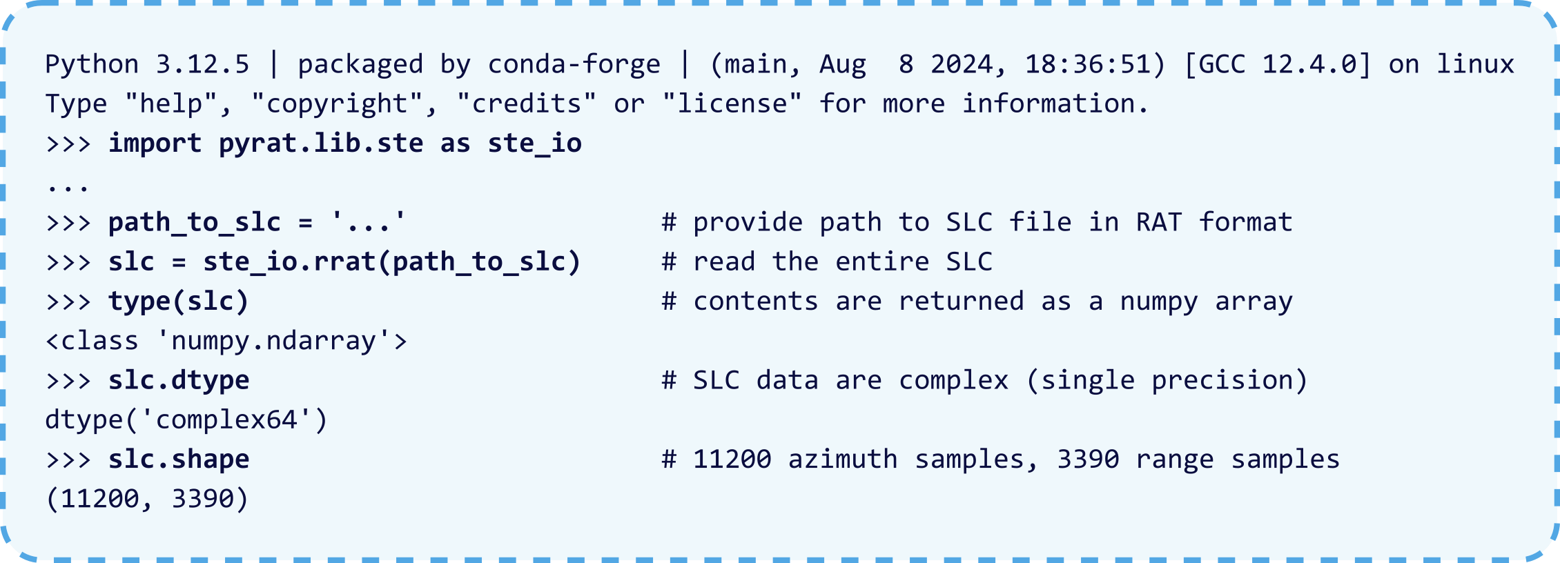
A native interface to F-SAR data is available as part of the PyRAT radar signal processing framework (Python RAdarTools). Researchers may want to consider using PyRAT as a basis for implementing new signal processing algorithms.
The following basic usage examples assume that PyRat has been downloaded and installed.
PyRAT Example 1
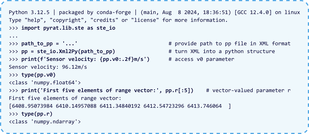
The Xml2Py class facilitates object-like access to parameters stored in the pp*.xml files of the RDP product components. This example reads a pp file from the RGI-RDP product component and illustrates how parameter values are accessed as python object properties.
The RatFormat object can be used to access the metadata in the header of RAT files. The structure of the RAT header is detailed in appendix 2 of the F-SAR Product Description. This example extracts some of the metadata related to the UTM grid used for a geocoded amplitude image.
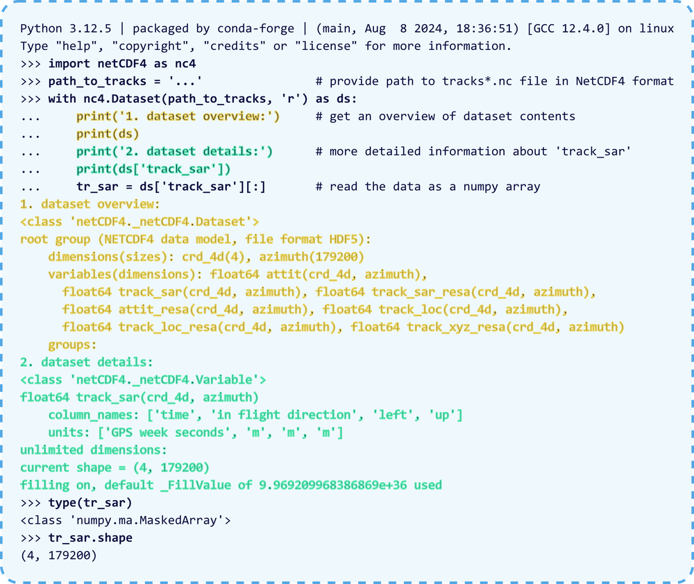
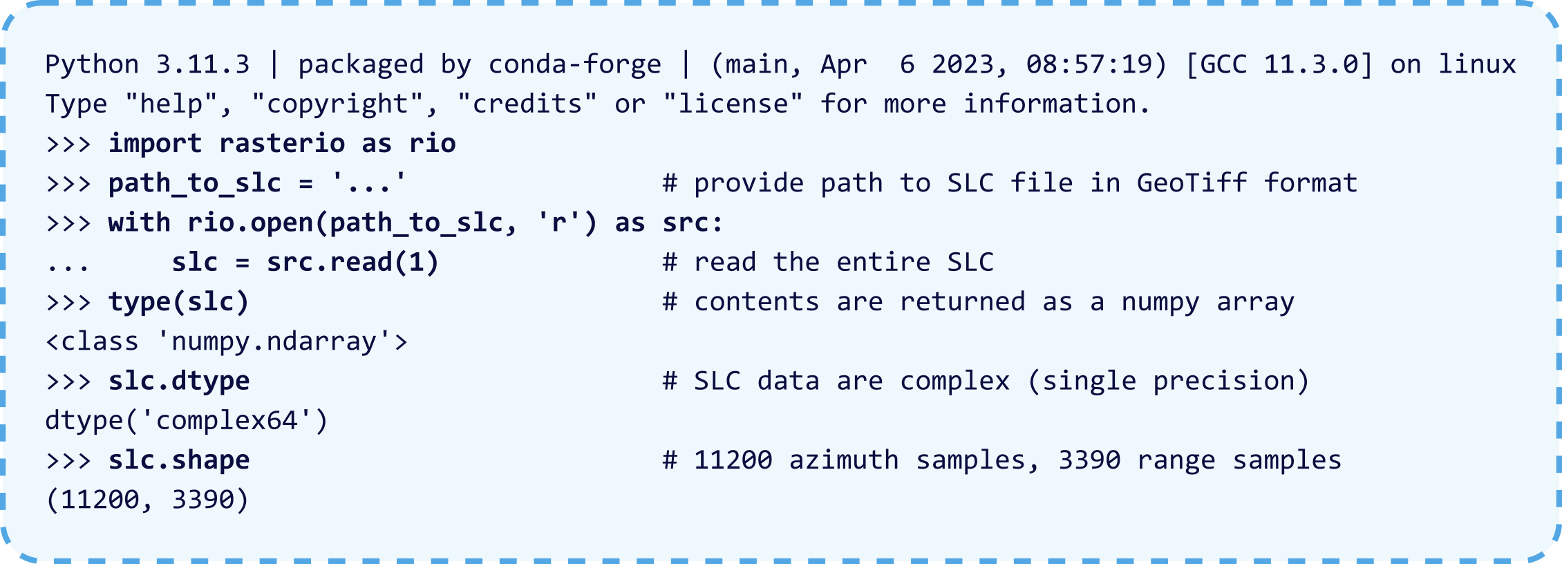
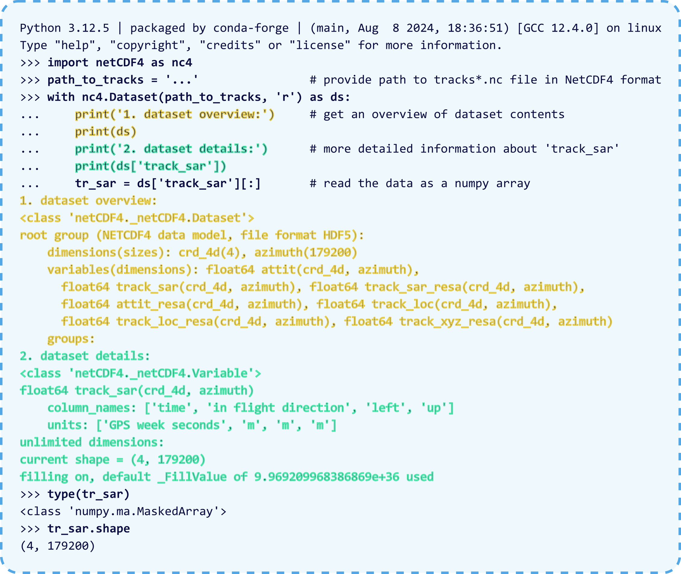
Some campaign data use the Cloud Optimized GeoTiff (COG) format instead of RAT to store binary image data. The rasterio package is recommended for working with this data in python. F-SAR products in this format also include sensor position and attitude information in NetCDF4 files, which can be read with the netCDF4 python package. The basic examples below show how rasterio and netCDF4 can be used to read data in COG format.
Rasterio Example
The RatFormat object can be used to access the metadata in the header of RAT files. The structure of the RAT header is detailed in appendix 2 of the F-SAR Product Description. This example extracts some of the metadata related to the UTM grid used for a geocoded amplitude image.
The netCDF4 package can be used to read sensor position and attitude data. The format is self-documenting: it also includes information about coordinate systems and units.
Radar data is usually provided in the radar slant-range coordinate system and on a geographic grid. The open source fsar_applyLUTs tool (apply LookUpTables) has been developed to facilitate the bi-directional transformation of imagery from one coordinate system to the other.


