Users of the DLR's National Experimental Test Center for Unmanned AircraftSystems in Cochstedt will now benefit from the establishment of a permanent GeoZone. With effect from November 27, 2025, the Federal Ministry of Transport (BMV) has established a so-called “geographical area” in accordance with Art. 15 (2) DVO (EU) 2019/947 to facilitate test activities at Magdeburg-Cochstedt Airport.
Within the GeoZone, UAS operations are exempt from several requirements in the “open” category. This means that in the open category, UAS operations can be carried out beyond visual line of sight (BVLOS) with unmanned aircraft weighing more than 25 kg maximum take-off mass and flying above 120 meters above ground level.
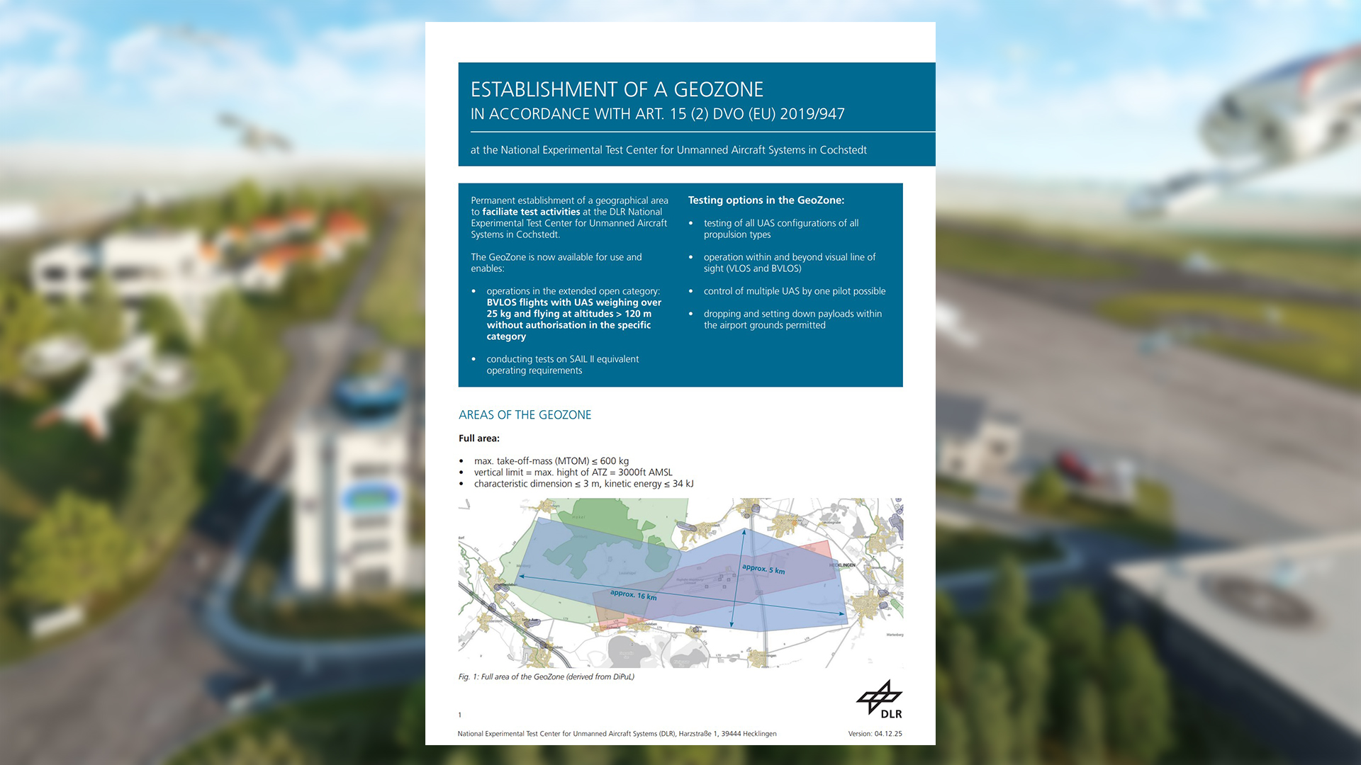
All areas of the GeoZone, as well as more detailed information on testing and usage options, can be found in the information sheet, which is available for download in the “Publications” section of this website.
Fact sheet on the GeoZone at Magdeburg-Cochstedt Airport (PDF)
In order to achieve an equivalent level of safety, all requirements for UAS operators follow the principles defined for the specific category of drone operation in accordance with SAIL II. Each operator confirms that they fully comply with all requirements (defined in sections 5.1–5.4 of the operator declaration). Compliance with these requirements must be declared to the DLR by signing the UAS operator declaration and risk assessment for the use of the geographical area.


