The first GNSS observations at O'Higgins took place from 1990 to 1993 in the context of campaigns conducted by the Working Group on Geodesy and Geographic Information of the Scientific Committee on Antarctic Research (SCAR).
Starting in 1995 continuous GNSS observation began at the OHIG site, which had to be given up in 2002. That same year the OHI2 station began operations with a one-week overlap. The OHI3 station began operations one year later. As a result, there has been an almost continuous time series since the end of 1995.
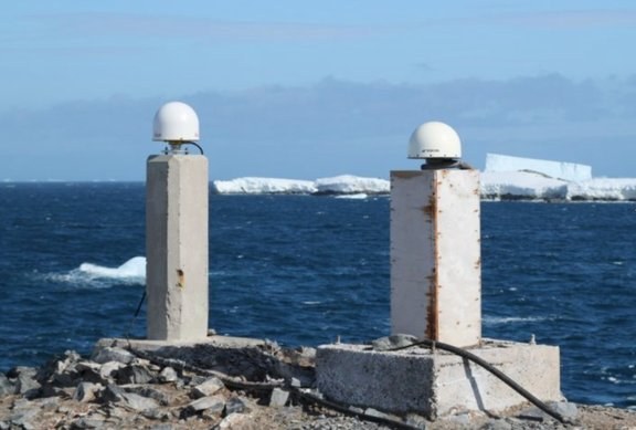
The multi-GNSS Stations OHI2 (right) and OHI3 (left)
The OHI2 and OHI3 stations, and earlier also OHIG, are part of the measurement network of the International GNSS Service (IGS) and regularly provide 30-second data. One-second data are available for the preceding three months. OHI3 also provides a real-time data stream in RTCM 3.0 format. Both stations are equipped with modern Javad and Leica multi-GNSS receivers. An additional GNSS receiver, OHIX, shared the antenna with OHI3 and was operated between 2009 and 2014 to receive Galileo signals as part of the CONGO network (Cooperative Network for GIOVE Observation) and the Multi-GNSS experiment (MGEX) of IGS. Since 2014 OHI2 and OHI3 have also been recording Galileo signals.
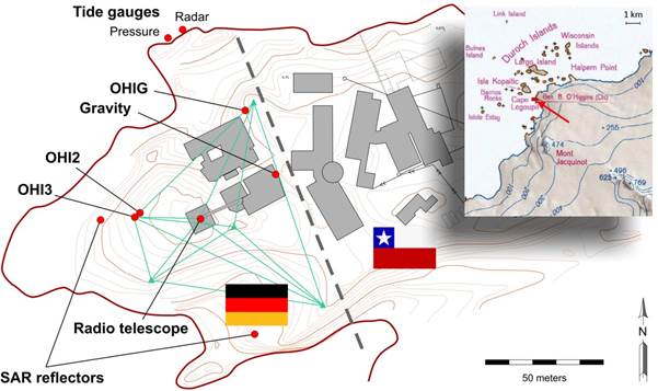
Map showing the Chilean base Bernardo O’Higgins (to the right of the dashed line) and the GARS O’Higgins station with the locations of the geodetic instruments (at left).
The local survey network is shown in green. The inset shows the station’s geographic context.


