Start: End of September 2019
Planning: With Agulhas II into "perennial ice"
It began toward the end of September 2019 in a discussion with Dr. Christine Wesche of the Alfred Wegener Institute (AWI). The idea of using a supply trip by the icebreaker S.A. Agulhas II to the AWI Antarctic station to conduct some research at the same time evolved in a few weeks with the support of DLR, AWI, and not least also my family, into a concrete plan. After the obligatory medical check-up and instruction about environmental protection in the Antarctic we were to head toward South Africa already in mid-January.
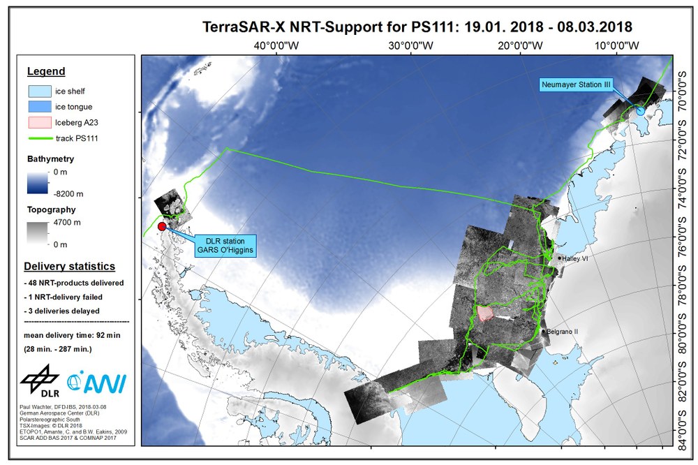
For three-and-a-half years, data from the German radar satellites TerraSAR-X and TanDEM-X have been made available to support AWI research in the Antarctic as part of a cooperation agreement between EOC and AWI. Specifically, the research icebreaker Polar Star has been provided up to now with ice maps generated by DLR in near real-time (NRT) during expeditions in Antarctic sea ice. These data sets are used by on-board scientists and crew members when planning fuel-saving, safe ship routes and identifying suitable places to carry out science experiments. In addition, for the area around Neumayer Station III images are routinely supplied that can be used to study long-range changes in the Ekström ice shelf as well as to obtain information about the structure of sea ice in Atka Bay. This information also contributes to the safety of the station crew when they are working at the edge of the ice shelf and on the sea ice in Atka Bay.

At the beginning of the 2017/2018 Antarctic season I could, in addition to the AWI expeditions, also support international research ships located between the Weddell Sea and the Ross Sea with the help of the radar eye on TerraSAR-X. Despite the positive feedback from various users of our data products, it is extremely valuable to have an opportunity to gain direct experience in dealing with the data locally. Initially, the goal will be to monitor the route of the S.A. Agulhas II icebreaker with TerraSAR-X data in order to support route planning as effectively as possible, and in the ideal case be able to optimise it. At the same time, the usefulness of the data is to be analysed while the ship is making its way through sea ice and ideas for possible improvements discussed with those responsible on-board. The key element of data acquisition will be the DLR receiving station at the northern tip of the Antarctic Peninsula. The German Antarctic Receiving Station (GARS) O’Higgins is able to acquire TerraSAR-X data, process them locally and – reduced to a suitable data volume – provide timely images to the respective users.

