The ‘Polar and Mountain Regions’ team focuses on analysing the processes occurring in Antarctica, the Arctic and mountain regions.
Polar and mountain regions are among the least densely populated areas in the world. Despite their low population density, they are of utmost importance for the global climate system, sea-level rise and water availability. The team analyses occurring changes in these regions by evaluating extensive remote sensing data, often using long time series from various sensors – including multispectral, radar and passive microwave data – as a basis. The aim of this research is to quantify the impacts of climate change on these sensitive ecosystems and to assess their consequences for nature and society.
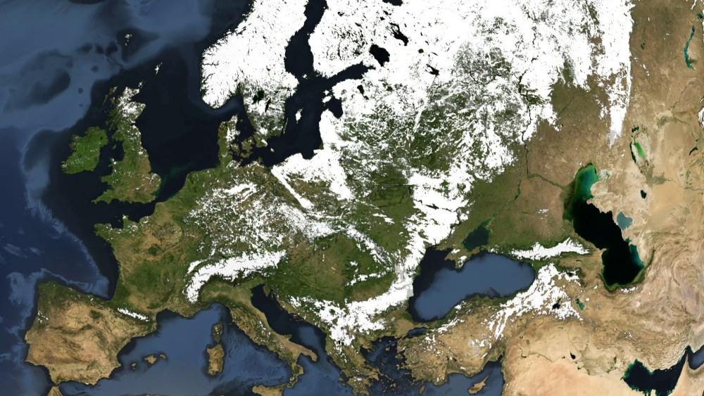
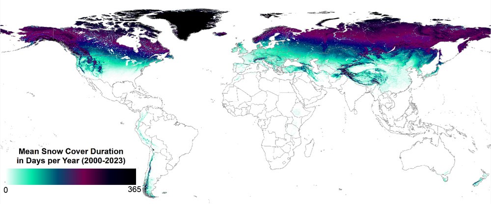
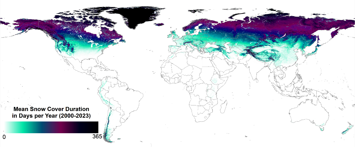
A key research focus is on the dynamics of global snow cover. Up to 50% of the Northern Hemisphere is covered in snow during winter, with both short-term weather anomalies and long-term climatic changes influencing the distribution, duration and depth of snow cover. These processes have far-reaching consequences for the water cycle, the global radiation balance, as well as for tourism, flora and fauna. To systematically analyse ongoing change processes, the ‘Global SnowPack’ was developed, a product based on daily satellite imagery that derives the extent of global snow cover and processes parameters such as the annual duration of snow cover and deviations from long-term averages.
Mean snow cover duration (days per hydrological year) based on the DLR Global SnowPack
Changes in glacier and snow cover in mountainous regions are of particular relevance. The upward shift of the snow line, the shortening of the snow cover duration, and the global retreat of mountain glaciers are among the core areas of research. These processes have serious implications for (winter) tourism, the habitats of endangered species, river discharge regimes, and water availability in the affected catchment areas.
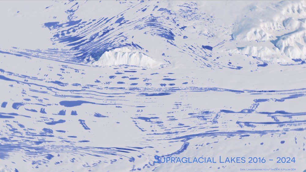
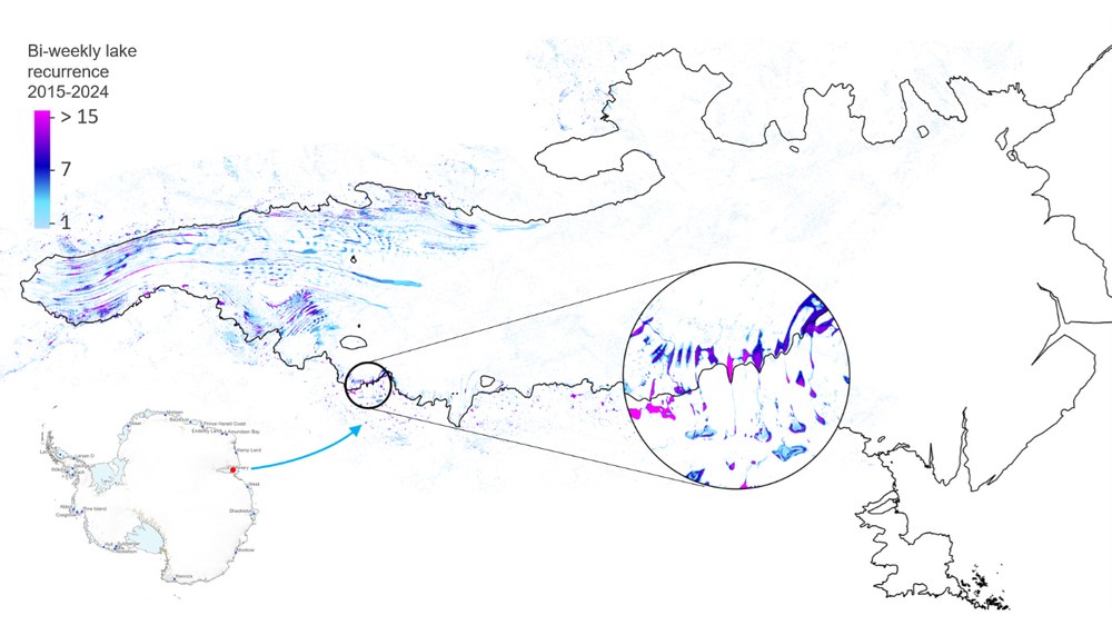
Supraglacial lakes in Antarctica, using the Amery Ice Shelf as an example
In the Arctic, particularly on the Greenland ice sheet, and in Antarctica, dynamic changes in glaciers and ice shelves are being investigated. In Greenland and Antarctica, supraglacial lakes play a significant role, as their occurrence and seasonal variation serve as direct indicators of the intensity of ice melt, and their existence can lead to additional runoff that erodes the ice from below. By analysing radar satellite imagery and cross-referencing it with other remote sensing data, time series of glaciological parameters—such as glacier extent, glacier movement, shelf ice fronts, supraglacial lakes, elevation changes and mass balances—are generated that are as long and high-resolution as possible. Analysis of this data enables well-founded conclusions to be drawn about glacier and ice shelf development over the past decades and provides a basis for forecasting future developments in the face of ongoing global warming.
Current Projects Polar and Mountain Regions
ESA AI4SNOW
AI4AlpineRisks
SOS: Serverless Scientific Computing and Engineering for Earth Observation and Sustainability Research (DFG)
The “Global SnowPack” is derived from daily satellite data with a resolution of approximately 400 metres. Gaps caused by cloud cover and the polar night are filled using specially developed methods, and the product has been available continuously for every calendar day since 1 September 2000.
Global SnowPack
Your consent to the storage of data ('cookies') is required for the playback of this video on Quickchannel.com. You can view and change your current data storage settings at any time under privacy.
Global SnowPack
The “Global SnowPack” is derived from daily satellite data with a resolution of approximately 400 metres. Gaps caused by cloud cover and the polar night are filled using specially developed methods, and the product has been available continuously for every calendar day since 1 September 2000.
Extent of supraglacial lakes on the Amery Ice Shelf in East Antarctica between 2016 and 2024. The extent of the lakes varies greatly from year to year, and even within a single year, many lakes are visible for only a few weeks. Pink shades indicate lakes that form every year, while light blue areas indicate lakes that form only rarely.
Supraglacial lakes
Your consent to the storage of data ('cookies') is required for the playback of this video on Quickchannel.com. You can view and change your current data storage settings at any time under privacy.
Supraglacial lakes
Extent of supraglacial lakes on the Amery Ice Shelf in East Antarctica between 2016 and 2024. The extent of the lakes varies greatly from year to year, and even within a single year, many lakes are visible for only a few weeks. Pink shades indicate lakes that form every year, while light blue areas indicate lakes that form only rarely.

