
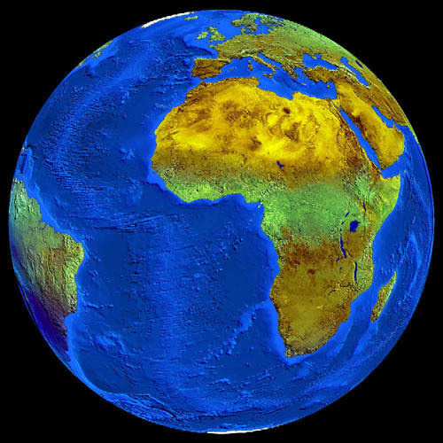
Cloud-free Africa
Satellites have been providing two-dimensional views of the earth for a long time, often in different spectral channels. The third dimension can also be opened up by means of remote sensing: Terrain models depict heights and depths, new types of sensors and computing methods enable 3D views, which in turn allow additional useful applications.

The special thing about this image, however, is that the fourth dimension, namely time, was used to produce it. For this completely cloud-free view of the earth, a total of 60 individual images from the Meteosat-5 satellite had to be processed over a period of two months. The cloudy areas were gradually replaced by cloud-free areas. The temporal dimension thus served to complete the spatial information. In addition, the depth structure of the oceans was visualized using a digital elevation model.
The example makes it clear that remote sensing is more than simply receiving photos from orbit - a view like the one shown here has never been offered to a satellite. Rather, it is about the intelligent handling of data that is only processed into image products on the ground, and in very different ways depending on the issue at hand. For example, the same data - analyzed under different criteria - would have produced a completely different image. In this case, the image is used as a background for the current animation of global cloud movements. Data reception and digital image processing were carried out at DLR's German Remote Sensing Data Center (DFD) in Oberpfaffenhofen.