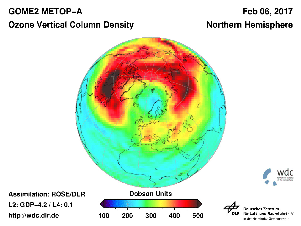
Since early February a distinct reduction in ozone concentration over northern Europe has been observed (Figure 1). This situation is unusual in the Northern Hemisphere.
Figure 1: Total column ozone concentration on 6 Feb. 2017
Ozone is primarily produced in the equatorial zone by energy-rich UV radiation in the stratosphere. From there, so-called Brewer-Dobson circulation transports it meridionally to polar regions, where the ozone accumulates. This initiates areas of ozone-poor air at lower latitudes.
At mid-latitudes there is an area of maximal zonal wind speed, the jet stream. It transports air masses latitudinally, usually eastward, hindering the meridional exchange of air masses. So-called planetary waves make this exchange possible.
Among other origins, planetary waves are initiated at land-ocean transitions. Since these transitions are considerably more prominent in the Northern Hemisphere, the jet stream fluctuates laterally in the Northern Hemisphere more than it does in the Southern Hemisphere. These meanders are associated with high and low pressure areas as well as storm paths. Especially prominent meanders cause air masses to be diverted from the equator to the poles, and vice versa. The result is constant mixing of the air masses between pole and equator. Thus extreme ozone concentration values over the North Pole are much less frequent compared with the situation at the South Pole.
If the meanders are too strongly distorted, individual pressure blocks can be separated off. In physics this phenomenon is described as breaking waves.
Since the beginning of February, a relatively long period of time, one such meander has been diverting ozone-poor air masses from lower latitudes to Scandinavia (Figure 2). This meander has been distorted meridionally to such an extent that a high pressure area was pinched off from the air flow. A “High-Over-Low” weather condition formed, which can cause extreme weather situations because of its persistence. It is lingering exceptionally long over Scandinavia, leading to low temperatures and cloud disintegration there, and accordingly to high levels of UV radiation.
The connection between atmospheric dynamics and the development of extreme weather situations is not yet fully understood because of its complexity and therefore a subject of current research in DFD’s Atmosphere department.
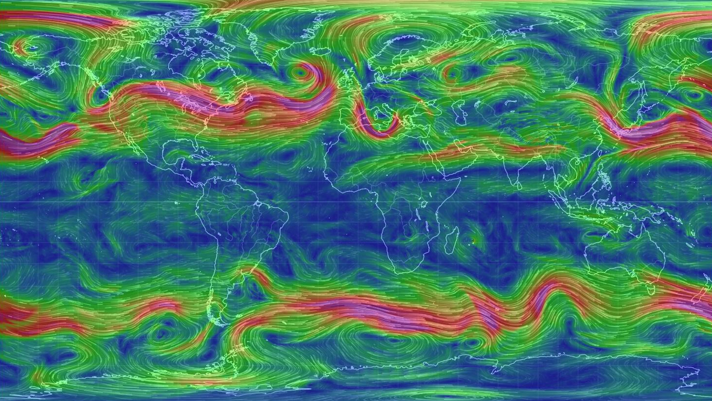
Figure 2: Air flow situation on 6 February 2017
Wind velocity at 500 hPa altitude on 6 February 2017. The high wind speeds of the jet stream are shown in red, both in the Northern Hemisphere and, even more pronounced, in the Southern Hemisphere.


