
Tracking Methane with an Airplane
As a greenhouse gas methane is 25-times more effective than CO2. Its sources include agriculture, forestry, and mining activities, livestock farming, wastewater treatment plants, and waste-disposal sites, among others. Because of its potent greenhouse effect it is particularly important to identify methane sources. EOC is participating in a large European measurement campaign to test various technologies for detecting and measuring carbon dioxide and methane sources.
The Intergovernmental Panel on Climate Change (IPCC) considers the greenhouse gases methane and CO2 to have the highest relevance for Earth’s climate. In the atmosphere both gases decisively influence Earth‘s energy balance, and the anthropogenic contribution is high.
For that reason a large European measurement campaign under the aegis of the CoMet project is testing in May and June 2018 various ground-based and aerial technologies for detecting and quantifying carbon dioxide and methane sources. Two DLR research aircraft are being employed for the purpose: a Cessna Caravan for small-scale measurements at low altitude and the atmospheric research aircraft HALO, primarily for large-scale measurements.


IMF scientists want to investigate whether methane sources can be detected with a hyperspectral sensor. Such sensors were originally designed to examine the ground. Except for two significant differences, their operating principle is like that of spectrometers used for studying the atmosphere. Hyperspectral sensors have, in general, higher spatial resolution, which means lower spectral resolution. The higher ground resolution compared with atmosphere spectrometers is an advantage when imaging small, selective sources. On the other hand, the lower spectral resolution complicates unambiguous identification of the trace gas methane.
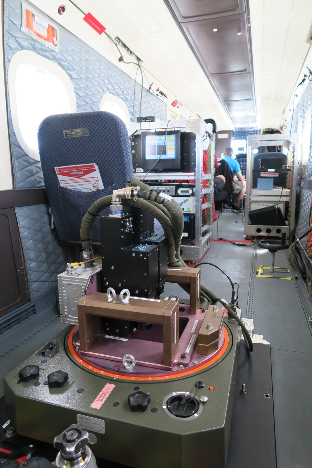
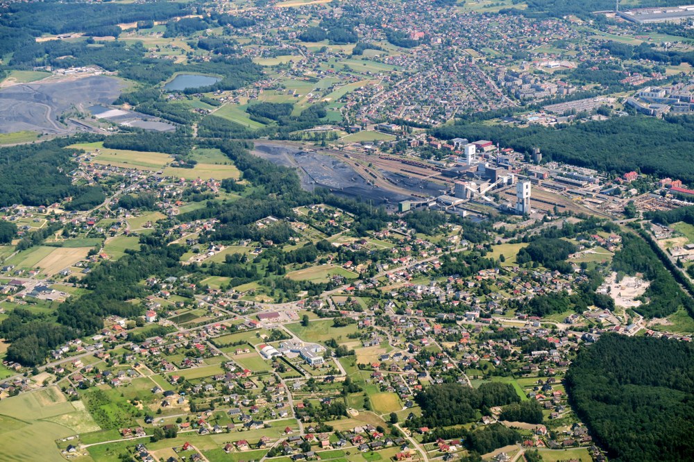
As part of the CoMet measurement campaign the Remote Sensing Technology Institute (IMF) flew over the coal-mining area near the Polish city Katowice. This area is one of Europe‘s largest methane sources. The gas is liberated there as firedamp from numerous anthracite mines. A HySpex hyperspectral system was employed on measurement flights with DLR‘s Dornier 228 research aircraft. The instrument is operated by OpAiRS, an IMF user service that makes available also to external users in science and industry various sensors and field instruments for aerial remote sensing.
Bremen University and Free University of Berlin also participated in the measurement campaign by providing a spectrometer customized for methane. This made it possible to fly over the test site with four aircraft simultaneously. The elaborate flights were planned and coordinated by DLR’s research flight department in Oberpfaffenhofen.
This perhaps unique data set will be analysed over the next few months. Evaluation of the HySpex data is being undertaken in close cooperation between OpAiRS scientists and IMF specialists in atmosphere processors. With this approach IMF expertise in the areas of sensor calibration and trace gas detection can be combined. The various measurements made by the CoMet Partner offer an exceptional opportunity to validate the IMF measurements.
The CoMet (Carbon dioxide and methane mission for HALO) research project is financed by the Deutsche Forschungsgemeinschaft (DFG), a German research foundation, and the participating partners: DLR’s Institute of Atmospheric Physics, Max Planck Institute of Biogeochemistry, Bremen University’s Institute of Environmental Physics, Heidelberg University’s Institute of Environmental Physics, Menlo Systems GmbH, and DLR’s Flight Experiments unit. In addition there are participants from research institutes in eight different countries, international measurement networks, and space agencies that benefit from this particular aircraft mission. The Remote Sensing Technology Institute participated in this special measurement campaign with a self-financed contribution, but it is not itself a formal part of the CoMet project.