Disasters require the perfect coordination of situation rooms, rapid response teams and public authorities. Major natural disasters, complex danger situations, and cross-border events stretch first responders to their limits. Methodologies and technologies developed In the HEIMDALL project can help those involved to prepare for and effectively manage such scenarios.
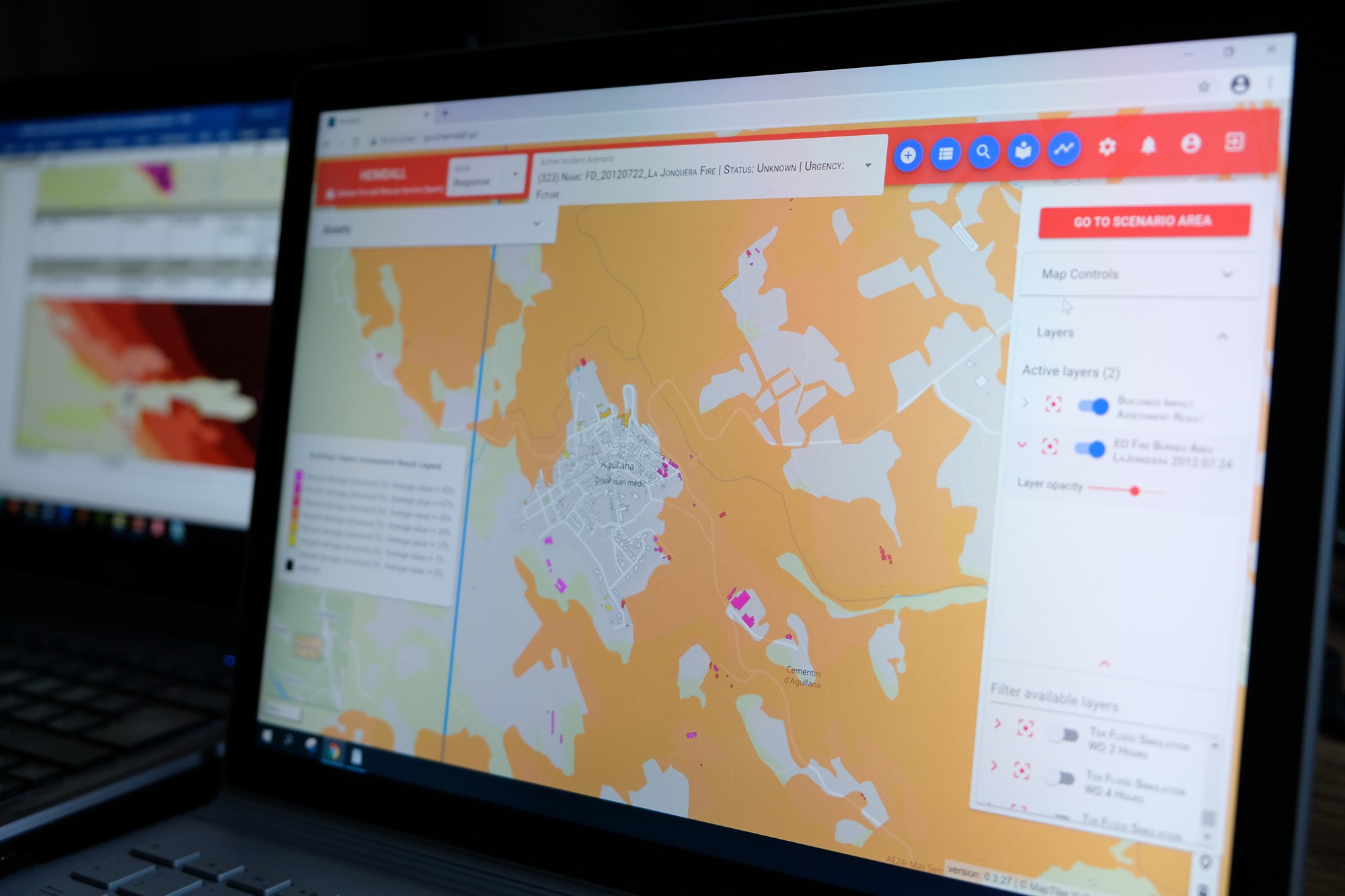
HEIMDALL uses a comprehensive digital platform - with components developed by the EOC - to help emergency services plan, assess, manage and learn from disasters.
HEIMDALL Project
Your consent to the storage of data ('cookies') is required for the playback of this video on Quickchannel.com. You can view and change your current data storage settings at any time under privacy.
HEIMDALL Project
HEIMDALL uses a comprehensive digital platform - with components developed by the EOC - to help emergency services plan, assess, manage and learn from disasters.
Already before a forest fire, flood, or slope collapse begins, the expected scenarios must be thought-out and feasible countermeasures planned. Only then can it be assure that disaster situations are managed as well as possible. Over the past three-and-a-half years, EOC, the DLR Institute of Communication and Navigation, and 14 European research and industrial partners have collaborated in the now-concluded EU project HEIMDALL to find appropriate solutions. The users – civil protection organisations from Spain, Italy, Scotland and Denmark – were closely involved as project partners so they could formulate their requirements and evaluate the project results in practice.
In the course of the project, EOC contributed several applications that were put together on a digital platform. The information system that was developed is intended to assist organisations to monitor, assess and predict disasters more effectively in the future.
Rapid response workers carrying out a HEIMDALL disaster drill
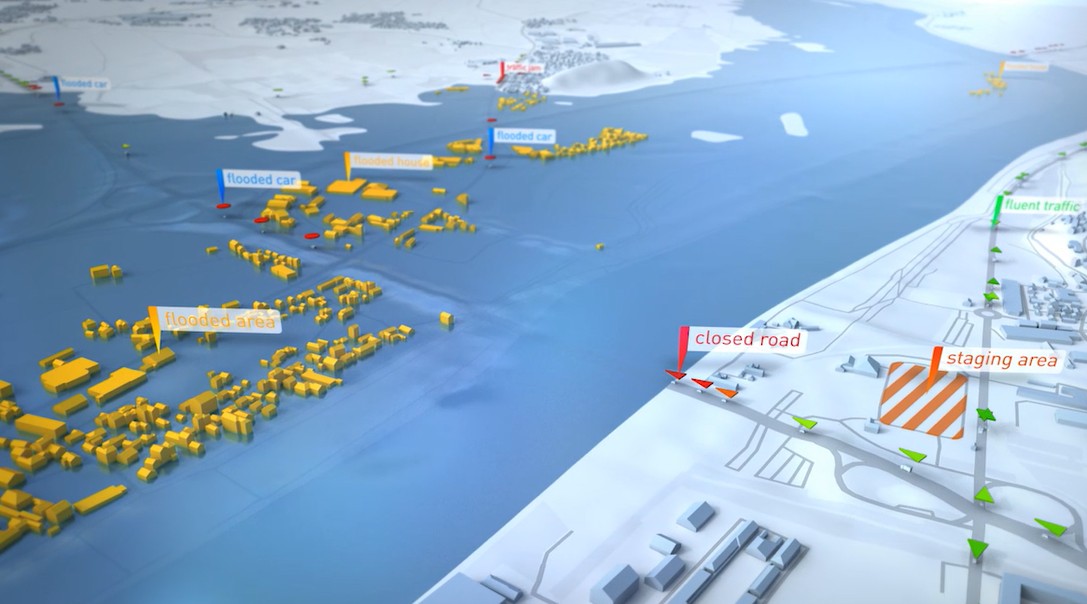
Satellite data are an important disaster information source. They include data from Copernicus, the European earth observation programme, which can record large parts of affected areas in near-real-time. Processing chains were developed by EOC to analyse optical, thermal and radar satellite data without manual interaction and transmit the derived data automatically to the HEIMDALL platform, for example, the precise location and extend of damage caused by floods or fires.
Burnt areas derived from satellite data
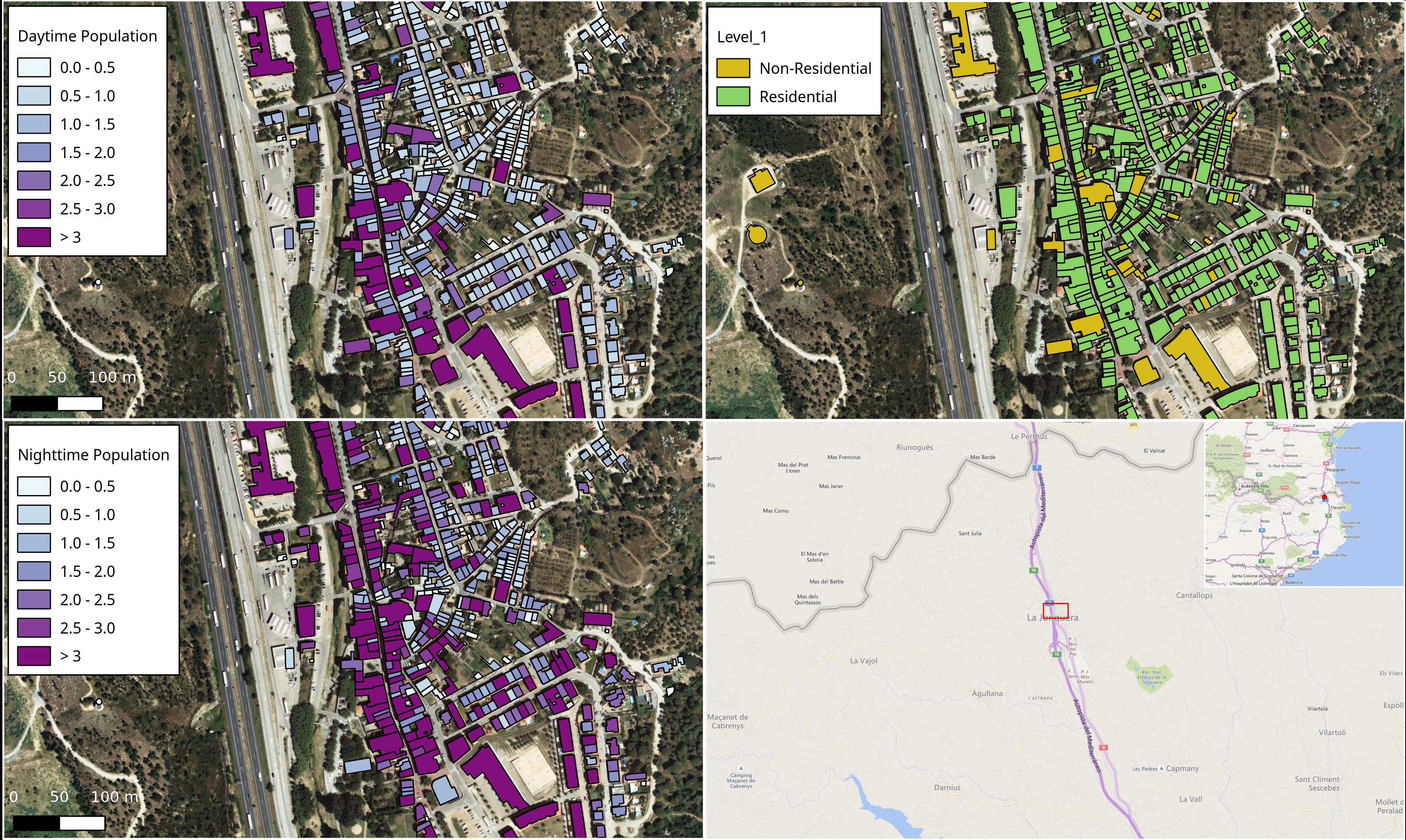
are spatially combined with other kinds of data in order to be able to identify potentially affected populations or infrastructure.
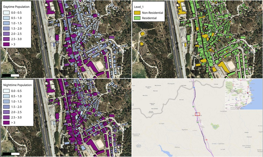
In addition, a methodology was developed at EOC for detailed risk assessment that estimates the affected populations using high-resolution building data. To do that, the scientists combined OpenStreetMap data, national data sets with building information, and laser scanned scatter plots to depict typical spatial distribution patterns of the population during night-time and daytime situations. This makes it possible for emergency relief planners to prioritise the measures they will take. Together with civil defence organisations, especially vulnerable infrastructure like schools, hospitals, care homes, industrial complexes, and power plants were also classified. On the basis of these data a risk assessment concept could be developed. It makes possible selective assessment by natural hazard, building damage and infrastructure cutbacks so that risks can be weighed in a more differentiated way and targeted measures taken in crisis situations.
Daytime and night-time estimates of population density at the building level as a function of building purpose
In order to learn from past disasters, data from previous natural disasters, such as their spatio-temporal progression, weather data, and emergency response plans were analysed and assembled in a scenario database. With the help of a tool developed at EOC, users can now access these scenarios, compare disasters, learn from past situations and experience, and adapt response strategies and measures.
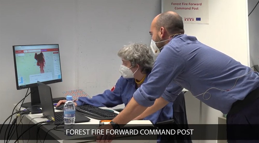
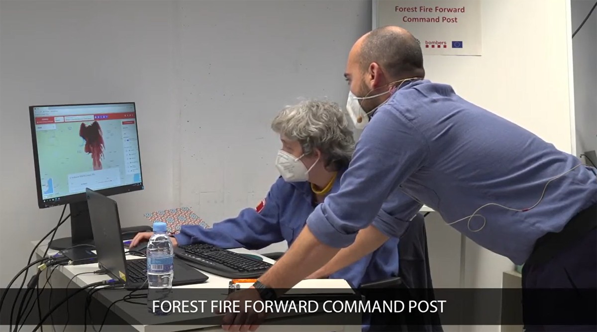
The HEIMDALL information system was demonstrated in a realistic disaster drill end of January 2021 at the conclusion of the project. In a control centre of the Catalan fire brigade and emergency services a cross-border forest fire and flood were simulated for the various phases of the disaster management cycle.
Users were convinced by the system that had been developed: “The demonstration presented today showed us that this platform ideally meets expectations and is very efficient as a coordination tool,“ affirmed Quim de Diego of the Catalan police, who participated in the drill.


