Mapping sea ice is essential for ship traffic in the Baltic Sea. EOC's Maritime Security Lab in Bremen has developed an AI-supported approach that will now be employed by the Ice Service of the Federal Maritime and Hydrographic Agency of Germany (BSH).
The Baltic Sea is an important hub in international shipping. However, large parts of its northern and eastern sections are frozen over in winter. This ice cover can then become up to a meter thick, affecting maritime travel. In addition, winds and currents constantly alter the ice situation and complicate navigation.
Up-to-date ice maps help ship captains find a safe and energy-saving route through the ice. For that reason the BSH Ice Service generates for German ships a daily overview of the ice situation on the German coast of the Baltic Sea, and also maps the entire Baltic Sea weekly.
For the first time in the 2024/25 ice season the Bremen Maritime Security Lab supported the Ice Service by supplying it with sea ice polygons. These are maps of ice surfaces showing places with the same ice concentration or ice thickness, as derived from radar images from the European Sentinel-1 satellites. To do this, the DLR scientists combined an AI-based ice classification with image segmentation algorithms and simplified lines. Historic BSH ice maps were used to train the AI. The polygons generated with this procedure will from now on be regularly generated for BSH in the ice season, freeing that agency of the elaborate mapping work.
“Precisely in the case of ice floes of various sizes, time intensive manual digitalization is avoided, with good detail provided”, concludes Wiebke Aldenhoff of the BSH Ice Service.
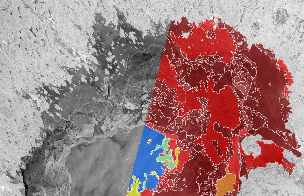
Sentinel-1 image of the Bottenwiek on 6 February 2025
showing an excerpt from the sea ice polygon generated from it. The colours show the ice concentration in the polygon, from blue (open water) to red (fully ice covered).
Credit:
DLR, CC BY-NC-ND 3.0, Contains modified Copernicus Sentinel data [2025]
In addition to radar data, under cloud-free conditions optical satellite images can also be used for ice mapping. AI models are also put to use here. They are trained at the Maritime Security Lab in Neustrelitz using Landsat-8 data. With the new method these results can also be processed to produce vector-based polygons that can be seamlessly integrated into existing GIS systems.
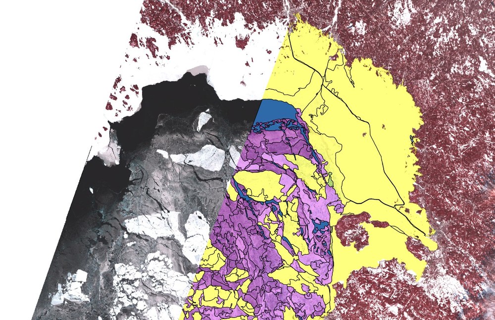
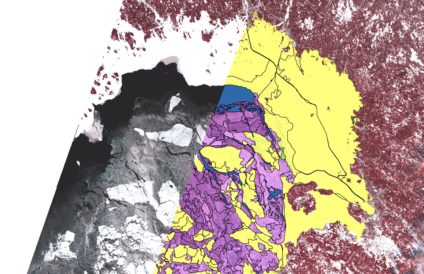
Sentinel-1 image of the Bottenwiek on 18 February 2025
in false-colours showing an excerpt from the sea ice polygon generated from it. Here the colours in the polygon show the ice thickness, from blue (ice-free) via magenta (15–30 cm) to yellow (30–50 cm).
The current ice season came to a close on May 23 with the melting of the last ice floes. But also in the next ice season DLR will be supporting BSH with its newly developed methodology.
The work is being funded as part of the Real-Time Maritime Security Services project.

