
Air Quality Analysis: validating satellite data with ground measurements in Limassol, Cyprus
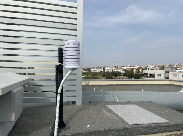
Satellite measurements offer global, comprehensive, uniform identification of air pollutants. But for the small-scale, dynamic conditions in cities their spatial and temporal resolution is insufficient. Satellites record a vertical pollution pillar over the depth of the entire atmosphere. It is difficult to measure ground-level concentrations, but it is particularly the near-ground pollution concentration that has substantial effects: an average person inhales about 11,000 litres of air – also including substances harmful to health like nitrogen dioxide (NO₂) and particulate matter (PM). Official, ground measuring stations provide exact values, but they are expensive and sparsely distributed. This is where the AirTRack system, developed jointly by Augsburg University and the German Aerospace Center (DLR), comes into play. It is based on commercially available, low-cost sensors and when appropriately calibrated they reliably provides data at high resolution on changes in the pollution concentration of PM, NO₂ and ozone, as well as meteorological parameters (temperature, humidity, air pressure). A close-knit network of such sensors makes it possible to detect small-scale pollution variability in the area measured. Together with satellite data that provide large-scale air quality structure, a more complete picture of pollution concentrations can be obtained. And, in addition, AirTrack contributes to the development and evaluation of methodologies to derive near-ground pollution concentrations from satellite data.

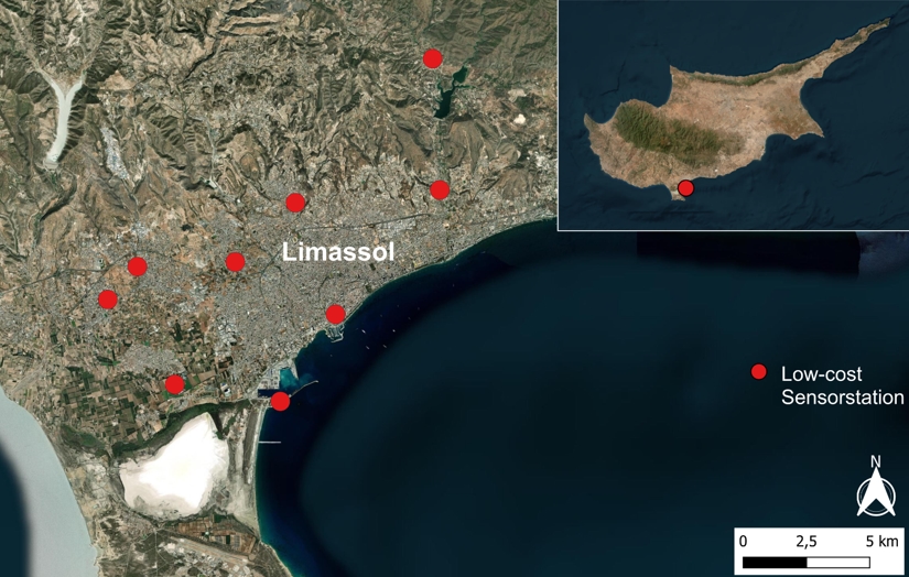
In April 2025, for the first time a close-knit network of AirTrack systems was installed in Limassol on Cyprus as part of the EU Exupery projects in cooperation with the University of Limassol and the Erastothenes Center of Excellence (see map). The island is an ideal location for such investigations since it has considerable air quality problems due to the high level of private vehicle traffic and periodical Sahara dust storms. With its over 100,000 inhabitants, Limassol has at the same time, as far as we know, only one official ground measurement station. Th AirTrack sensors were carefully placed at locations with various characteristics such as at expressway and harbour vicinities, inner cities, and surrounding urban areas. Since that time that have been providing real-time date by the minute on pollution levels as well as their spatial and temporal variability.
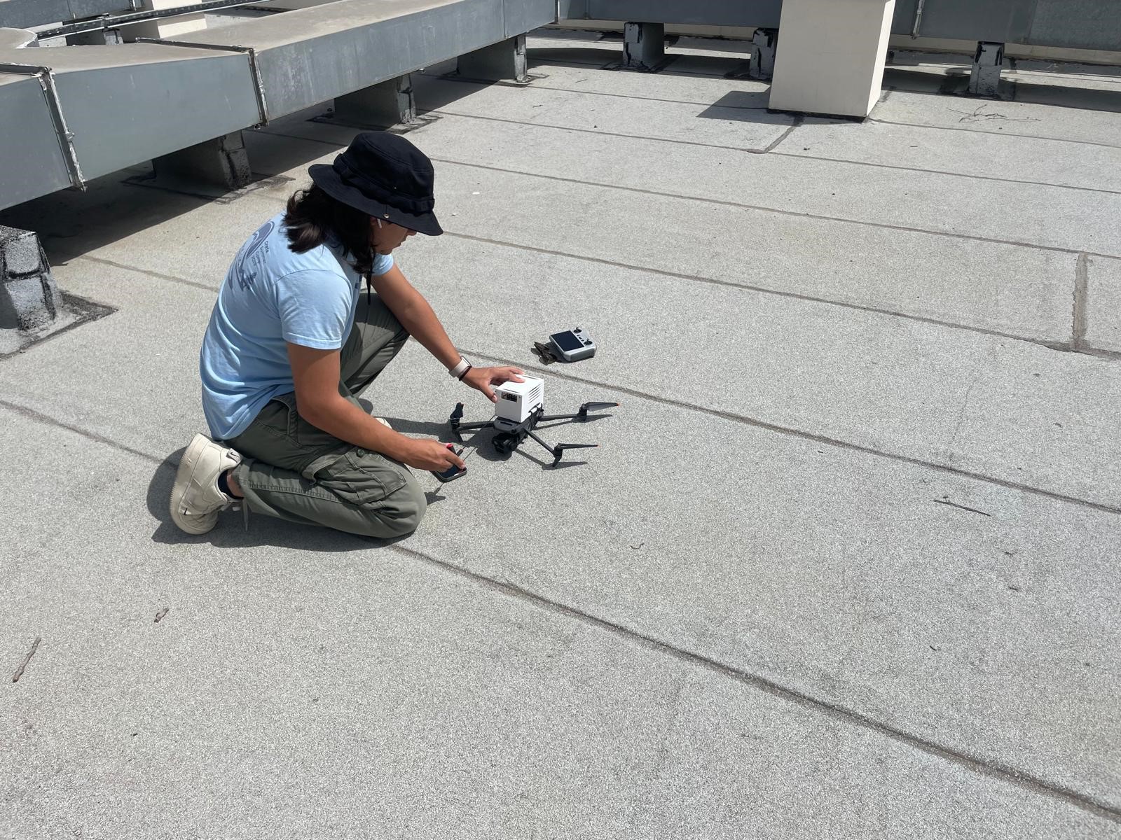
Simultaneously with the overflight of the European satellite Sentinel-5P, ground conditions were recorded by the stations of the AirTrack system and by smaller, mobile AirTrack systems on two drones. The drones record vertical profiles of pollution that can likewise contribute to improved interpretation of satellite data. The measurement instrument on board Sentinel-5P, the TROPOMI (TROPOspheric Monitoring Instrument), supplies data on global air pollution at a horizontal resolution of some 25 square kilometres.
With the dense AirTrack network on the ground, it is now possible to draw conclusions about the so-called "Observational Filter" of the satellite-based instrument. This filter indicates how the instrument "sees" spatial variability. Knowledge about this filter is essential for reliably comparing the satellite measurements with those made on the ground.


By combining low-cost ground sensors, vertical drone profiles and satellite measurements the spatial-temporal dynamics of air pollution can be detected in much greater detail. This offers the potential to selectively augment satellite measurements. Long term this could contribute to more reliable information about air quality and health risks at the local level.
Links:
Kontakt
Prof. Michael Bittner