
Global SnowPack available from EOC Geoservice
Global snow cover is an important parameter of water availability on our planet. It not only influences flora and fauna, agriculture and tourism, but also the stability of glacier and permafrost regions worldwide, not to mention Earth’s radiant energy balance. Global SnowPack presents the evidence daily and globally, and is now available to the public in an expanded version.
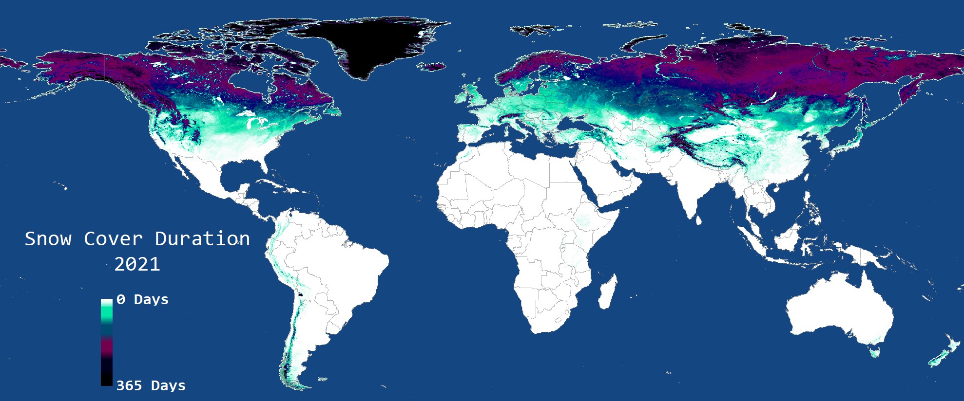
Climate change leads to snow cover dislocations because of increased temperatures and changes in the precipitation regime. In many of Earth’s regions the total duration of snow cover has become shorter – frequently as a result of the earlier start of snowmelt in springtime or the delayed onset of snowfall in winter. But there are also individual regions in which snow cover increases. The WMO has designated snow cover as one of the essential climate variables (ECV) that requires continuous monitoring. In order to better understand climate change and its effects on our planet it is important to monitor global snow cover at the highest possible spatial and temporal resolutions.
Global SnowPack was developed for that purpose and made generally available in a first version already in 2015. The snow cover is derived from remote sensing data collected by the MODIS sensors on the Aqua and Terra satellites and accessible to the public globally for every day of the year. Parameters like the duration of snow cover and the beginning and ending of the snow season are derived from these daily data. Now, an advanced version of Global SnowPack contains an improved algorithm for interpolation between data gaps (triggered by clouds or polar night) and a near-real-time function that augments this data product daily with the latest satellite data. These data are made available through EOC Geoservice and can, for example, provide insights about sudden changes in snow cover. Via Web Map Services (WMS) these data can be easily integrated into existing projects and applications.
