Pilot project for AI-based detection of parking spaces using aerial imagery in Baden-Württemberg
The Baden-Württemberg Ministry of Transport provides MobiData BW®, a mobility data platform that aggregates mobility data and makes it accessible via standardised interfaces. Parking data is an important component of this mobility data. However, there is no comprehensive, standardised data available for public parking spaces across the whole state. To make access to such data as straightforward as possible for local authorities, various approaches to automated data collection were investigated.
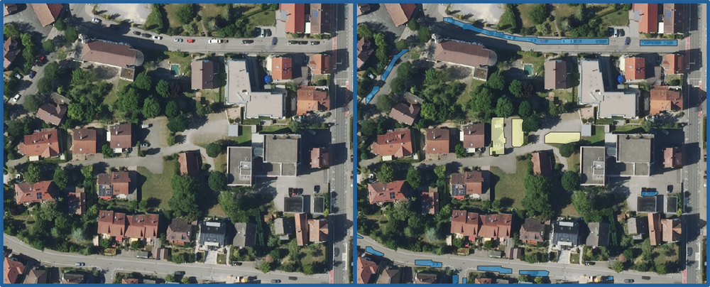
This is where the KI4Parkplätze (KI4PA) project comes in. Through the automated analysis of aerial photographs, parking spaces are identified and made available in the ParkAPI format. The approach has been trialled in individual local authorities and assessed for its transferability. Further scaling up to include additional local authorities and, in the long term, at the state level is possible. The data obtained as part of the project can be used to establish the digital car park register, where it can subsequently be quality-assured and enriched.
Contribution Institute for AI Safety and Security
The Department of Algorithms and Hybrid Solutions at our institute develops and implements the AI-supported software for the automated analysis of aerial imagery data from Baden-Württemberg. The method of instance segmentation is employed for the detection and categorisation of public parking spaces. To ensure robustness, ensemble methods for uncertainty estimation and symbolic post-processing are utilised. The verified results are then made available via the ParkAPI interface of the MobiData BW mobility data platform and are ready for use.
Commissioned by the Baden-Württemberg Ministry of Transport Publication date: 24 August 2026