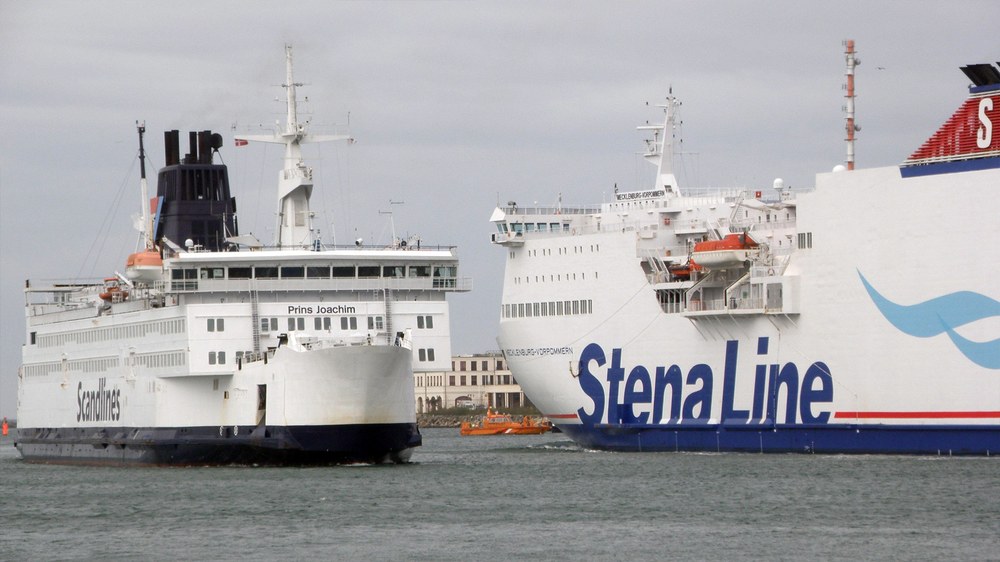
Maritime backup system for position, navigation and time
The R-Mode Baltic and R-Mode Baltic 2 projects aim to set up and extensively test the world's first test field for the new maritime terrestrial backup system called R-Mode, which is based simultaneously on signals from two existing maritime communication channels, in the Baltic Sea. This is an important step towards the reliable provision of position, navigation and time (PNT) information on board a ship, which has been demanded by maritime organisations for years.
In this project, the institute is concentrating on R-mode signal design for transmissions in the medium and ultra-short wave range, the development of methods for range and position estimation, synchronisation in the station network with R-mode signals, the integration of R-mode in a PNT data processing unit and the international standardisation of R-mode. DLR is leading the flagship projects of the "EU Strategy for the Baltic Sea Region (EUSBSR)". Partners in the projects are national maritime transport authorities, research institutions and industry from four European countries.
Global Navigation Satellite Systems (GNSS) are today the main source of PNT information for safety of life maritime operations. GNSS-based PNT data is used as input for various systems such as the AIS (Automatic Identification System) and the position display on the ECDIS (Electronic Chart Display and Information System). The worldwide availability and high performance of GNSS makes it an indispensable tool for nautical personnel. But GNSS is vulnerable, as has been shown in various studies. Interference from natural sources such as the ionosphere, as well as man-made interference, can lead to a deterioration in performance and furthermore to a loss of availability. Therefore, skippers worldwide are looking for a backup system that supports them with sufficient position and time accuracy to safely complete maritime manoeuvres. International bodies such as the IMO (International Maritime Organisation) and the IALA (International Association of Marine Aids to Navigation and Lighthouse Authorities) are currently stepping up their efforts to introduce reliable PNT systems into the maritime world.
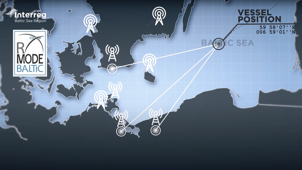
R(anging) mode is a technology that uses existing maritime differential GPS (DGPS) navigation stations (maritime radio beacon) or AIS base stations to transmit range information by adding signals to the conventional transmission scheme. By 2020, the R-Mode Baltic project team will set up the world's first R-Mode test field in the Baltic Sea using the signals from both types of station and develop initial applications.The aim is to demonstrate that R-Mode can fulfil the requirements of maritime users for a backup system.The work of the project team is divided into the following six main topics.
DGPS NAVIGATION STATIONS provide low rate differential corrections for GNSS in the medium wave range around 300 kHz. Based on already available R-mode developments with additional sinusoidal signals and the legacy signal, the project team will investigate methods to solve the signal wave ambiguity problem by improved signal design and signal processing.In addition, methods will be developed to suppress the effects of space wave induced fading.Up to six stations will be equipped with R-mode technology.
AIS BASE STATIONS provide information from shore to ships using AIS messages transmitted in the ultra-short waveband (VHF) around 162 MHz.The project team will test the implementation of R-Mode on AIS and VHF Data Exchange System (VDES) signals.An optimal signal design will be selected and algorithms for range estimation will be developed, taking into account the load on the radio channel.Four AIS base stations will be adapted for the transmission of R-mode signals.
TIME SYNCHRONISATION OF R-MODE TRANSMITTERS is essential for a terrestrial backup system, as the transmitters must operate with a common time accuracy of a few 10ns. The project will analyse the performance of currently available time comparison methods and station clock alternatives and propose a suitable R-mode timing infrastructure. Furthermore, the self-synchronisation of the R-mode system will be investigated.A proof-of-concept of a transnational cost-efficient time synchronisation solution with suitable hold over clocks at the transmitter sites will be developed and demonstrated.
R-MODE POSITIONING is based on the distance estimates to different transmitters.An assessment of how the possible sources of error affect the performance and reliability of the R-Mode system supports the consideration of whether to use circular and hyperbolic lateration methods for positioning.Based on existing GNSS receiver platforms, hardware is developed for two prototype receivers and processors with different levels of integration.The supplied software fulfils the requirements of the R-mode backup system and includes the results of the project research on R-mode positioning methods. At the end of the project, the prototypes will be extensively tested to demonstrate the performance of the R-Mode technology.
TWO R-MODE APPLICATIONS are being developed. Firstly, an existing prototype PNT data processing unit will be extended to support R-mode receiver raw data input. This approach enables position calculation based on R-mode signals transmitted by DGPS navigation stations and/or AIS base stations.If GNSS positioning is lost, an R-mode based position is automatically provided. On the other hand, a portable pilot unit (PPU) is equipped with an R-mode module.If GNSS is available, the device operates in standard mode.If GNSS positioning fails, it automatically switches to R-mode operating mode.The R-Mode PPU informs the pilot of the active positioning mode via the display.
R-MODE STANDARDISATION is a prerequisite for the spread of R-Mode technology, as DGPS navigation stations and AIS base stations have been developed in accordance with international standards and guidelines from IALA, IMO, ITU, IEC and others. The implementation of R-mode technology on these stations therefore requires the modification of existing international standards. The project team will disseminate project findings to various standardisation bodies and international organisations, communicate with them and encourage them to extend the scope of existing PNT standardisation to include R-mode technology.
The video explains how the R-Mode Baltic project is helping to increase maritime safety in the Baltic Sea. The project launches the development of a technical system that allows for safe ship navigation when the established Global Navigation Satellite Systems fail due to intentional or unintentional interference. The 12 partners of maritime administrations, research institutions and private companies of Germany, Sweden, Norway and Poland test broadcast signals transmitted via radio beacons and base stations of the Very high frequency Data Exchange System (VDES). This serves to develop prototypes for ranging mode transmitters, receivers and applications. The Baltic Sea is the first operational test area for this technology worldwide that provides R-Mode signals in two frequency bands. Project website: https://www.r-mode-baltic.eu/
Video: R-Mode Baltic - Safe Navigation in the Baltic Sea (engl.)
Your consent to the storage of data ('cookies') is required for the playback of this video on Youtube.com. You can view and change your current data storage settings at any time under privacy.
Video: R-Mode Baltic - Safe Navigation in the Baltic Sea (engl.)
The video explains how the R-Mode Baltic project is helping to increase maritime safety in the Baltic Sea. The project launches the development of a technical system that allows for safe ship navigation when the established Global Navigation Satellite Systems fail due to intentional or unintentional interference. The 12 partners of maritime administrations, research institutions and private companies of Germany, Sweden, Norway and Poland test broadcast signals transmitted via radio beacons and base stations of the Very high frequency Data Exchange System (VDES). This serves to develop prototypes for ranging mode transmitters, receivers and applications. The Baltic Sea is the first operational test area for this technology worldwide that provides R-Mode signals in two frequency bands. Project website: https://www.r-mode-baltic.eu/
Credit:
DLR
Duration: October 2017 to December 2021
Funding: co-financed by the European Union through the European Regional Development Fund in the Interreg Baltic Sea Region Programme