
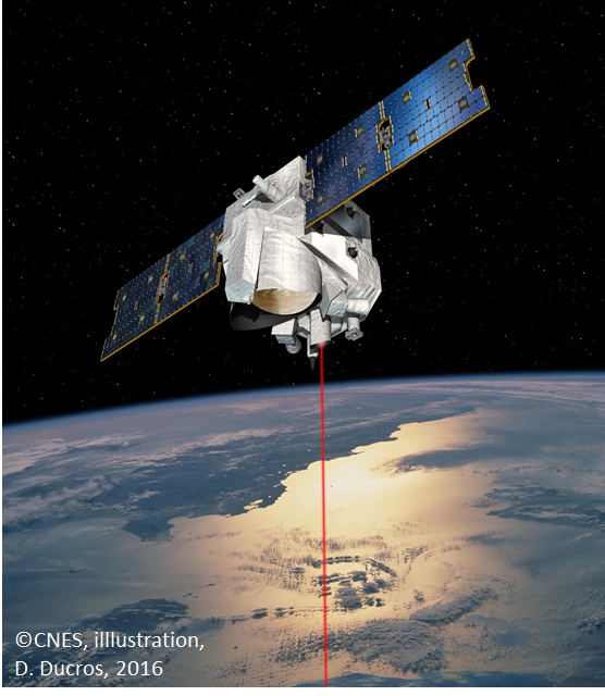
MERLIN
Knowledge about the emissions of methane is of great importance for climate prediction. Large uncertainties exist in the assessment of the development of tropical and boreal wetlands which comprise the largest natural methane sources. By using lidar measurements of atmospheric methane, the mission MERLIN is expected to significantly improve our knowledge of the global natural and anthropogenic methane emissions on a global basis. MERLIN was approved at ministerial level as a joint project between France and Germany. The launch is planned in the timeframe 2029.

Grafik ©CNES
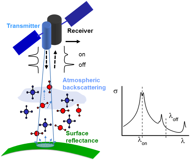
The first lidar in space for the measurement of atmospheric greenhouse gases
Methane is the third most important greenhouse gas in the atmosphere after water vapour and carbon dioxide, and responsible for about 20% of the climate warming induced by long-lived greenhouse gases since pre-industrial times. Methane is also an important player in reducing the oxidation capacity of the atmosphere by reacting with hydroxyl radicals (OH). It serves as an important source of tropospheric ozone and stratospheric water vapor, both key to climate, too.
Despite its importance, there is a lack of accurate and global observations of methane for quantifying biosphere-atmosphere exchange processes and related climate feedbacks. Space-based integrated path differential absorption (IPDA) lidar has potential to fill this gap, and consequently a Methane Remote Sensing Lidar Mission (MERLIN) on a small satellite in Polar orbit was proposed by DLR and CNES in the frame of a German-French climate monitoring initiative.
Grafik ©DLR
What are the scientific objectives of MERLIN? Wetlands are the most important natural methane sources. They also show the largest uncertainty and variability of methane fluxes. Wetlands are abundant in remote tropical and subarctic regions, challenging the deployment of in-situ instrumentation. On the other hand, spaceborne passive remote sensing is hindered in the tropics by frequently occurring thunderstorm clouds, and blind at high latitudes due to lack of sunlight. In the tropics it is expected that MERLIN will measure in between clouds, thanks to its small field of view, while its coverage at high latitudes will be particularly dense thanks to overlapping ascending and descending orbits.
The institute is tightly linked to the MERLIN mission by providing the German principal investigator (PI) and three members of the scientific advisory group (SAG). The mission will deepen our relations with the French partners and with the future MERLIN user community that employs inverse atmospheric models to quantify methane sources and sinks. Furthermore, close collaborations with NASA scientists, aiming to measure carbon dioxide with lidar, exist via the exchange of experts in the mission advisory groups, and via common mission performance assessments.
Links
Downloads
- MERLIN Mission Executive Summary (990.2 KB)