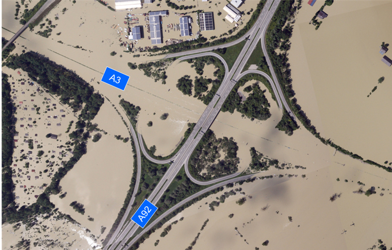
Between 2013 and 2020, the ZKI-DE service made it possible for federal authorities to obtain at short notice current geoinformation and analyses, which presented public administrations with new options for action. This innovative collaboration between the Ministry of the Interior (BMI) and the German Aerospace Center (Deutsches Zentrum für Luft- und Raumfahrt, DLR) met the need of federal authorities for current, value-added remote sensing data and analyses for crisis situations and to support civil security.
Between 2016 und 2020 another goal of the cooperation was to enable the Federal Agency for Cartography and Geodesy (Bundesamt für Kartographie und Geodäsie, BKG) to carry out primary activities of the ZKI-DE services by 2021.
ZKI-DE services included
Providing information products like up-to-date satellite images and damage analyses for disasters and major accidents
Remote sensing products for German security services, for example during major public events
Advising users about possibilities for using remote sensing technology
Training users to apply remote sensing, and regularly providing them with information on technological innovations
Continuously adapting the information products to the specific requirements of users and to changing technical options.


