
Lidar

A lidar instrument contains a transmitter, which consists of a pulsed high-power laser, and an optical receiver system comprising a receiving telescope and optical detectors. Unlike optical instruments, a lidar is not dependent on an external light source and is therefore able to conduct measurements at night, for example.
The distance between the instrument and the target can be determined from the time it takes from the emission of a laser pulse to the reception of the backscattered light. The laser signal can be reflected to the receiving telescope by solid or liquid objects, such as Earth's surface or water droplets, as well as by atmospheric gas components.
A distance profile is obtained directly from the time-of-flight measurements. This enables, for example, ground and ice elevation measurements or the determination of the vertical structure of physical properties of Earth's atmosphere (temperature, air pressure and air density profiles), concentrations of trace gases, aerosol layers and clouds. This is one of the main advantages of the lidar measurement principle when compared to passive optical instruments which can only determine height profiles with very high accuracy.
The intensity and spectral properties of the reflected light provide information about the physical properties and composition of the reflecting object. The lidar measurement technique can be used to determine a variety of important parameters of the Earth's atmosphere, such as temperature, air density or trace gas concentrations.
For some time now, lidar instruments have been increasingly used in satellite-based Earth observation. For example, satellite-based lidar instruments for determining polar ice and aerosol height profiles have been operating in Earth orbit for a few years now (ICESAT, CALYPSO).
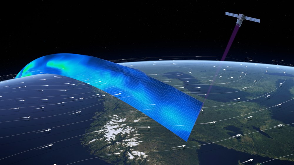
ESA's lidar satellite AEOLUS measured high-precision horizontal wind profiles in the Earth's lower atmosphere between 2018 and 2023. This involved utilising what is known as the Doppler effect. The movement of the air caused by the wind shifts the wavelength of the scattered laser light. This shift is measured and used to calculate the wind speed. EUMETSAT, the European Agency for the Exploitation of Meteorological Satellites, has begun building a successor system with support from ESA. Scientists are also calling for space-based lidar systems to measure water vapour, carbon dioxide and methane profiles.
The Franco-German small satellite MERLIN (Methane Remote Sensing LIDAR Mission) is currently in the construction phase. MERLIN is a climate mission designed to monitor the levels of the greenhouse gas methane in the Earth's atmosphere. MERLIN will use a lidar instrument to detect and monitor the greenhouse gas in the Earth's atmosphere from an altitude of approximately 500 kilometres. One of the aims of the three-year mission is to create a global map of methane concentrations. The mission will also provide information on the regions of the Earth where methane is released into the atmosphere (methane sources) and the areas where it is removed from the atmosphere (methane sinks).
The use of lidar systems in space places extremely high demands on the high-energy lasers used, for example in terms of operational safety and lifetime, pulse energy and beam quality. Whilst some systems are already in orbit and others are currently being built, there is still an urgent need to further develop these systems, which are subject to extremely high operational loads. DLR is therefore specifically supporting the development of space-specific high-power pulsed lasers and other key technologies for space-based lidar applications.