Oil on Greek Beaches: Copernicus Data Reveal Pollution
September 18, 2017
Oil on Greek Beaches: Copernicus Data Reveal Pollution
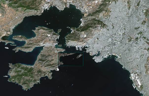
On Sunday 10 Sept. 2017 the tanker AGIA ZONI II sank for reasons not yet known off the Greek coast near Athens. While measures to contain and remove the resulting oil slick are underway, the latest satellite images reveal the extent of the pollution.
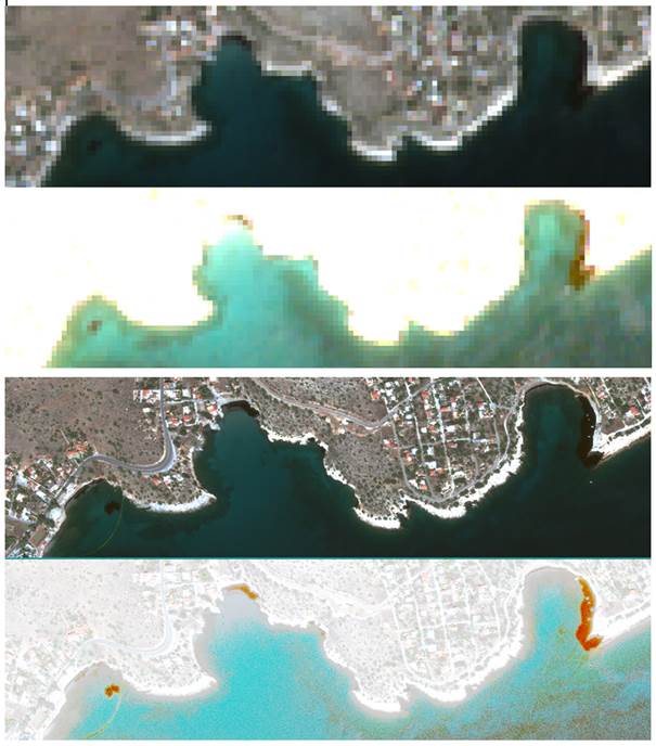
On 13 Sept. 2017 the Sentinel-2A satellite of Europe‘s Copernicus programme recorded the area between the harbour of Piräus and the island of Salamis. An analysis of the data shows which of the island’s bays are particularly affected by the oil pollution. Just seven minutes before, almost simultaneously, the GeoEye-1 satellite also recorded the area. The oil slicks are visible in both images. After image processing, the polluted coastal areas are conspicuous because of their range of reddish-brown colours, in contrast to the bright land surfaces.
The Sentinel-2 mission includes two satellites whose sensors capture the earth’s surface in 12 spectral channels. In addition to the visible spectrum there are also channels in near- and shortwave-infrared. Thanks to their very broad swath width of 290 kilometres Sentinel-2A and -2B can map the same area every five days. The channels used here have a ground resolution of 10 metres, which is adequate for detecting pollution in the case of AGIA ZONI II.
The GeoEye-1 image shows the same oil slick at the much higher resolution of half a metre and confirms the analysis of the Sentinel-2 data. GeoEye-1 is a commercial high-resolution U.S. satellite with five spectral channels in the visible and near-infrared ranges.
Excerpt of the Sentinel-2A scene with the GeoEye-1 scene superimposed.
To the west is Salamis island, to the east greater Athens with the harbour of Piraeus

