Sentinel-5 P: volcanic emissions with unprecedented sharpness
May 18, 2018
Sentinel-5 P: volcanic emissions with unprecedented sharpness
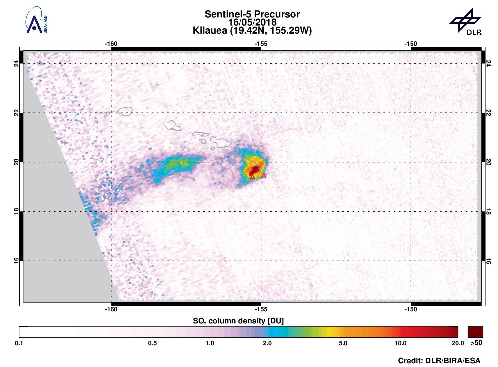
The high resolution of the new Copernicus satellite Sentinel-5 Precursor (S5P) makes it possible for the first time to separately record nearby emission sources, such as the sulphur dioxide clouds at the Pu'u 'O'o' and Halema'uma'u craters of Kilauea. The TROPOMI instrument on board S5P provides 3.5×7 kilometre measuring points. This is a considerable improvement compared to previous UV instruments.
After several weeks of increasing lava lake levels in the craters Halema'uma'u and Pu'u 'O'o of the Hawaiian shield volcano Kilauea, the crater floor of Pu'u 'O'o’ collapsed on May 1st, causing earthquakes and several fissures opened in the East Rift Zone and erupted. On May 6th the strongest eruption occurred and new fissures opened in the residential area ‘Leilani Estates’ north-east of the Pu'u 'O'o’ crater. More than 1,700 people have been evacuated, and many homes have been consumed by fire.
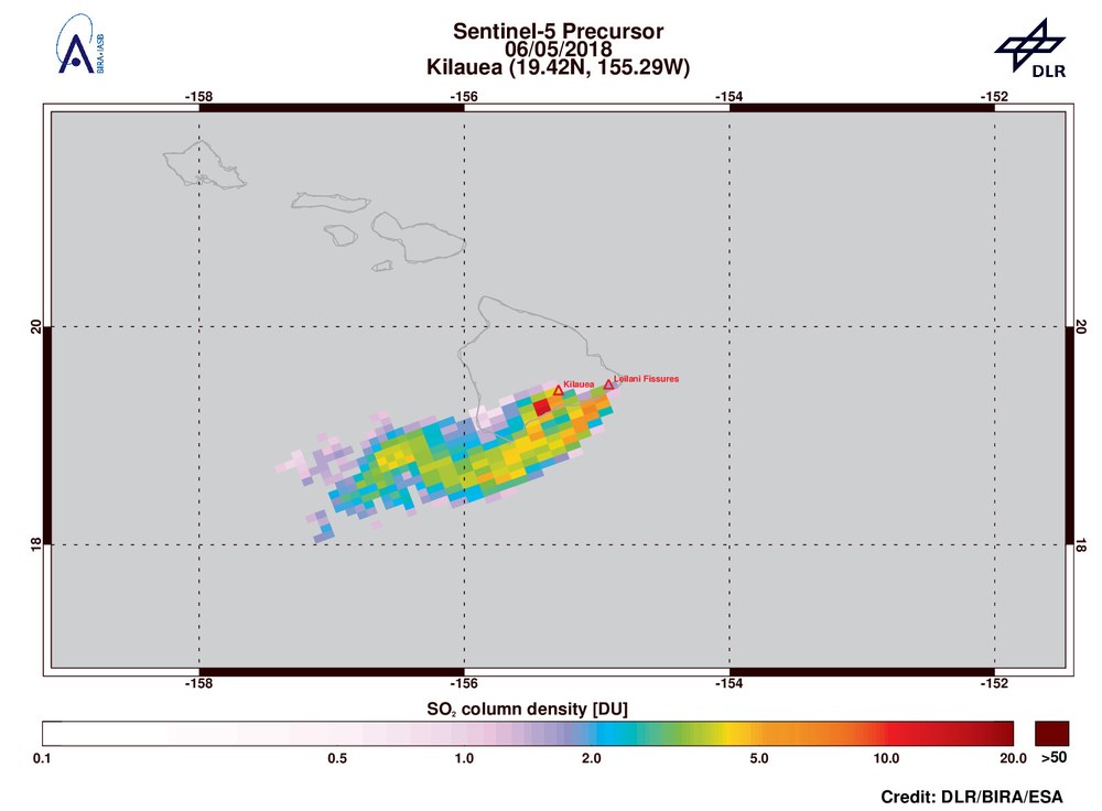
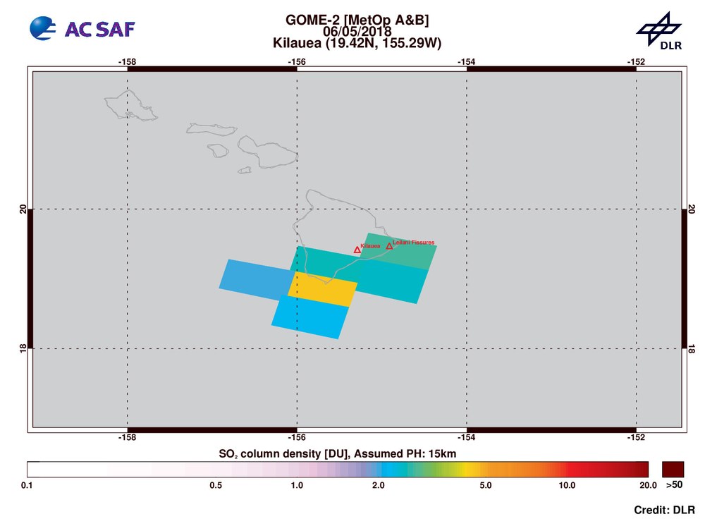
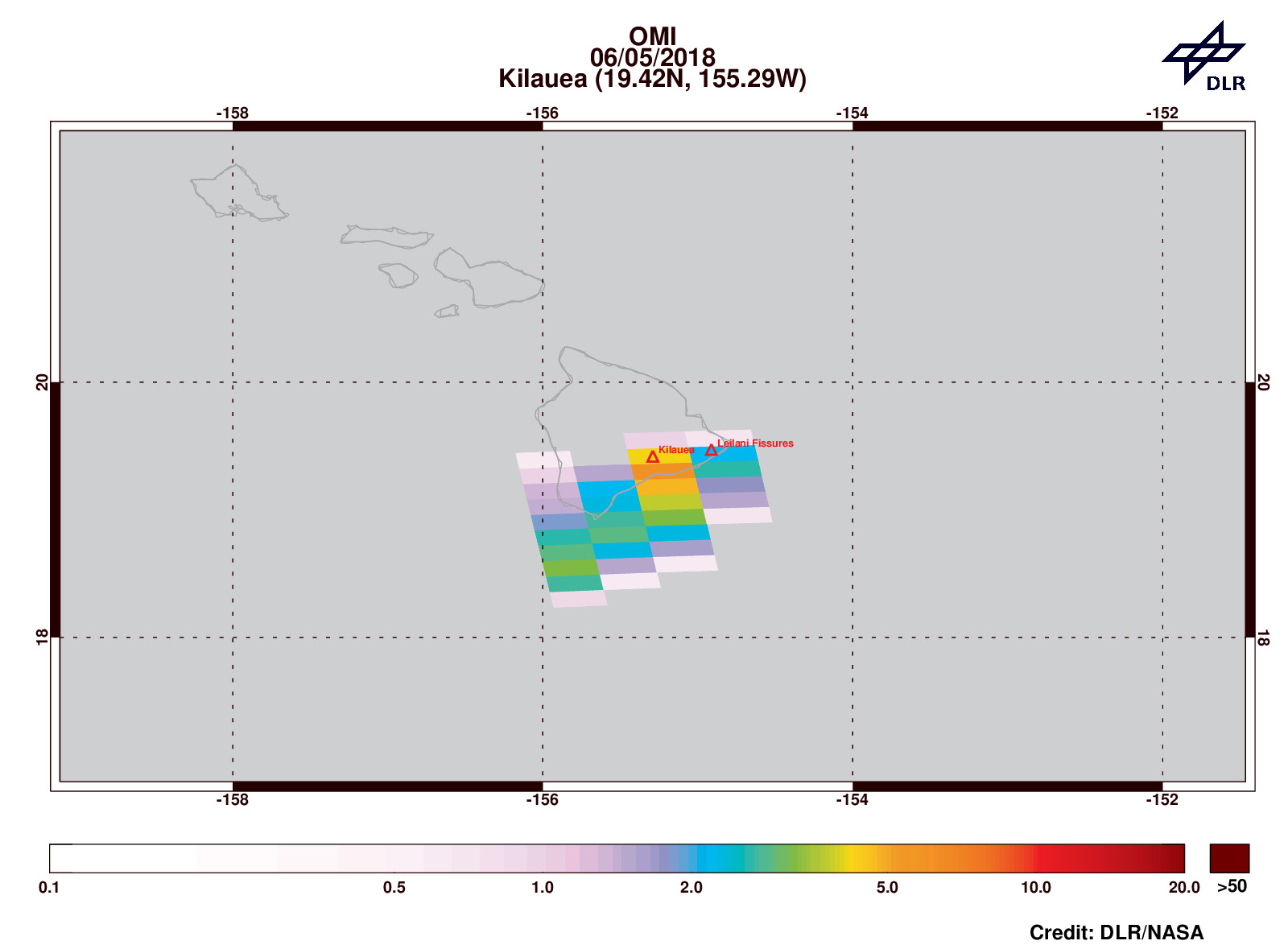
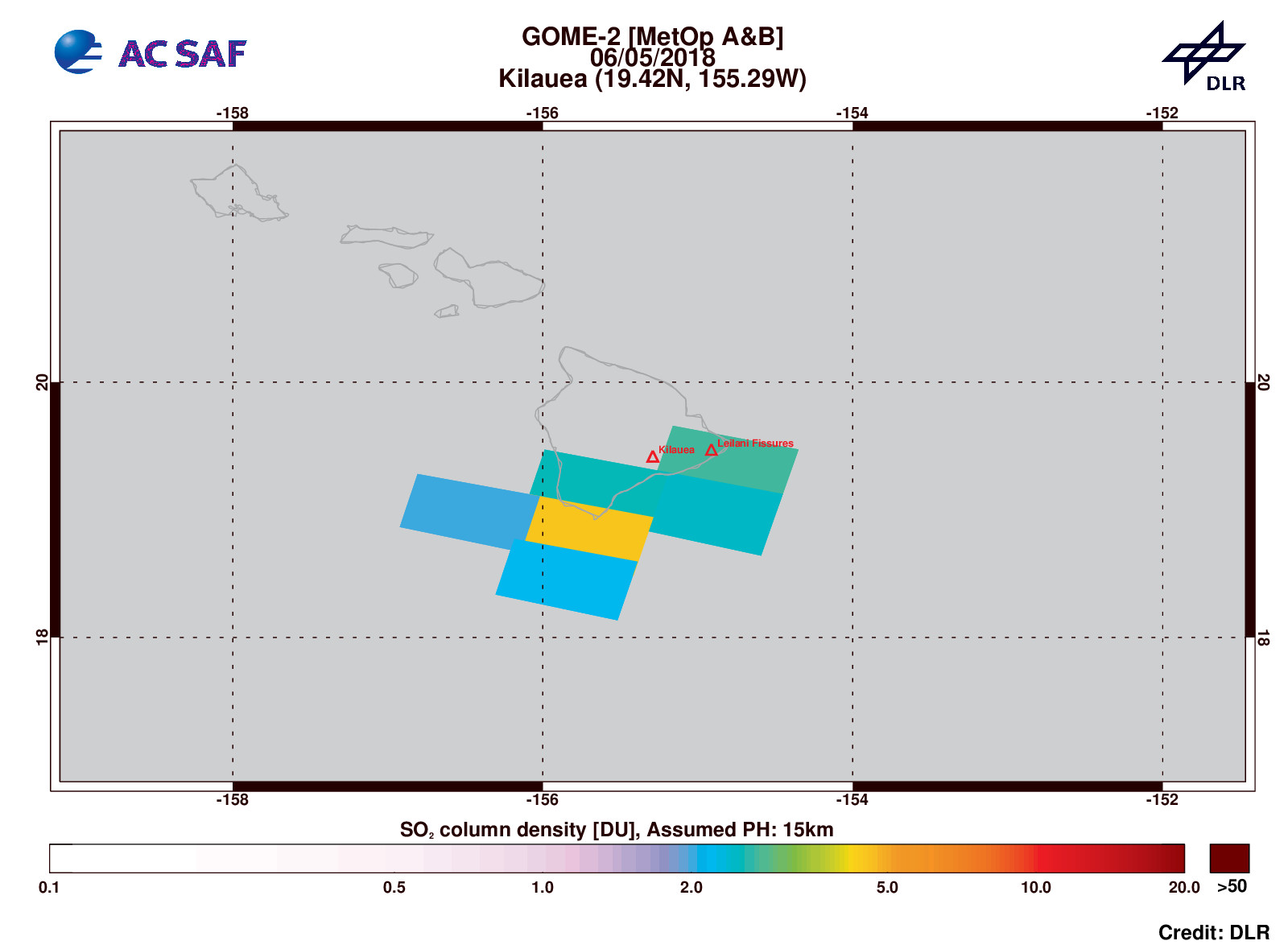
Due to the unprecedented spatial resolution of 3.5 × 7 km2 of the TROPOMI instrument aboard the new Copernicus Sentinel-5 precursor UV satellite (S5P) it is for the first time possible to detect and discriminate the sulfur dioxide (SO2) plumes from the Pu'u 'O'o’ fissure eruption and the lava lake emissions of the nearby Halema'uma'u crater in the Kilauea caldera, see Figure 1. Former UV satellite missions have a much lower spatial resolutions of 40 × 80 km2 (GOME-2/MetOp-A & -B) or 13 × 24 km2 (OMI/AURA); measurements of these satellites reveal only a big SO2 cloud over Hawaii (see Figures 2 and 3). Only with TROPOMI it is possible to distinguish the individual SO2 plumes from the different sources before they are combined in a larger plume.
ESA developed (in close co-operation with The Netherlands) and launched the S5P satellite on 13 October 2017 on behalf of the European Commission and is currently finishing its commissioning phase in which the retrieval algorithms are being optimized. The SO2 retrieval algorithm and the operational processors were developed by BIRA and DLR, and they are integrated in the S5P ground segment running at DLR-EOC in Oberpfaffenhofen.
SO2 is a natural trace gas in Earth’s atmosphere. The largest source for SO2 in the atmosphere is the burning of fossil fuels by power plants and other industrial facilities. Furthermore volcanic degassing events and eruptions inject SO2 into the atmosphere, ranging from the lower troposphere (passive degassing), as well as high as into the stratosphere (explosive eruptions).
The timely retrieval of SO2 is extremely important for volcanic eruptions which are a major natural hazard, not only to the local environment and populations near large volcanoes but also to aviation: SO2 causes breath disease (e.g. when entering the aircraft cabin) as well as sulphidation of aircraft engines. Furthermore SO2 can be a proxy for volcanic ash emissions, which can have a severe effect on the aircraft.
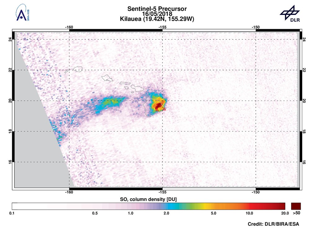
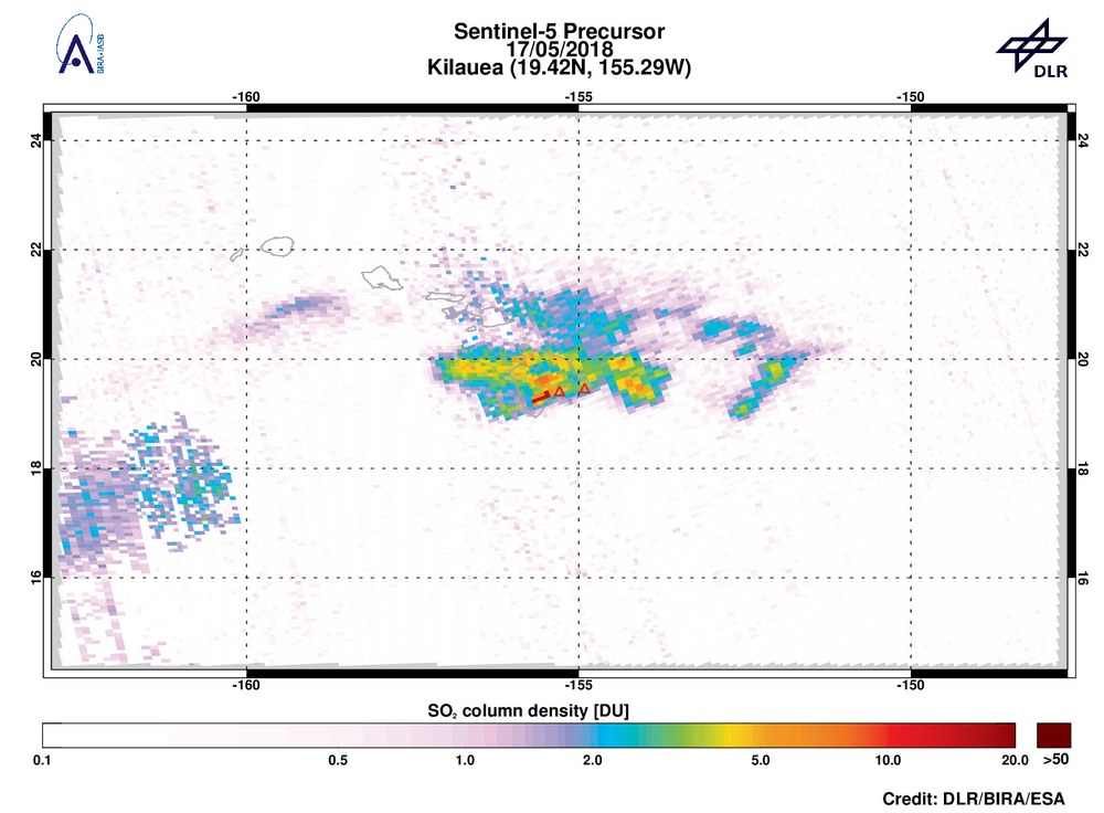
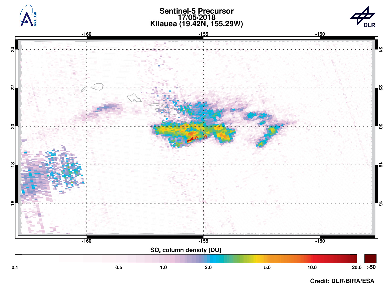
On May 17th around 04:15 am local time (14:15h UTC) an explosive eruption has taken place at the Halema'uma'u crater at Kilauea’s summit. The steam-induced eruption was powerful but short-lived, sending ash as high as 9km into the air. It was the first time since 1924 that such an eruption occurred at Kilauea. We plan to report on this even in more detail in upcoming news early next week....
Figure 1: SO2 emission from the Kilauea volcano and the fissure eruptions north west of the Pu'u 'O'o crater
(named “Leilani fissures”), as detected by the TROPOMI instrument aboard the Sentinel-5 precursor satellite. The SO2 plume of both locations is clearly distinguishable.
Figure 2: Same as Figure 1, but SO2 signal measured by OMI aboard the NASA AURA satellite.
In this measurement, the emissions from both sources appear only as a huge SO2 cloud over Hawaii due to the smaller spatial resolution of the instrument (13 × 24 km2).


