
Launch of the Hyperspectral Satellite EnMAP

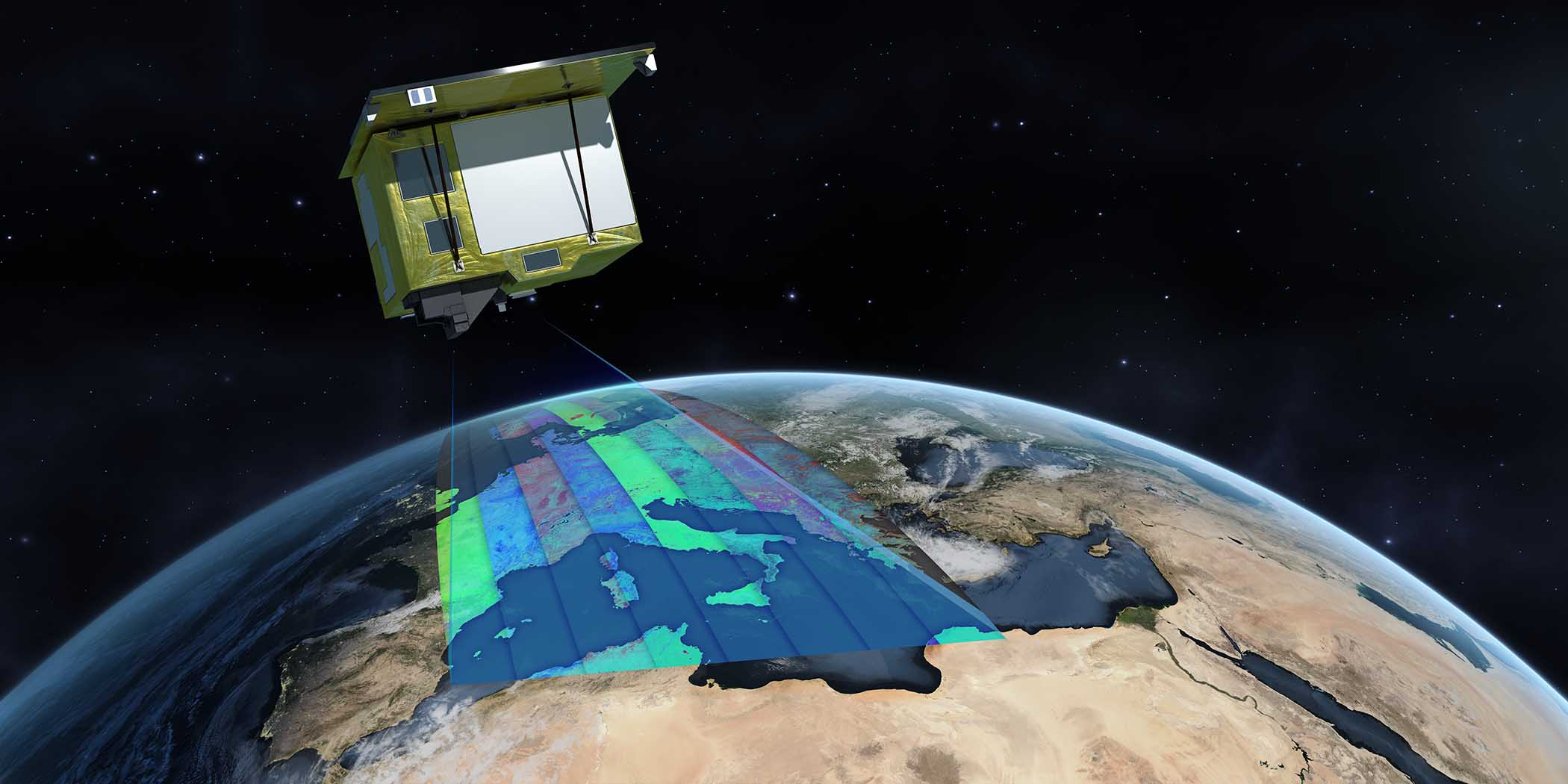
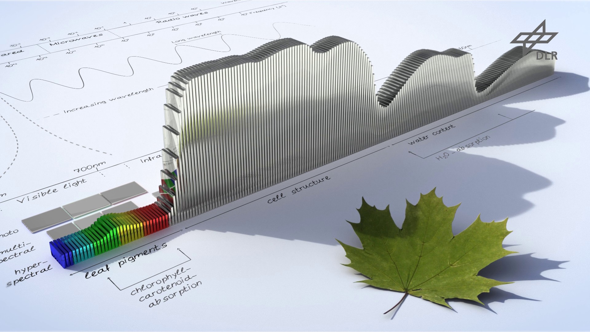
The German hyperspectral satellite EnMAP (Environmental Mapping and Analysis Program) will take off from NASA Kennedy Space Center in Florida, USA, on Friday, April 1, 2022. EnMAP records sunlight reflected by Earth in 242 separate bands, including infrared, which is invisible to the human eye. The fine spectral resolution of the images makes it possible to obtain precise information about the state of the land surface and the changes it undergoes.
EOC developed the mission ground segment together with GSOC. The associated responsibilities include control of the satellite, planning the data recording, and data reception, archiving, and transmission to an international user community.
EOC acquires the mission data with its stations in Inuvik, Canada and Neustrelitz. In addition, These stations as well as the EOC Antarctic station will also be used in the phase immediately following the launch in order to establish the first contacts with the satellite. As soon as the satellite begins regular operation, EOC will receive, process, and store the mission data and make them available via a web portal to scientists worldwide free of charge. The data will be calibrated, corrected, geolocated, and atmospheric effects will be eliminated. Instead of the three bands (red, green and blue) of the typical digital camera, there will be 242 bands extending out to shortwave infrared. This makes it possible to differentiate signatures on the ground that, for example, identify particular material that cannot otherwise be distinguished by color from their surroundings. With the help of these spectra, physical, chemical and biological ground parameters can be derived, such as the carbon content of soils.

The high spatial and very high spectral resolution also make it possible to detect and record the components and condition of flora. Thus the water and nutrient content of plants can be determined for large areas, for example in agriculture to ascertain the exact amount of fertilizer, or find out where irrigation is required.
The water quality of inland and coastal waters can likewise be quantitatively determined with EnMAP. Substances found in water such as suspended matter or the nutrients introduced into rivers and lakes can be closely monitored so that there can be quick reactions to changes.
Because of the possibility to investigate from space the condition of vegetation, soil and water with high precision, regularly, and in short temporal intervals everywhere on Earth with EnMAP, forecasts about development trends can be derived that in turn contribute to the improved and sustainable use of natural resources.
The event will be live streamed from 5:25 to – 8:00 pm live on the youtube channel of DLR’s media partner Phoenix together with a commentary by Phoenix moderator Michael Krons.
Now let’s hope for good weather conditions at Cape Canaveral, Florida, and cross our fingers for a perfect launch on Friday!