
DSM-to-DTM: AI-Powered Digital Terrain Model Generation from Digital Surface Model
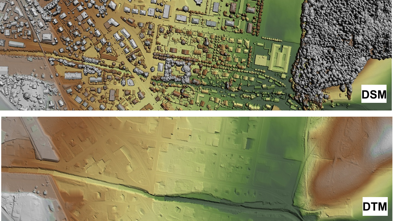
Elevation data or Digital Surface Models (DSMs) contain both terrain information and surface features such as vegetation and buildings. However, many commercial and industrial applications require Digital Terrain Models (DTMs), which represent only the bare earth surface. DTMs are essential for modeling water flow and flood risks, analyzing soil erosion and landslide hazards, as well as for geological and seismic studies. They play a central role in land-use planning, agriculture, infrastructure development, and construction projects by providing accurate information for planning processes. DTMs are typically derived from DSMs based on LiDAR, SAR, or optical stereo data, and their creation currently requires extensive manual effort.


As part of the technology transfer project "DSM-to-DTM: AI-Powered Digital Terrain Model Generation from Digital Surface Model", an innovative software solution is being developed that focuses on optimized and automated DTM generation using artificial intelligence. It operates independently of the sensor type and resolution, in the range of 5 m to 0.1 m, and reliably produces DTMs across various terrain types. A tool capable of extracting DTMs from different sensor types is of great importance for Germany, especially considering the increasing frequency and intensity of natural disasters such as floods and landslides due to climate change. The method will be designed as a fully automated end-to-end solution that does not require manual thresholding or adjustments for different sensors or geographic regions. This significantly reduces user effort and ensures that the software performs reliably in diverse scenarios without additional manual intervention.