S²VSE - System and Service Volume Simulation Environment

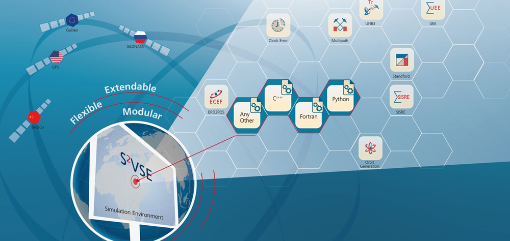
S²VSE is a modular and flexible simulation and performance analysis tool for the space, ground and user segment

S²VSE

  • Reproduction, analysis and study of current and future GNSS structures (e.g. LEO PNT) and operational scenarios.
  • Evaluation of the system performance under different conditions and influencing factors (e.g. propagation effects)
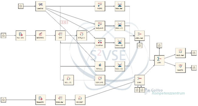
  • Freely combines individual components to create workflows matching different scenarios.

Explainable AI for Safety of Life Applications

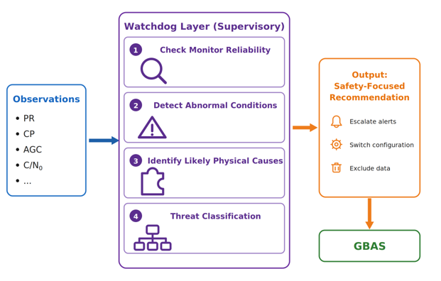
  • We work on the implementation of Explainable AI (XAI) for different PNT use cases such as sensor fusion and safety of life applications.
  • A key example from our projects is the design of an XAI-enabled Watchdog Layer for GBAS, developed to enhance system transparency and meet the explainability requirements.

Constellation Design Optimisation and Analysis

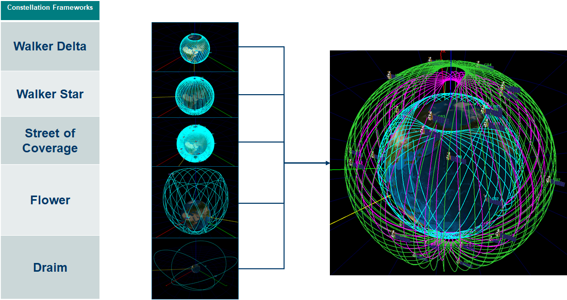
  • Optimisation of constellations via the use of the genetic algorithm Non-dominated Sorting Genetic Algorithm 2 (NSGA-II).
  • Multiple objectives for optimization (e.g. DOP, DOC, …).

User Environment Modelling

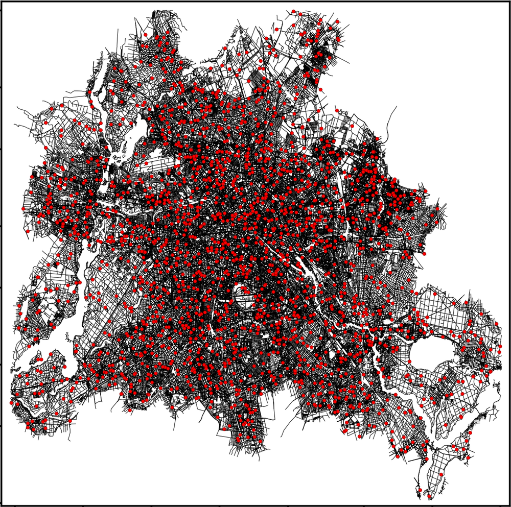
  • Satellite systems experience reduced functionality in obstructed environments caused by natural and man made terrain.
  • S²VSE includes a Digital Surface Module which can extract data from different open data sources to create virtual user environments for evaluation.

ANTIQUE - Assisted Navigation Through Inertial QUantum Equipment

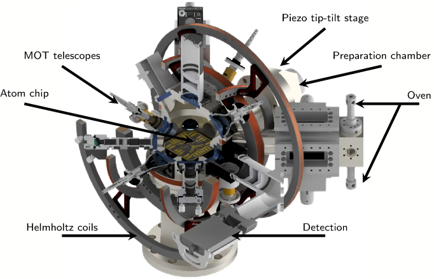
  • Expansion of traditional sensor fusion, combining GNSS with other sensors by replacing components with innovative new technologies (Quantum Sensors and Machine Learning).
  • Our approach takes Hybrid INS of Quantum + Intertial Measurement Units (IMU), providing several advantages, e.g continuous bandwidth of up to 400 Hz or 11-hours drift-free periods without GNSS.

HEATMAP - Heat Environment Analysis Through Mapping And Positioning

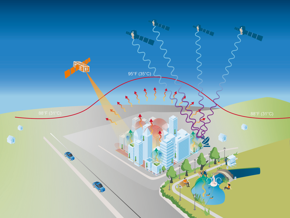
  • Urban Heat Islands are urbanised areas that experience higher temperatures as surrounding areas.
  • The idea is to combine Earth observation data with GNSS derived temperature estimates.