
Blog
- Flight N°18: The journey home
- Flight N°17: Transfer to Fortaleza
- Flight N°16: A third look at pristine rainforest near Santarém
- Flight N°15: Yet another wetland flight over Tefé
- Flight N°14: Pantanal and the AERIS measurement site
- Flight N°13: A second look at Balbina and ATTO
- Flight N°12: Amazon Delta
- Flight N°11: Return to the Llanos de Moxos wetlands in Bolivia
- Flight No. 10: One flight, two targets — Santarém and the Amazon Basin
- Flight No. 09: Back to the Pantanal wetlands in search of methane hotspots
- Media Day at the hangar: a special day for CoMet 3.0 Tropics
- Flight N°08: Exploring the Llanos de Moxos — a flight over the Bolivian wetlands
- Flight N°07: Secondary forest near Santarém
- Flight N°06: Chasing methane eddies — flight to ATTO, Balbina and the Amazon
- Flight N°05: Targeting plumes over the Araguaia floodplain around Bananal Island
- Flight N°04: Mission Pantanal — first flight from Cuiabá
- Flight N°03: Official start of CoMet 3.0 Tropics — from Fortaleza to Cuiabá
- Flight N°02: Measuring GHGs across hemispheres — from Oberpfaffenhofen to Fortaleza
- Flight N°01: A test flight over the Upper Silesian Coal Basin
- Successful EMI flight
- Kick-off workshop at USP, São Paulo

Flight N°18: The journey home

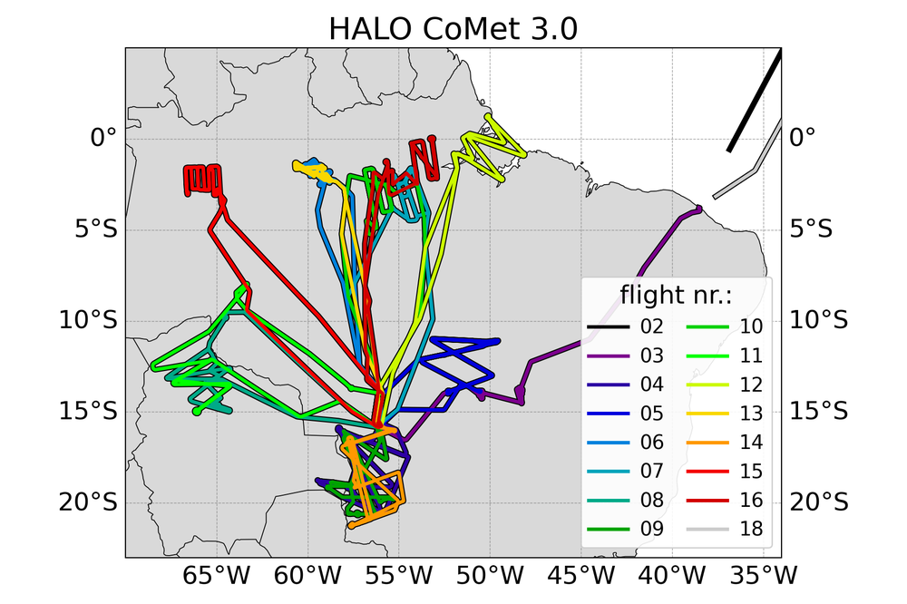
The final flight of the campaign carried HALO all the way home, from Fortaleza, across the Atlantic and Europe, to Oberpfaffenhofen. As on the outward transfer, CHARM-F measured signals back reflected from the ocean surface, while the aircraft also flew over international waters collecting flask samples along the way, and MAMAP2D captured a memorable sunrise en route.
Crossing the ITCZ brought a stretch of turbulence. Over Europe, the route followed the Spanish coastline, passing the harbor of Barcelona — which was also a target of ESA’s AB2CD campaign in October 2025 with the French ATR42 — before continuing over the Po Valley in Italy, an area previously surveyed during CoMet 1.0. Combining measurements from different campaigns and locations helps to consolidate the results. HALO touched down at Oberpfaffenhofen in the early evening, bringing the CoMet 3.0 Tropics campaign to a close after 18 flights.
Flight N°17: Transfer to Fortaleza
Flight no, seventeen was not a scientific flight. As there was no Brazilian observer on board, the crew did not have clearance to take measurements on the way from Cuiabá to Fortaleza. Therefore, HALO flew the roughly three-hour transfer on normal commercial air routes, before the final flight home was due.
Flight N°16: A third look at pristine rainforest near Santarém
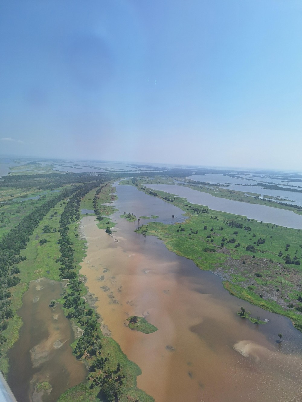
Flight no. sixteen was another CarbonARA follow-up out of Cuiabá, building on the earlier flights to Santarém's secondary and primary forest. This time, the target was an area of pristine rainforest that had not been covered by any previous CoMet flight. Additionally, there was an overflight of two EM27/SUN ground stations in the same region.
The remote-sensing leg started under clear skies, with the first leg entirely cloud-free and the second, south of the Amazon, being only lightly affected by cumulus. Conditions worsened later in the pattern, with clouds and cloud shadows affecting a large share of the MAMAP2D data on the final remote-sensing legs. Two dropsondes were released during the flight to profile the atmosphere.
During the subsequent in-situ leg, which involved flying low over hilly terrain, several fire plumes were encountered — one of which produced a clear signal across CO, CH4, CO2 and N2O simultaneously. Further fires were tracked and measured as the aircraft continued its zigzag pattern along and across the Amazon River. A dedicated racetrack pattern concluded the in-situ part of the flight. Comparing the boundary layer with the free troposphere revealed elevated CO background levels, well above the roughly 60–80 ppb typical of the wet-season Amazon boundary layer. HALO then headed back to Cuiabá after a flight that once again combined pristine-forest carbon-cycle measurements with some productive, albeit opportunistic, fire chasing.
Flight N°15: Yet another wetland flight over Tefé
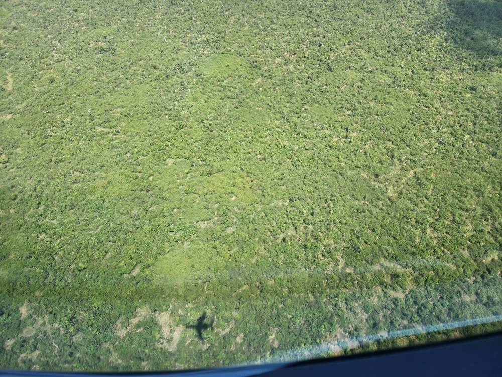
At the end of August, HALO left Cuiabá for its second-to-last regional flight, heading to the campaign's westernmost target area around the town of Tefé in the state of Amazonas. From Tefé, the aircraft flew parallel lines upstream across the wide floodplain between the upper Amazon (or Solimões River) and the Japurá, which joins the main stream opposite the town. Much of this area is part of the Mamirauá Sustainable Development Reserve, which is one of the largest protected floodplain forests in the Amazon region. Lakes, side channels and seasonally flooded forest dominate the landscape, and a local flux tower already pointing to a strong CH4 source here. From the air, the rivers are easy to tell apart. The Solimões and the Japurá carry brown, sediment-laden whitewater, while Lake Tefé holds dark blackwater.
Mostly clear skies allowed the remote-sensing pattern to cover almost the entire target area. The following in-situ leg set a campaign record, with CH4 mixing ratios above 2,900 ppb. High concentrations, however, do not necessarily mean a strong source. Low surface winds may have let CH4 accumulate near the ground, and only further analysis will show how large the emissions really are. After the in-situ measurements, HALO overflew the Tefé flux tower at two altitudes. On the way back to Cuiabá, a well-timed cloud gap made it possible to survey an oil and gas facility as well. All in all, another data-rich flight to a new target region.
Flight N°14: Pantanal and the AERIS measurement site
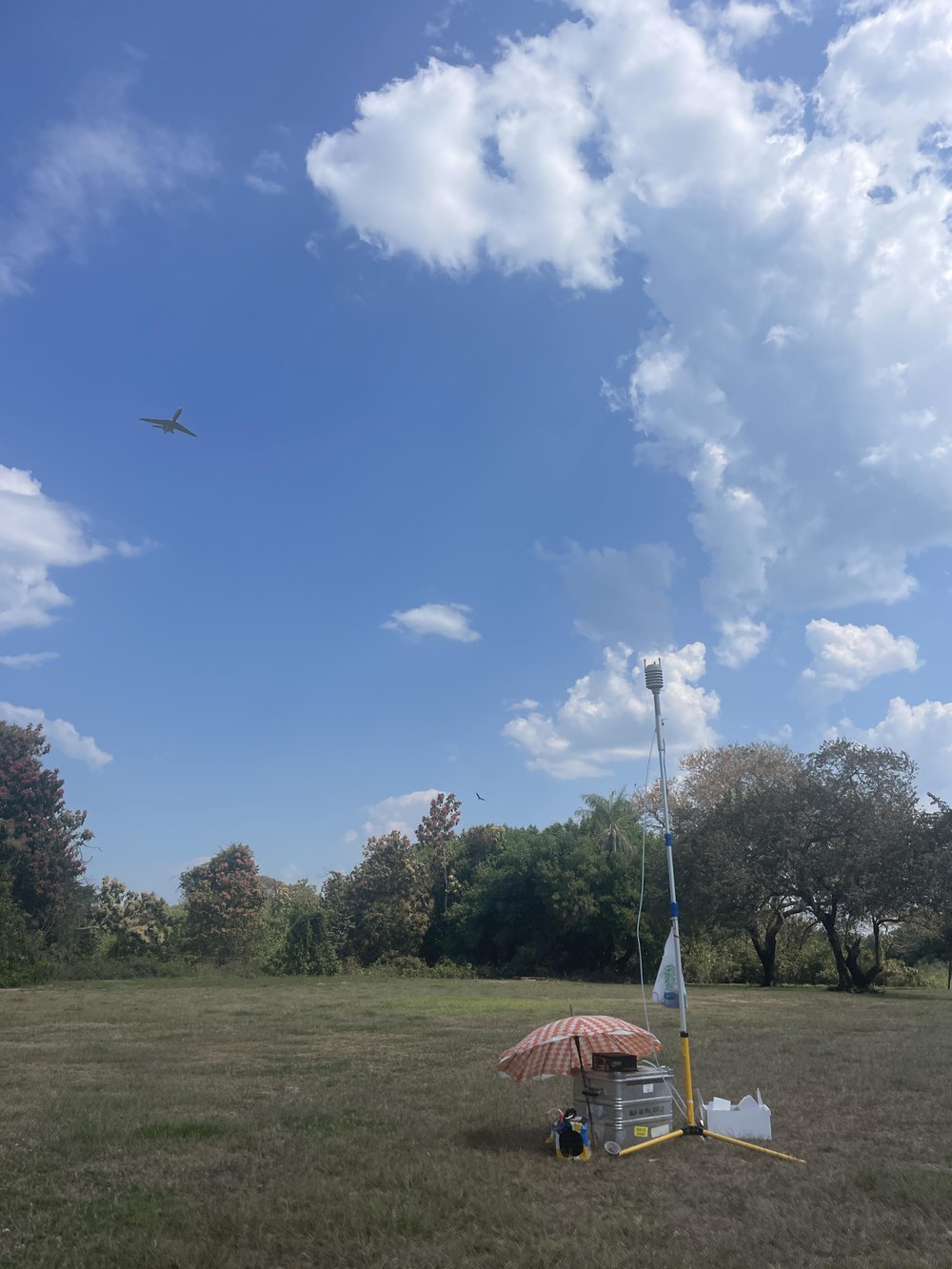
On 29 August, HALO returned to the Pantanal for the third time. Once again, the focus was on CH4 emissions from the wetland, now combined with an overflight of a temporary measurement site where colleagues had set up their AERIS instrument.
Hazy conditions dominated much of the transfer out. A fire that had been burning for at least six days in the southern Pantanal, covering some 75 km², was detected by the remote-sensing instruments. After descending into a spiral for the in-situ leg, the crew noticed the smell of smoke in the cabin and measured a CO enhancement of around 250 ppb upon entering the boundary layer. Five dropsondes were released during the flight to profile the atmosphere.
After passing south of a larger fire and spotting its plume, HALO turned back to fly directly through it. The plume had risen higher than estimated, but the instruments still picked up a sharp CO signal and MAMAP2D made clear K-line detections. Further along the route, the landscape became greener, with more lakes, and the river came back into view. HALO then made a short detour to fly over the AERIS ground station, which colleagues from DLR and UNEMAT had set up with meteorological and CH4 instruments. A large feedlot was also passed along the way. As on earlier flights, CH4 concentrations were concentrated in the same areas, reaching up to around 2,070 ppb. The flask samples collected during the flight captured both wetland and fire-related signals.
Flight N°13: A second look at Balbina and ATTO
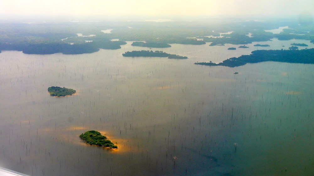
For the thirteenth research flight, HALO returned to Balbina and the ATTO tower for a more detailed, daylight follow-up to the earlier night flight. The plan was thorough: a remote-sensing leg following the Uatumã River from the Amazon towards the dam, a crossing of the reservoir roughly perpendicular to the wind, a racetrack pattern flown at several altitudes over ATTO, repeated crossings of the reservoir along the wind direction for eddy-covariance flux measurements, and a final downwind survey of the entire reservoir shoreline for a mass-balance estimate.
Hazy conditions in the morning raised the possibility of nearby fires, though none could be confirmed at the time. Cloud cover over the target area gradually dissipated as the flight progressed, so the remote-sensing pattern went ahead largely as planned. The ATTO racetrack pattern was completed at several altitudes, with dropsondes released both along the transfer and directly over the tower. Small to moderate fires were spotted in the area later in the flight, though none of their plumes crossed the aircraft's track. With time running short toward the end of the in-situ part, some of the planned final profiles had to be dropped. HALO still passed ATTO once more before heading back to Cuiabá, continuing remote-sensing measurements and releasing further dropsondes along the way.
Flight N°12: Amazon Delta
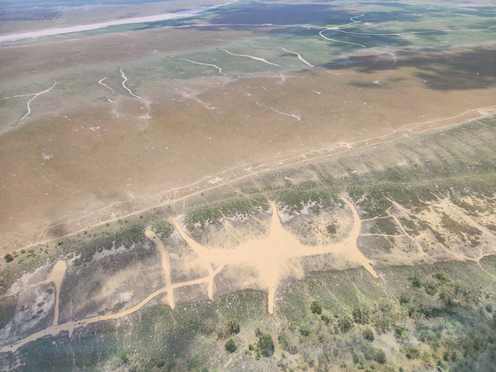
On 25 August, HALO's twelfth research flight targeted the Amazon Delta. The remote-sensing pattern covered a wide area, stretching across Marajó Island and Marajó Bay as far as the lower Tocantins River. At lower altitude, the in-situ pattern then focused on a smaller part of the delta, following its maze of channels, wetlands and grasslands west of Marajó Island.
Fires in the area pushed CO levels well above expectations during the transfer out, though the smoke plume itself stayed clear of the flight track. Conditions over the delta were far better than forecast. Clouds were patchy and mostly limited to land, so the remote-sensing pattern captured good data over the water. Over parts of the forest, however, clouds still reduced the coverage. Five dropsondes were released along the way, each returning a clean vertical profile of the atmosphere. Only one planned release had to be skipped.
The following in-situ leg showed that the concentrations of CH4, CO, and CO2 all increased with increasing height above the water. CH4 was distinctly elevated over wetlands threaded with small streams and over grasslands grazed by cattle near watering holes. Some of the CH4 over open water appeared to have been carried in from nearby, densely vegetated islands. On the way back to Cuiabá, the crew also spotted a substantial fire near the intersection of two regional highways, concluding a long, and data-rich flight over both natural and human-caused CH4 sources across the delta.
Flight N°11: Return to the Llanos de Moxos wetlands in Bolivia
Following the promising results from our first flight to the Llanos de Moxos, we returned to the region after a day of rain. Porto Velho and a large feedlot in Mato Grosso were also on the target list.
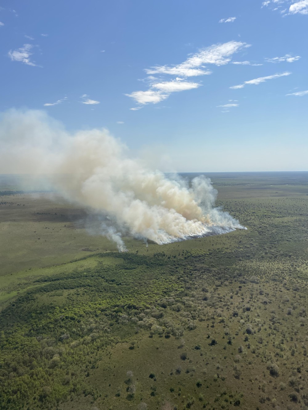
On arrival, the area was found to be almost entirely overcast, which was worse than forecast. However, the remote-sensing pattern went ahead anyway, and, fortunately, the clouds gradually broke up, allowing good datato be collected , with a lot of potential for cloud slicing studies for CHARM-F alongside several dropsonde releases. En route, the crew crossed several fire plumes, including one near El Perú that was not visible on the Copernicus fire watch. MAMAP2D detected this fire via K-lines, and MIRO recorded a CO peak of about 1,010 ppb. The JIG-JAS team also collected a flask sample directly from a small agricultural grass fire.
A planned missed approach at Porto Velho let HALO overfly the ground-station FTIR precisely as intended. The final target, a feedlot in Mato Grosso, was flown over five times. A strong signal was detected at all altitudes, which suggests good mixing within the boundary layer. The flight adds valuable time-series CH4 data over the Bolivian wetlands.
Flight No. 10: One flight, two targets — Santarém and the Amazon Basin
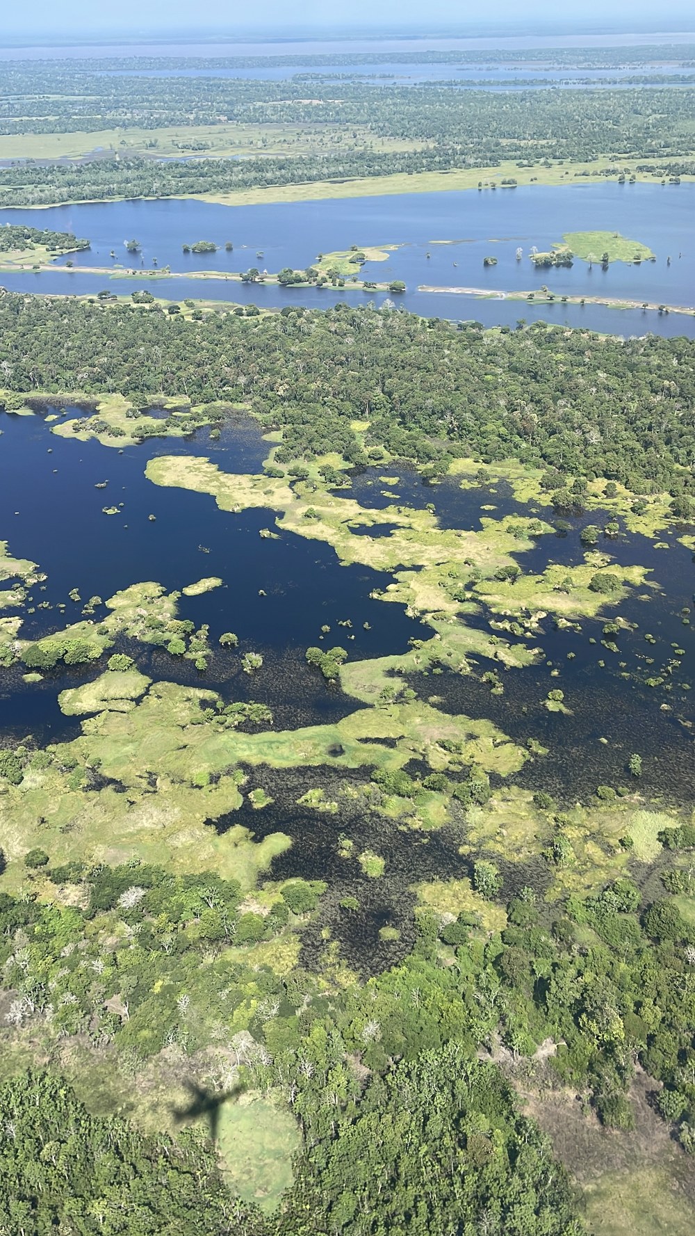
On 21 August, HALO flew to the Santarém region of the Brazilian Amazon to investigate CH4 emissions along the Amazon and Tapajós rivers, combining remote sensing with in-situ sampling. The main focus, however, was the carbon cycle of the primary forest west of Santarém, benchmarked against several ground stations. The pattern included an overflight of an EM27 ground station, remote-sensing and in-situ legs over primary forest, and an intensive sampling run over the proposed Chacorão dam site, an area flagged as a CH4 hotspot in earlier inventories.
Despite increasing convection, haze, low clouds and even some rain, the team completed all three planned dropsonde releases and all main measurement activities, while also observing several fires along the way. The flight additionally yielded useful data on the atmospheric boundary layer, supporting the interpretation of the trace-gas observations. All of this contributes to CoMet 3.0 Tropics' broader goal of quantifying CH4 emissions from tropical ecosystems.
Flight No. 09: Back to the Pantanal wetlands in search of methane hotspots
Building on findings from our first Pantanal flight, HALO returned to the region on 16 August with two objectives: quantifying CH4 emissions across the wetland and capturing data on biomass burning as a target of opportunity.
Despite a delayed take-off due to misunderstandings with ATC, the remote-sensing legs ran smoothly under clear skies. After spiraling down to the in-situ leg, the aircraft followed the Paraguay River valley north, where the team flew three experimental racetrack climb/descent maneuvers to determine the planetary boundary layer height. Signals over Bolivia were modest, but a 20ppb enhancement appeared while crossing back into Brazil, and CH4 reached up to 2,400 ppb over the main river valley during the second racetrack pattern.
On the climb back to Cuiabá, an active fire was confirmed visually and picked up by the remote-sensing instrument as well. Despite early ATC communication hurdles, all scientific objectives were met, the racetrack maneuvers proved highly effective, and five dropsondes were released successfully.
Media Day at the hangar: a special day for CoMet 3.0 Tropics
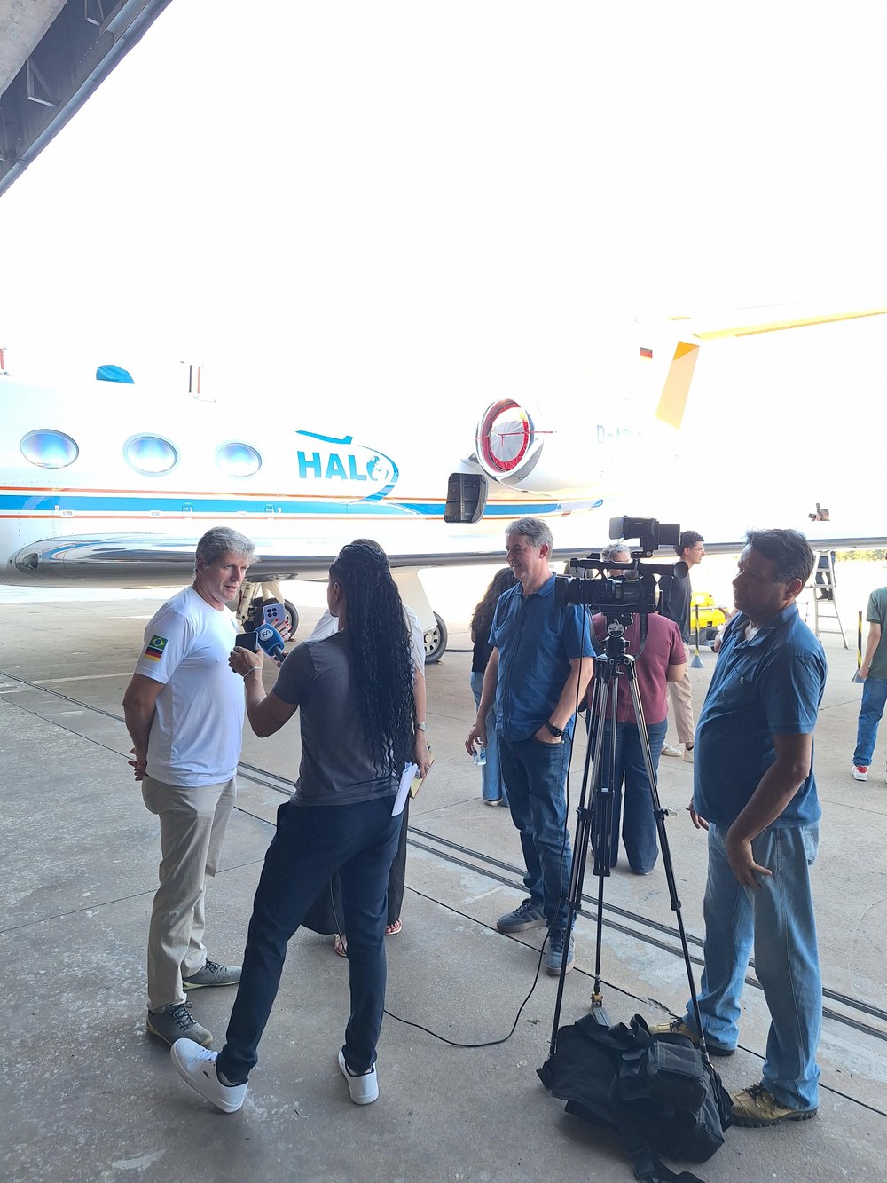
On 18 August, the HALO hangar at Cuiabá's airport in Várzea Grande welcomed press representatives and a delegation from Mato Grosso and the Pantanal region for the official presentation of the research aircraft.
Cuiabá serves as the campaign's central base for monitoring greenhouse gas emissions across the Pantanal, Cerrado, and Amazon biomes. Over six weeks, HALO is flying 14 research flights from its base, covering Brazilian and neighboring Bolivian airspace to measure atmospheric CO₂ and CH₄. Around 120 researchers and professionals are involved — 60 from Brazil and 60 from Germany — backed by roughly 10 million euros in European funding, including support from the accompanying ESA Earth Observation project BRACCIOLE, which studies CH₄, CO₂, N₂O, fire and vegetation photosynthetic activity and links the earlier CarbonARA campaign to CoMet 3.0 Tropics.
International project coordinator Andreas Fix explained why Mato Grosso matters so much for this research: the region sits at the crossroads of several ecosystems and emission sources, both natural, such as wetlands, and human-driven, such as agriculture. National coordinator Dirceu Luís Herdies (INPE) emphasized how the resulting data can refine climate models and support strategies for extreme events such as heatwaves and floods, gathered with instruments not otherwise available on the market.
Guests included Rodrigo Bruno Zanin (Adjunct Secretary of Science and Technology of Mato Grosso), Marcos de Sá (President of FAPEMAT) and Sérgio Roberto de Paulo (International Office, UFMT), along with colleagues from partner universities, research institutions and state secretariats. TV Gazeta covered the visit, bringing the campaign to a wider audience across Mato Grosso.
Thank you to everyone who joined us in Cuiabá, and to the press team for helping tell this story!
Flight N°08: Exploring the Llanos de Moxos — a flight over the Bolivian wetlands
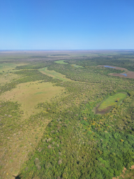
Our eighth research flight of CoMet 3.0 Tropics took us deep into the Bolivian wetlands, targeting the Llanos de Moxos in the vicinity of Trinidad along with a planned maneuver near Porto Velho.
Real-time adjustments were needed due to airspace restrictions, but the instruments still captured a CH4 enhancement of 140 ppb at the bottom of the spiral near Porto Velho, and the remote-sensing pattern over the Llanos de Moxos concluded with a missed approach at Trinidad, where the in-situ legs began.
Flat terrain, sparse tree cover, and virtually no infrastructure characterized a barren landscape. Across this landscape, substantial CH4 enhancements were measured throughout the region. Along the way, HALO also passed through several fire plumes, which added useful CO2 and CO data to the CH4 measurements. Despite the early restrictions near Porto Velho, almost cloud-free skies over the Llanos de Moxos made this a highly productive flight.
Flight N°07: Secondary forest near Santarém
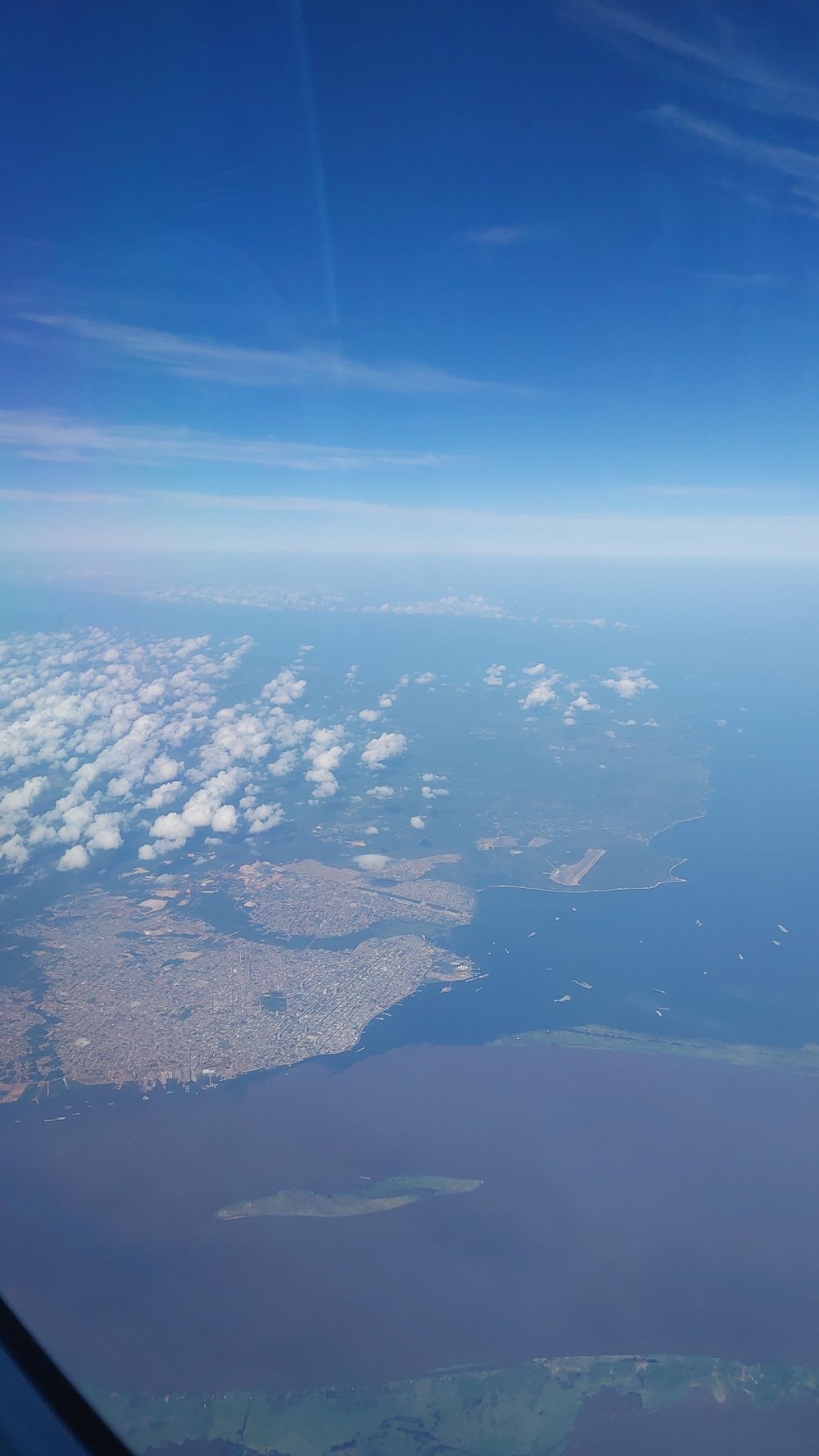
On 8 August, HALO departed Cuiabá ahead of schedule for a CarbonARA follow-up over secondary forest south and south-east of Santarém, combining remote sensing, dropsondes and in-situ measurements. Flight planning was supported by the CarbonARA team at King's College London, building on the legacy of ESA's CarbonARA campaign the previous year.
Conditions turned out better than the forecast of low clouds, cirrus and possible deep convection had suggested, though cloud cover still made the remote-sensing leg over the ground stations challenging. Over the forest itself, skies were largely clear, which favored the CH4/CO2 column and SIF measurements. Six dropsondes were released — twice as much as originally planned — with all data received on the ground. After descending to in-situ altitudes, HALO flew a missed approach at Santarém airport, followed by an in-situ pattern that included overflights of the two EM27 ground stationsoperated by UFOPA.
The in-situ legs revealed a striking north–south CH4 gradient, clear CO2 eddies over the secondary forest, and a plume of elevated CO and CH4. After a low loop over the LBA K67 tower, a spiral climb over the CUP tower rounded off the flight. An unstable CO2 channel forced the CHARM-F lidar laser to be switched off at times. Nevertheless, HALO landed back in Cuiabá on time with a rich dataset. A second flight to the region, ideally also covering the primary forest, was already under consideration.
Flight N°06: Chasing methane eddies — flight to ATTO, Balbina and the Amazon
Klaus Gottschaldt
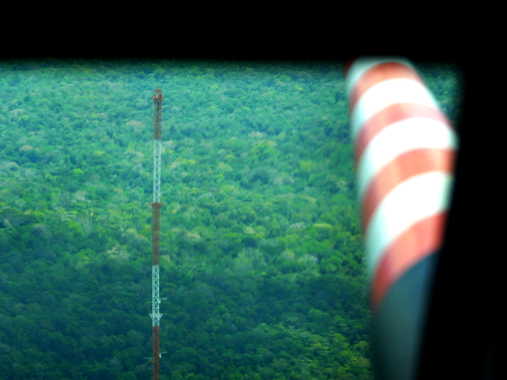
On the night of 7 August, HALO flew its sixth research flight of the campaign, targeting airborne GHG measurements over the ATTO tower and Balbina — a hydropower dam with one of Brazil's largest reservoirs — tightly coordinated with ground teams at both sites.
The night flight allowed the CHARM-F lidar's high-altitude remote-sensing patterns over ATTO and Balbina to be compared directly with in-situ data gathered later at sunrise, once the aircraft had spiraled down. At Balbina, this coordination extended to INPA and MPI-BGC, who carried out complementary lake measurements with support from UNEP's IMEO. At ATTO, the Large-Scale Biosphere-Atmosphere Program (LBA) kept all ground instruments running at the tall tower for the duration of the flight. HALO flew spiral profiles over ATTO while radiosondes were released for later comparison, along the Uatumã river, and over the Balbina reservoir the in-situ instruments recorded clear CH4 and CO2 enhancements. Balbina is suspected to be a significant methane source, and the data collected here will help pin down the processes behind it, despite some reduced visibility from haze along the way.
Flight N°05: Targeting plumes over the Araguaia floodplain around Bananal Island
A. Fix
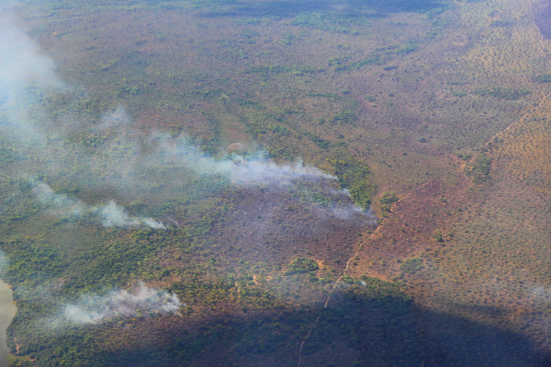
On 4 August, HALO took off for the campaign's fifth flight, heading to the Araguaia floodplain around the Bananal Island in the Cerrado region. The aim was to capture atmospheric profiles and greenhouse gas distributions across the river valleys, plus a few fire plumes for K-line measurements. In satellite data high methane signals show up in this area.
Cloud cover on the first leg soon gave way too much better remote-sensing conditions. Overpasses of active fires showed clear CH4 and CO2 enhancements alongside the river-valley, and six dropsondes were released to record temperature, humidity and pressure profiles. A successful flight all around, both scientifically and operationally.
Flight N°04: Mission Pantanal — first flight from Cuiabá
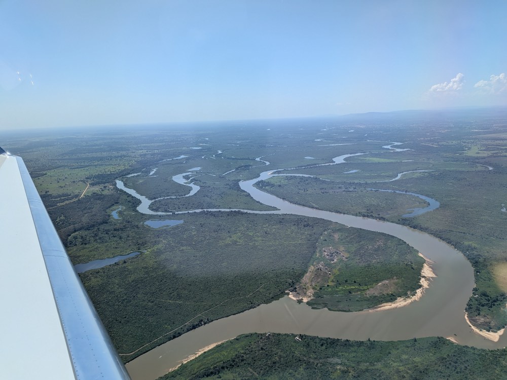
The operational phase of CoMet 3.0 Tropics from Cuiabá got underway on 31 July, with HALO's first research flight targeting greenhouse gas emissions over the Pantanal in Brazil and Bolivia across multiple remote-sensing and in-situ legs.
Both remote-sensing and in-situ instruments picked up strong CH4 enhancements over key geographical features along the river valleys, offering valuable insight into natural wetland emissions versus anthropogenic sources. Active fires along the route were also targeted directly, with multiple passes through smoke plumes at both remote-sensing and in-situ altitudes capturing further CH4 enhancements.
Eight dropsondes were released over the course of the flight, and low-altitude sawtooth maneuvers mapped the boundary layer height before a scenic pass along the Brazil–Bolivia border river. HALO landed back in Cuiabá after eight hours in the air over the Pantanal. It was HALO's first breath of Bolivian air.
Flight N°03: Official start of CoMet 3.0 Tropics — from Fortaleza to Cuiabá
The flight from Fortaleza to Cuiabá completed HALO's journey to its campaign base, this time with a dedicated measurement program. Along the way, the aircraft crossed the Cerrado biome and the Serra da Mesa hydropower dam, providing a first test of the instruments over complex emission sources. Moreover, CH4 and ammonia plumes were detected over a massive feedlot housing roughly 70,000 cattle, despite challenging wind conditions.
These baseline checks over the dam and the feedlot rounded off the transfer, ensuring that the aircraft and the instruments – which are now based in Cuiabá – were fully prepared for the forthcoming research flights.
Flight N°02: Measuring GHGs across hemispheres — from Oberpfaffenhofen to Fortaleza
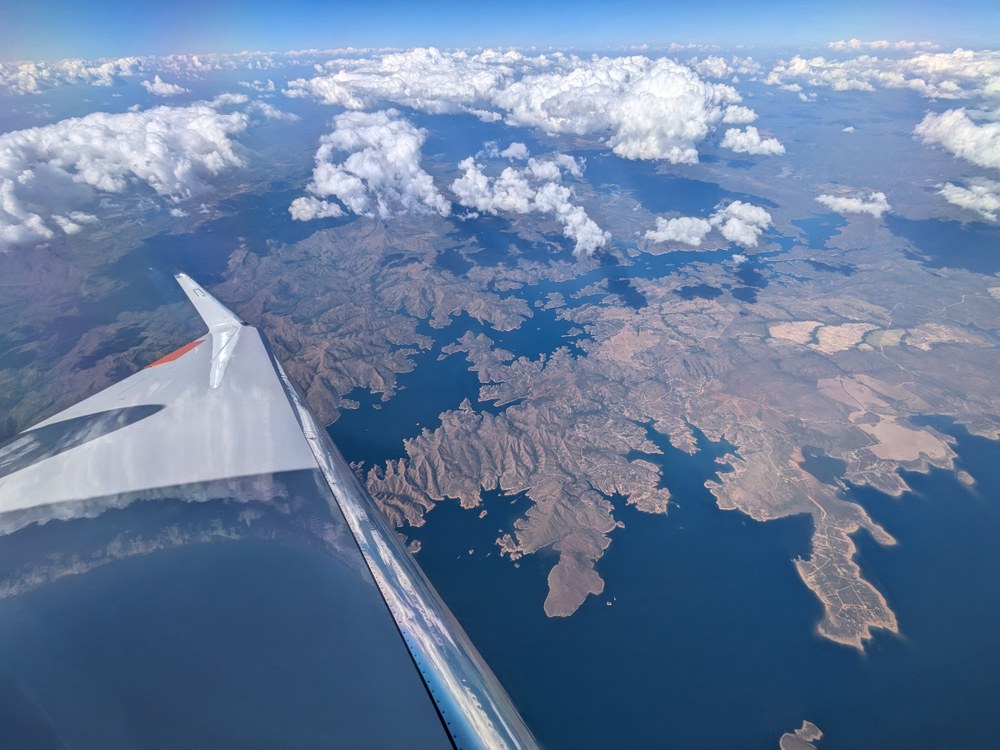
CoMet 3.0 Tropics has arrived in South America, though the science began well before touchdown in Brazil. Transferring HALO from Oberpfaffenhofen was no mere repositioning flight. With all instruments (but the dropsondes) running along the way, HALO sampled a wide range of ecosystems and weather regimes on the way to South America.
Over southern France and Spain, particularly near Madrid, the flight tracked over plumes of smoke from the massive fires that plunged Southern Europe into fear in the summer of 2026. Leaving Europe, the long transatlantic leg from Seville to Fortaleza then offered an ideal opportunity for instrument calibration over water, with roll maneuvers used to evaluate back-reflection signals against the wind-roughened Atlantic Sea surface.
From wildfire plumes over Europe to ocean-glint calibrations over the open Atlantic, this first transfer flight provided extensive calibration data and initial insights into the atmosphere even before the actual campaign began.
Flight N°01: A test flight over the Upper Silesian Coal Basin
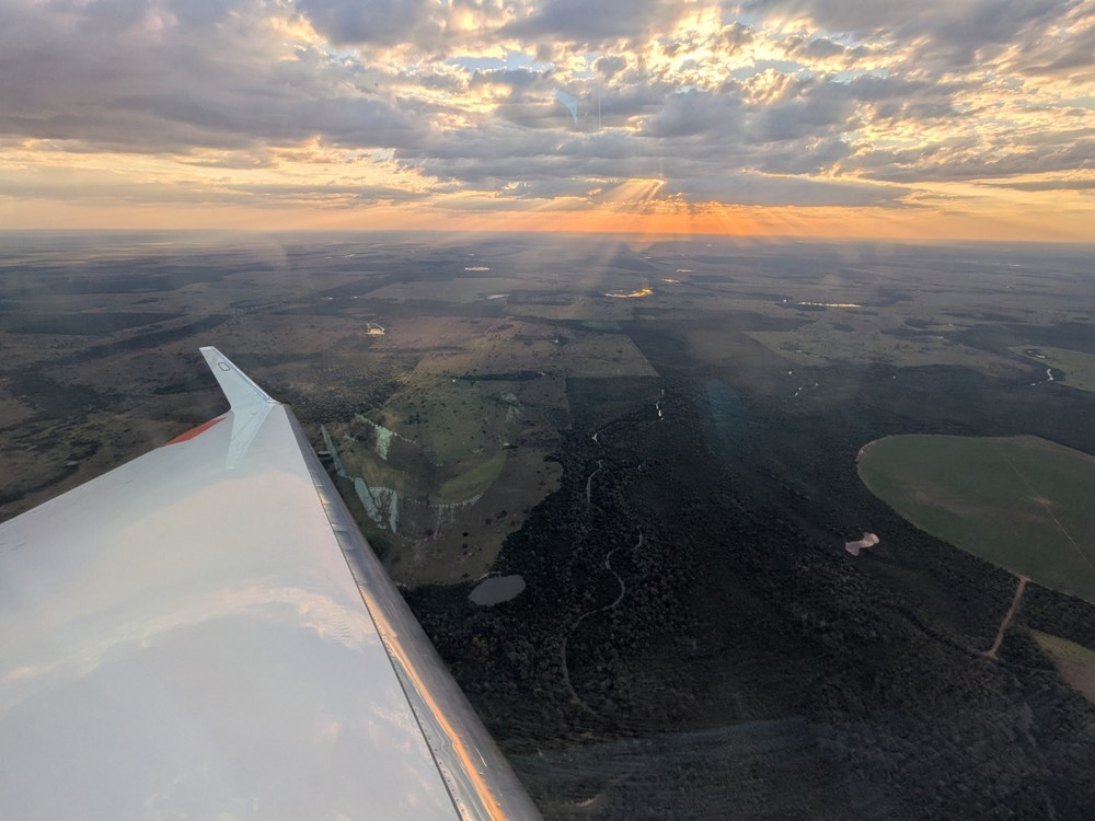
Before the HALO set course south toward Brazil, the aircraft and its crew completed a final test flight near their home base. On 20 July, the test flight took HALO from Oberpfaffenhofen via East Germany into Poland, targeting the coal mine ventilation shafts of the Upper Silesian Coal Basin (USCB) together with the coal-fired power plants Jänschwalde, Schwarze Pumpe and Lippendorf.
More cloud cover than forecast complicated the USCB pattern, with parts of the downwind leg past the ArcelorMittal steel plant obscured. A missed approach at Kraków Airport still went ahead as planned, followed by an in-situ leg downwind of the shafts to sample the emission plume close to the ground. With precipitation and dense cloud over East Germany, the crew decided to skip the planned Jänschwalde power plant pattern and repeat the USCB pattern a second time instead, gathering an additional dataset over the coal mine ventilation shafts. On the way back, HALO still managed a fly-by past Lippendorf power plant under partial cloud cover, before finishing with a low pass over the Hohenpeißenberg ICOS station — a useful early test of the instruments and measurement strategy ahead of the campaign to come.
Successful EMI flight
An important step in preparing the CoMet 3.0 Tropics campaign was completed on schedule: the required EMI (electromagnetic interference) flight was carried out successfully, clearing HALO's instrument payload for the campaign ahead. A special thanks goes to everyone involved.
Kick-off workshop at USP, São Paulo
Long before HALO left the ground, the campaign took shape at a two-day workshop hosted by the Universidade de São Paulo (USP) — a major step forward for European–Brazilian science cooperation. Researchers from the DLR Institut für Physik der Atmosphäre, the University of Bremen, MPI-BGC, ESA, IPEN, INPE, CENSIPAM, and several leading Brazilian universities came together to share the latest findings on greenhouse gas emissions, advance flight planning for HALO, and build the scientific foundation for the campaign — spanning active and passive remote sensing, in-situ instruments, joint modeling strategies and outreach planning.
Alongside the science, preparing the campaign also meant securing the necessary permits for Brazilian airspace, a process carried out together with INPE and the German Embassy, and applying for the scientific license required from the Brazilian National Council for Scientific and Technological Development (CNPq). CoMet 3.0 Tropics is about more than the measurements themselves. It aims to build a lasting partnership between Europe and Brazil to better understand greenhouse gas fluxes and their drivers in tropical ecosystems such as the Amazon, the Pantanal and the Cerrado.