Digital Atlas 2.0 – cross-domain software applications and geodata infrastructures for the processing of geodata
In the project Digital Atlas 2.0, the German Aerospace Center is developing cross-domain software for processing and providing geodata that is used in areas such as automated driving, energy system simulations and urban planning.
A digital transformation is progressing worldwide. The driving factors are the increase in computer performance and capacity for the storage and processing of data using new methods and concepts such as artificial intelligence (AI) and mixed reality (MR). There are also new working models in the labour market due to pandemic situations or the increase in mobility costs. The exchange and integration of different data sets from different domains in society is also taking on new forms.
Geodata plays an extremely important role in the digital transformation, as a large proportion of the datasets from the various domains have a spatial reference. In the project Digital Atlas 2.0, eleven institutes and facilities of the German Aerospace Center (DLR) are working on the methodical development of cross-domain software applications for the processing of geodata and the establishment of a geodata infrastructure (GDI) to provide generated datasets via standardised interfaces.
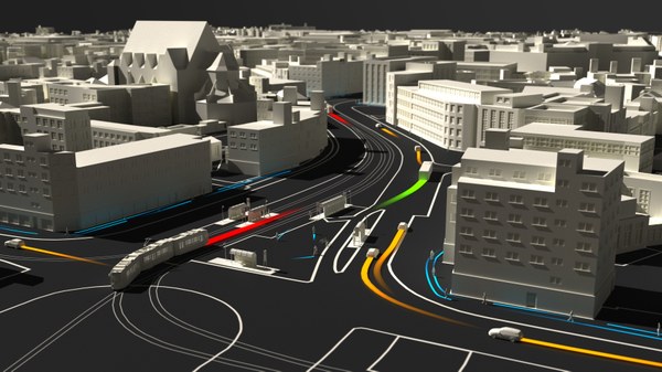
The areas of application addressed by the researchers include the extraction of infrastructure elements such as roads, trees, solar panels, masts, road markings and road cracks from aerial and satellite images. This extracted and prepared data is used in areas such as the automated driving of ground-based vehicles, the simulation of energy systems in urban areas or in the mapping of 3D worlds, including by means of mixed reality (MR) - which depicts reality.
From the maritime sector, applications and methods are being developed and researched to update two- and three-dimensional maps of a harbour in real time. Images from optical systems that are processed using AI are used to update the digital maps in real time. These maps could then be used by authorities or emergency services with security tasks to recognise and assess critical situations in good time. The project will also develop, evaluate and provide a highly accurate map for the automated navigation of ships.
Urban planning is also an important area of application for the project's activities. The scientists merge and evaluate methods for the spatial calculation of noise distribution and attenuation metrics as well as changes in green spaces from satellite images and other geodata and make them available via open source software. Specific indicators that are calculated are, for example, accessibility metrics, which represent the accessibility of places by people using public transport in a selected geographical region.
As the digital transformation aggregates data from different domains and makes it available for various applications, the standardisation of data models and technical interfaces plays an important role. The project also deals with the further development of data models and technologies such as ASAM OpenDRIVE, Road2Simulation, Road2Automation, OGC CityGML and GAIA-X.
In this project, the DLR Institute of Transportation Systems is working on the topic of data management of geodata sets. This includes data management for the mapping of the mixed reality application in the project, standardisation of data models and the development of an infrastructure and route condition register in order to provide various of the above-mentioned data sets in a structured manner via a geodata infrastructure. The institute also has the role of consortium leader for the project and is therefore responsible for project management.
Project title:
Digitaler Atlas 2.0
Duration:
01/2022 to 12/2025
List of publications in the project:
Reference to other projects:
This project is managed by the department: