Envisat
Europe's environmental satellite
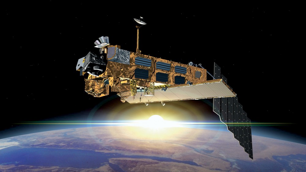
On 1 March 2002, Europe's largest satellite, Envisat (Environmental Satellite), was launched into an orbit at an altitude of 800 kilometres aboard an Ariane 5 from Europe's Spaceport in Kourou, French Guiana. For more than ten years, and thus more than twice as long as planned, it orbited Earth 14 times a day and collected data on the state of the oceans and terrestrial ecosystems, the movement of glaciers and tectonic plates, as well as air pollution.
Luanch: 1 March 2002, 02:07 CET
End of mission: 8 April 2012
With its ten scientific instruments, Envisat delivered up to 280 gigabytes of data per day. Numerous research groups around the world are working on the data evaluation, which at times numbered in the thousands. Even in the long term, Envisat data represents a scientific treasure trove that will be used by generations of future scientists.
Strong German participation in the project
More than 100 European companies were involved in the development and construction of the Envisat satellite. Airbus Defence and Space (formerly Astrium) played a leading role here. It headed the industrial consortium and was thus responsible for the seven ESA instruments. A further three instruments were provided by the space agencies of individual member states.
Airbus Defence and Space was also the main contractor for the atmospheric sensors MIPAS (Michelson Interferometer for passive Atmospheric Sounding) and SCIAMACHY (Scanning Imaging Spectrometer for Atmospheric Chartography). The latter was built in partnership with the Dutch company Dutch Space (formerly Fokker). The Envisat project also involved small and medium-sized companies from several German federal states, such as OHB in Bremen, Jena-Optronik in Jena and Carl Zeiss AG in Oberkochen.
Envisat was operated from the ESA control centre in Darmstadt. DLR's German Remote Sensing Data Center (DFD) in Oberpfaffenhofen was and is responsible for processing and archiving data from the three atmospheric measurement instruments (SCIAMACHY, MIPAS and GOMOS) and the ASAR radar instrument, and making them available to scientists worldwide.
The University of Bremen and the Forschungszentrum Karlsruhe provided the scientific expertise for the SCIAMACHY and MIPAS instruments. This means that Germany played a leading role in the field of atmospheric observation with ENVISAT. German scientists also played a major role in the evaluation of data from the other sensors.
Although Envisat far exceeded its planned lifespan, it was in perfect condition until the very end. Only the fuel reserves for orbit corrections were slowly running low. Its sudden outage was all the more surprising, creating a data gap that still has only been partially closed, for example in areas where successor instruments already existed that could continue the data set on an ongoing basis.
Data from Envisat and its successors have long since become part of our daily lives. Information on solar radiation, for example, is regularly supplied to operators of solar energy systems, information on ice coverage is provided to the shipping industry, and land cover information is made available for spatial planning. Such data are routinely provided as part of the Copernicus programme. Copernicus is a joint initiative of the European Commission and the European Space Agency (ESA) for monitoring the global environment and safeguarding security.
As unique as the universal satellite Envisat was, and as valuable as it is from a scientific point of view, collecting data on as many parameters as possible at the same time and under the same conditions is a costly and complex undertaking for a universal system. In the future, ESA will be relying on a new generation of smaller individual missions, each of which will pursue specific scientific questions. To this end, satellites will be placed in Earth orbit at short, regular intervals. These include the ‘Sentinel’ satellites of the Copernicus programme and the satellites of the ESA ‘Earth Explorer’ series.
Mission data
| | |
|---|
Launch | 01.03.2002, 02:07 CET |
Launch location | Kourou |
Launcher | Ariane 5 |
Orbital altitude | Sun synchronour polar orbit at 800 km; one orbit in 100 minutes |
Satellite mass | 8211 kilograms |
Satellite dimensions | 10.5 x 4 x 4 metres (at launch)
26 x 10 x 5 metres (in orbit) |
Data transfer | 2 x 100 Mbit/s via Artemis (als Relais-Satellit)
2 x 100 Mbit/s direct downlink to the ground station |
Data storage | total of 160 gigabits on board |
Nominal mission duration | 5 years |
Actual mission duration | 10 years and 1 month |
End of mission | 08.04.2012 (outage in communication) |
Related links