
Blog
- Flight N°17: Way back home!
- Flight N°16: Night adventure to coal powerplants
- Flight N°15: A final visit to Lake Winnipeg
- Flight N°14: Anthropogenic sources around Calgary and the coal mines
- Flight N°13: A second look at the Hudson Bay Lowlands
- Flight N°12: First flight to the Hudson Bay Lowlands
- Flight N°11: Returning to Lake Winnipeg
- Flight N°10: An unexpected forest fire
- Flight N°9: The first flight to the Lake Winnipeg wetlands
- Flight N°8: Off to the Lloydminster Oil Fields
- Flight N°7: Another visit to the Peace-Athabasca Delta and Athabasca Oil Sands
- Open house day in Yellowknife together with the NASA team
- Flight N°6: Peace-Athabasca Delta under clear skies
- Flight N°5: Mackenzie Delta and a personal meeting with the AVIRIS-NG team
- Flight N°4: Coordinated measurements over the Athabasca Oil Sands
- Flight N°3: Exploration of oil fields near Edmonton
- Flight N°2: The campaign has started
- First scientific test flight to Madrid
- Successful EMI flight
- Preparations for CoMet 2.0 Arctic ᐅᑭᐅᖅᑕᖅᑐᖅ

Flight N°17: Way back home!
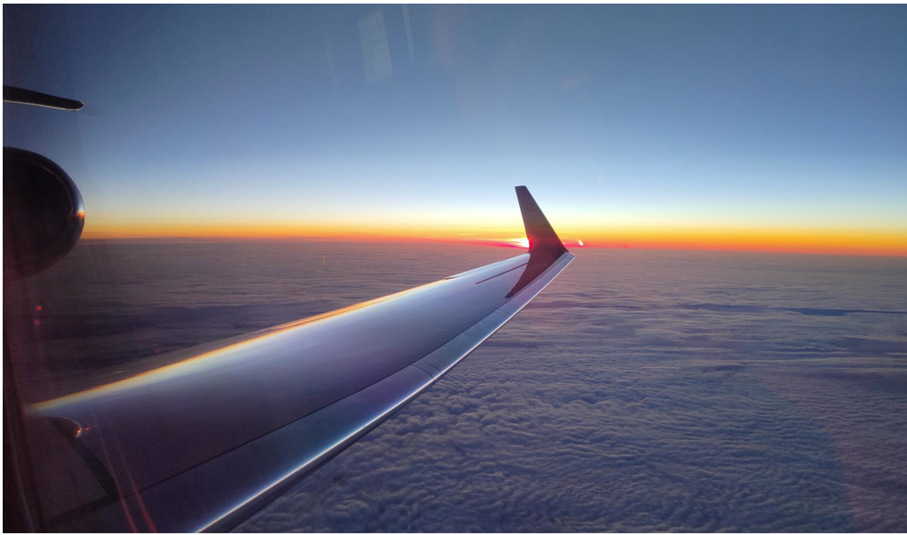
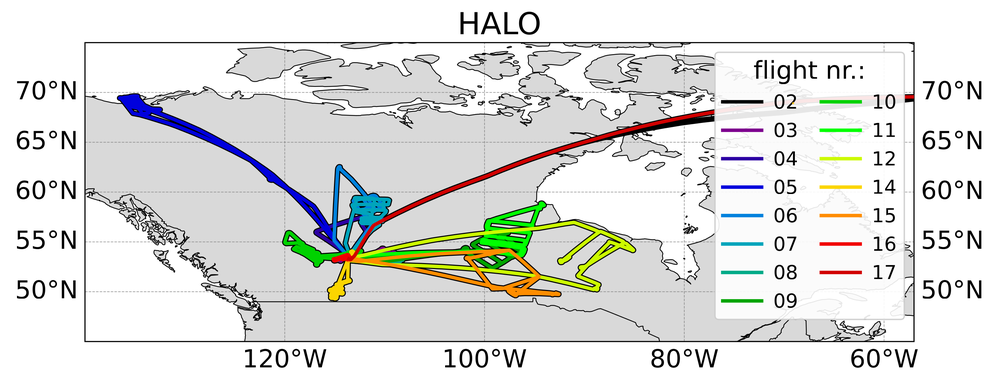
After 16 research flights, it was time for the return flight to Oberpfaffenhofen. No special care was taken for the weather condition during this flight and also no scientific targets were defined. All instruments onboard HALO were stable.
The flight track was majorly dominated by clouds. JIG observed minor variabilities in the upper troposphere in all its measured components.
Flight N°16: Night adventure to coal powerplants
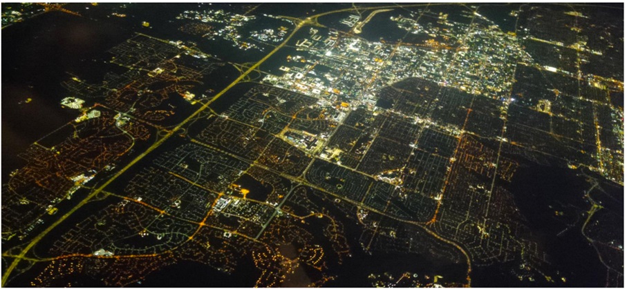
One of our last research flights was aimed at the two coal-fired power plants near Lake Genesee. The idea behind this was to test the hypothesis that the emissions from point sources, i.e. the coal-fired power plants, should be easier to quantify at night, as their emissions are not disturbed by turbulence over the ground as they are during the day. The CO2 emissions could be detected with CHARM-F, but not very clearly, which is due to the narrow beam configuration of the detector, which did not optimise the sensitivity for point sources. In addition, there was a relatively strong wind and the power plant may not have been running at full power. As this was a night flight, no in-situ measurements were carried out. Only JIG took measurements at high altitude, while the passive sensors require sunlight to detect greenhouse gases. JIG observed a small persistent gradient in the upper atmosphere, but no information on local emitters could be obtained.
Flight N°15: A final visit to Lake Winnipeg
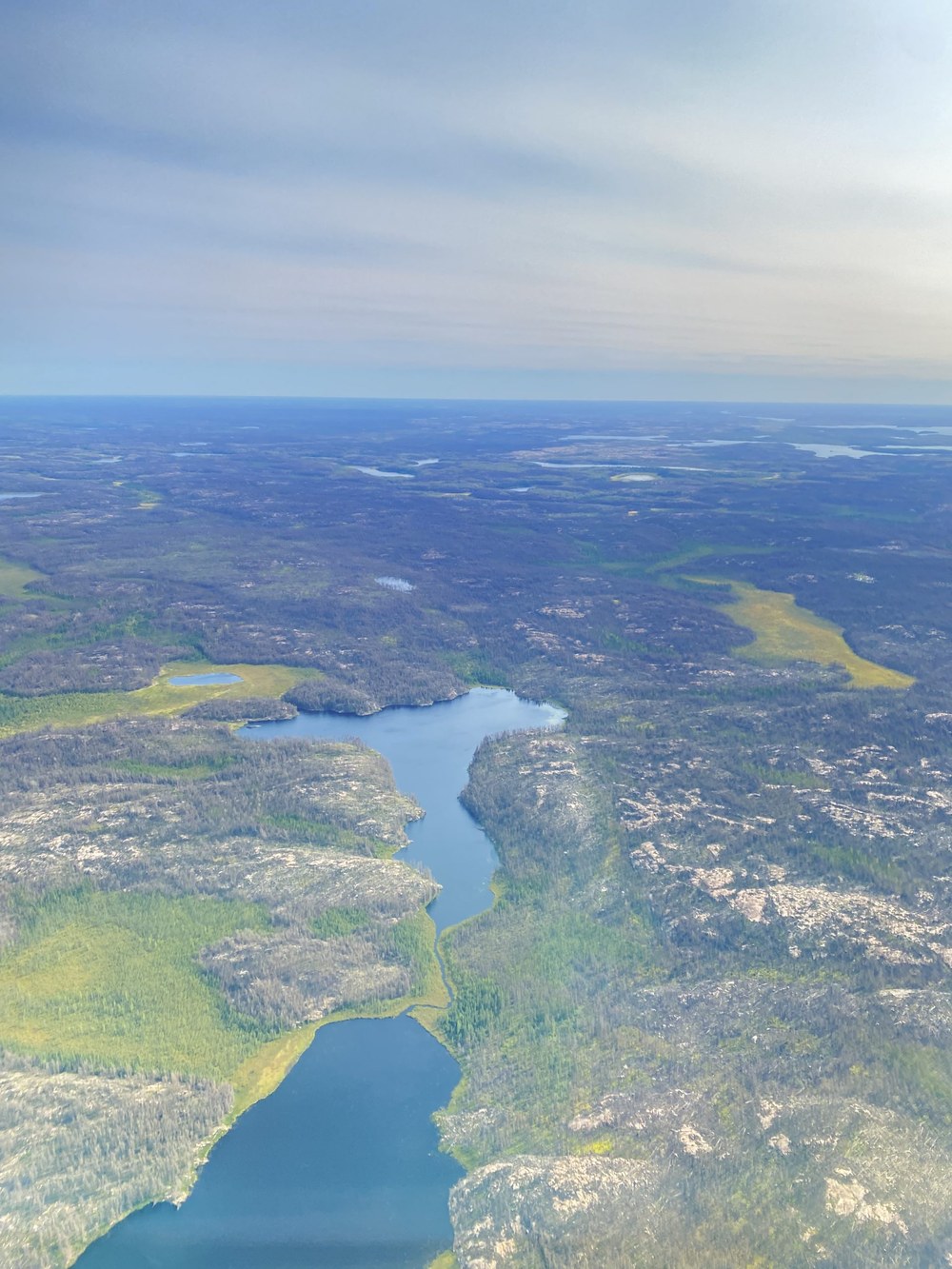
This time the flight took us to the southern part of Lake Winnipeg, as further possible methane sources were suspected there after the first two Winnipeg flights. In addition, the flight included a low approach over wetlands in southern Ontario and remote sensing measurements over a landfill in the Winnipeg metropolitan area. We wanted to determine if there were high levels of methane emissions from wetlands between Lake Winnipeg and the lakes to the west, Lake Winnipegosis and Lake Manitoba. The target areas were selected using emission models that estimate greenhouse gas emissions as a function of factors such as surface water extent, microbial activity, temperature, precipitation and flooding. When looking at the aerial images with their mosaic-like structure of trees, shallow waters, bogs and swamps, it became clear how difficult it is to quantify the methane production of these landscapes.
In addition to the ongoing forest fire activities, which forced us to change our flight routes, we particularly wanted to better characterise the air layers close to the ground. The so-called planetary boundary layer is the part of the troposphere in which properties of the Earth's surface such as temperature, albedo, humidity and surface structures have a strong influence on atmospheric dynamics. Due to turbulent mixing, vertical mixing is particularly pronounced here, while the free troposphere above is dominated by stably stratified air masses. The majority of greenhouse gases released at the surface therefore remain within the planetary boundary layer. One aim of the in-situ measurements during the flight was to determine the height of the planetary boundary layer. This was done by means of targeted ascending and descending flights.
Flight N°14: Anthropogenic sources around Calgary and the coal mines
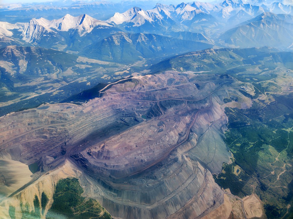
In addition to the various Arctic wetlands in Canada, the campaign also focussed on various anthropogenic sources of methane. On 10 September, we flew to several potential anthropogenic methane sources, in particular to the large coal mines near Elkford and Sparwood in south-eastern British Columbia, at a comparatively short distance from our base in Edmonton.
Coal mining often releases large quantities of various gases. The gas mixture, which consists mainly of methane and escapes during mining activities, is also known as mine gas. In the early days of underground coal mining, this gas posed a significant risk as it often reached concentrations where even a single spark could trigger an explosion. However, methane is not only released during underground mining, but also during surface mining, as is the case with the mines in the Elkford region.
Flight N°13: A second look at the Hudson Bay Lowlands
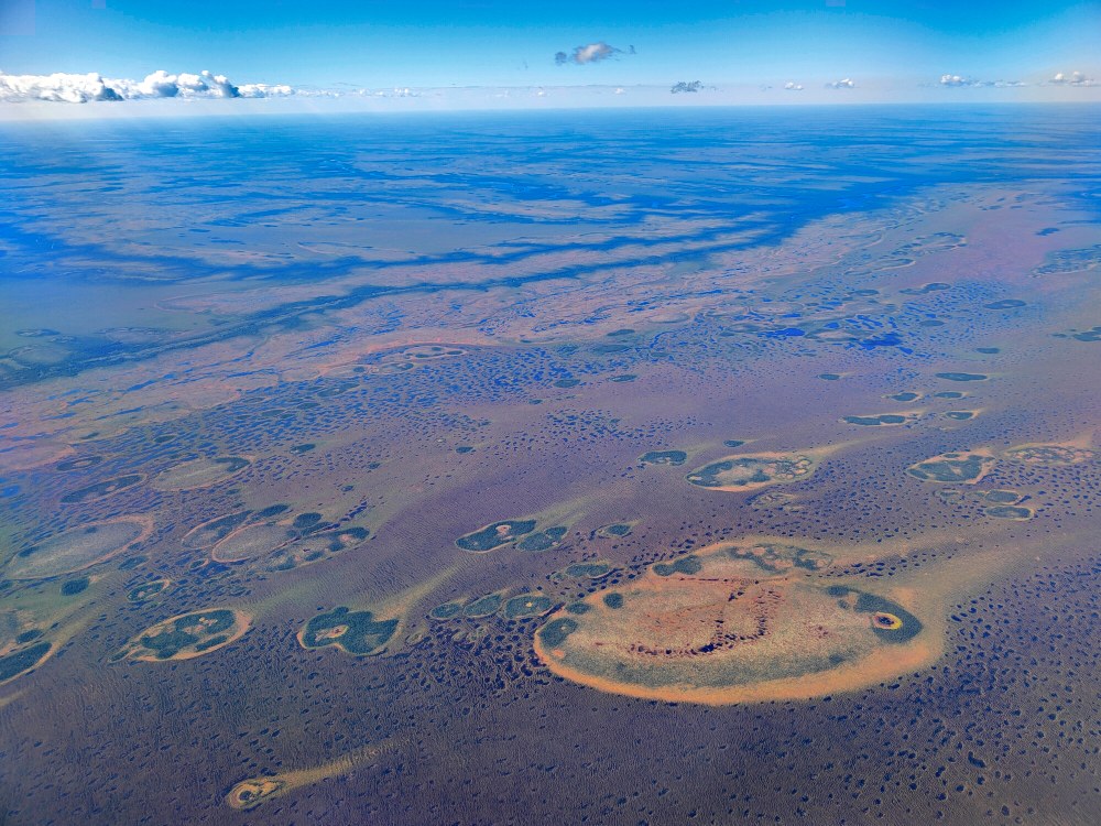
This was our second flight over the Hudson Bay Lowlands and took place on 7 September, just two days after our previous visit to the region. The vast area that stretches along the southern coast of Hudson Bay is entirely characterised by lakes, small islands, rivers and peatlands. In winter, the landscape is frozen and Hudson Bay itself freezes over. In summer, the surface thaws and can reach moderately warm temperatures, allowing for a short but intense growing season. Dead biomass accumulates in the marshes and is decomposed by microorganisms, releasing methane.
The region is almost inaccessible, offers hardly any fertile land and has a climate that makes human settlement very difficult. Our strategy was to measure the accumulation of methane in the air masses flowing over the wetlands. To do this, we flew both along the wind direction and across it in so-called upwind and downwind flight sections. For the in-situ measurements, we descended to 500 feet (about 150 metres) above the ground in order to capture the clearest possible methane signals.
Flight N°12: First flight to the Hudson Bay Lowlands
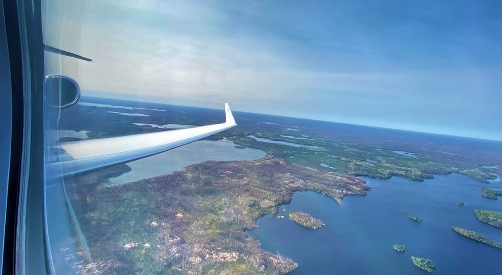
The Hudson Bay Lowlands are the third largest wetlands on Earth after the Amazon and the Siberian wetlands complex. In such vast and inaccessible regions, it is extremely difficult to collect data on methane emissions from the ground or with smaller research aircraft, especially due to the enormous area. We were therefore particularly keen to explore this area on a large scale. In order to get more than just a remote sensing view of this region, we decided to fly so-called "dips" into the boundary layer with HALO. We mainly flew at an altitude of around 2,500 metres and only occasionally descended into the planetary boundary layer.
In total, the flight lasted more than ten hours, enabling us to obtain extensive data sets from a region that has been little studied to date. During the entire flight, a diffuse aerosol layer was visible, which was most likely caused by the still active forest fires in the north-west of the USA and in the Canadian Rocky Mountains in British Columbia and Alberta. The smoke plumes from these fires had been transported to the north-east in the previous days and were therefore also visible over the Hudson Bay Lowlands.
Flight N°11: Returning to Lake Winnipeg
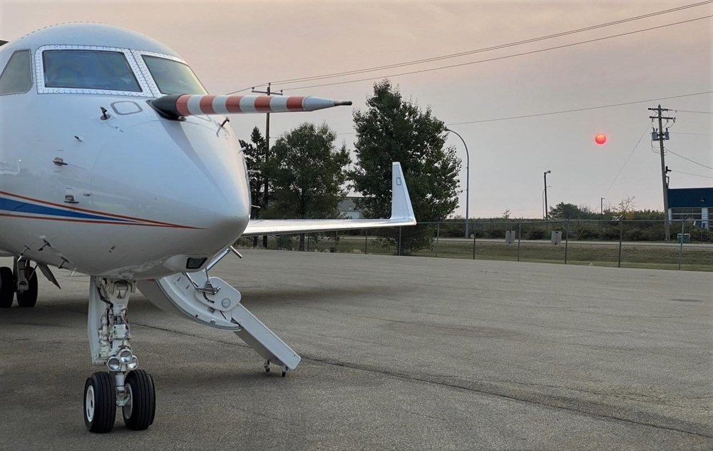
On the eleventh research flight, on 3 September, the wetlands north-east of Lake Winnipeg were once again the target. The area was flown over a second time to confirm and validate the measurements taken last time. The flight patterns were adapted to the different wind conditions. Wind direction is a key parameter for determining methane fluxes over an area. During the flight, wind direction is measured using a sensor in the nose mast of HALO, which in turn enables measurements to be taken in the immediate vicinity of the aircraft.
After landing, we were able to watch a spectacular sunset with a glowing red sun. This colouring is due to aerosols released by forest fires in the Rocky Mountains that covered the area around Edmonton that day. These particles scatter the sunlight, whereby the short-wave blue components are more strongly scattered so that the remaining light appears predominantly red.
Flight N°10: An unexpected forest fire
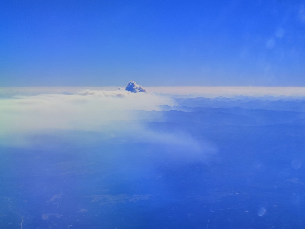
On 2 September, we wanted to measure methane emissions from oil and gas production in western Alberta. During this flight, we had an unexpected opportunity to observe the plume of smoke from a newly developing forest fire. Due to unfavourable weather conditions, we had not been able to carry out a measurement flight in the previous days.
The target this time was a new region with oil and gas production facilities north-west of our base in Edmonton, on the edge of the Rocky Mountains. From the air, these facilities were recognisable as clearing areas in the forest, spread out like tracks across the landscape.
As we followed the planned flight pattern, we noticed an unusual cloud structure over the Rocky Mountains that rose well above the surrounding clouds and pierced the planetary boundary layer. To reach such a height, the rising air must be significantly warmer than the surrounding air, which indicated an active forest fire.
Forest fires play an important role in the carbon cycle, as they release large amounts of carbon into the atmosphere within a short period of time, which had previously been stored in the vegetation for decades. Over the course of the next hour, we were able to observe the rapid development of a pronounced smoke plume. The flight route was adjusted at short notice so that HALO could fly over and through the plume to measure it with in-situ and remote sensing instruments. We later learnt that it was the Chetamon forest fire near Jasper in Alberta. Satellite images show that its smoke plume spread several hundred kilometres to the west within a few hours. Together with smoke plumes from numerous other fires in the US and Canadian Rocky Mountains, the Chetamon forest fire contributed to a large-scale haze over much of southern Canada, which we observed a few days later in both Edmonton and the Hudsonbay Lowlands.
Flight N°9: The first flight to the Lake Winnipeg wetlands
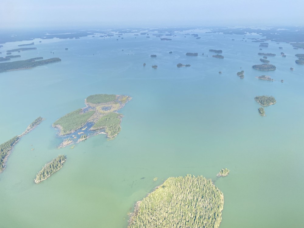
On 26 August, we flew over the wetlands of the Lake Winnipeg area, which is the tenth largest freshwater lake in the world. We also wanted to fly over forest fires to better characterise their influence on our measurements.
During the flight, we carried out a planned missed approach at the airport. This is a flight manoeuvre in which a descent similar to a landing approach is performed in order to record a vertical atmospheric profile. Shortly before touchdown, the aircraft climbs back to its original altitude.
In addition, we use multiple drop probes to collect data on the surrounding atmosphere. During the descent, each probe transmits its measurement data to the aircraft by radio. The wind speed and wind direction can be determined using the GPS position data. In addition, the probes are equipped with sensors for pressure, temperature and humidity, which provide vertical profiles of the thermodynamic properties of the atmosphere. A small parachute slows the descent and ensures that the probe remains stable during the entire descent.
Flight N°8: Off to the Lloydminster Oil Fields
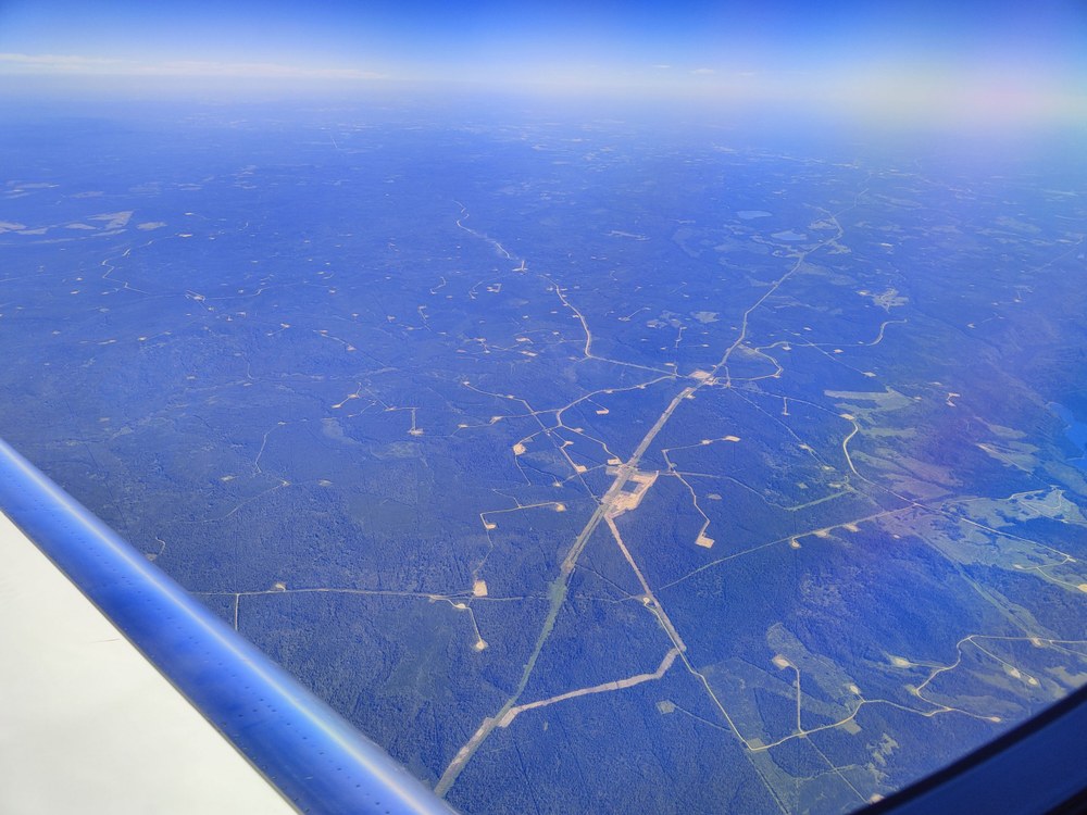
After six days on the ground, HALO and the crew left the hangar again to fly over Lloydminster. This is where the so-called "Heavy Oil Capital of Canada" is located. This area had already been flown over at the beginning of the campaign and now offered the opportunity to collect additional data for validation.
Lloydminster is known for being the only border town in Canada. The city is located in both the province of Saskatchewan and Alberta. This was not a problem for our flight planning, as both provinces belong to the same time zone and no coordination with different air traffic control centres was required.
During the flight, spiral descents were performed to obtain in-situ measurements at different altitudes and to create vertical profiles of trace gas concentrations. In this section, we flew over individual oil production facilities, which can be recognised in the image by the lighter areas in the fields.
Flight N°7: Another visit to the Peace-Athabasca Delta and Athabasca Oil Sands
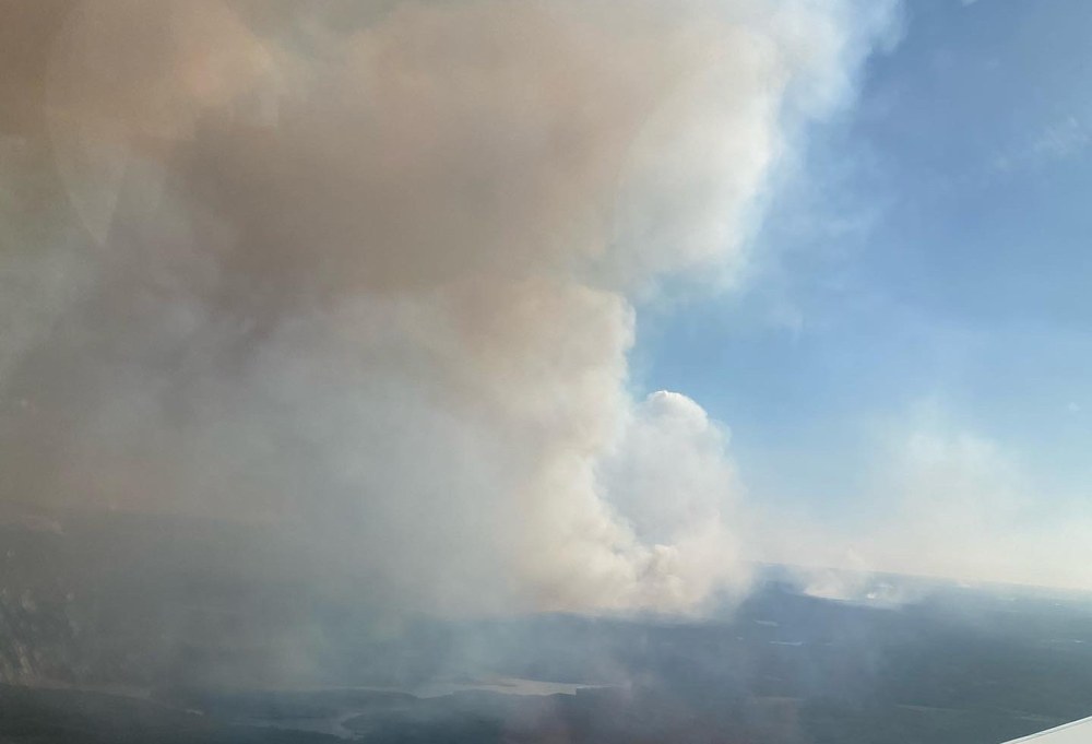
On 18 August, we again flew over the areas of the Athabasca River Delta and the Oil Sands, which had already been the target during the fourth and sixth measurement flights.
In addition to these target areas, on the return flight we observed a forest fire near one of the survey areas. In order to obtain representative samples on this unique occasion, we dived with HALO into the smoke plume of the fire. It was quite a bumpy flight.
Open house day in Yellowknife together with the NASA team
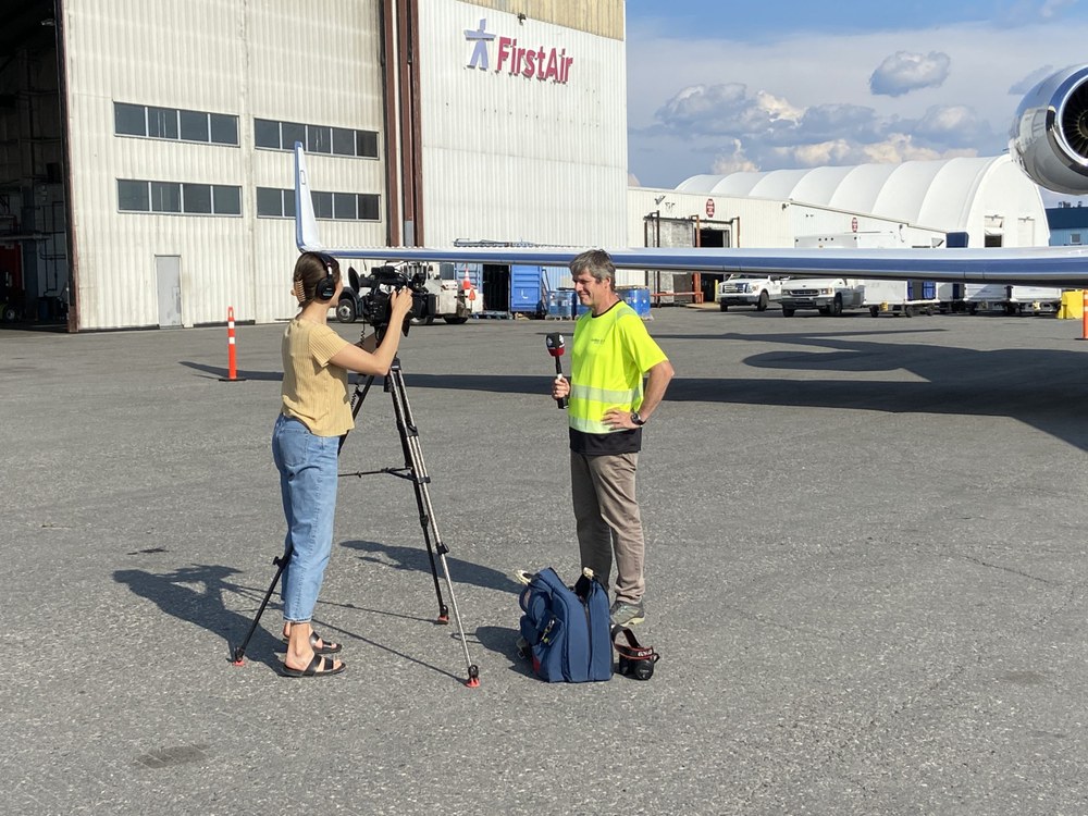
In addition to the measurement flights, an open day was held in Yellowknife on 16 August together with NASA. The public had the opportunity to meet researchers and view the research aircraft.
About 30 Yellowknife residents had the opportunity to interact directly with researchers from the CoMet 2.0 campaign and the team from NASA's Terrestrial Ecology Programme. Visitors were able to tour the HALO aircraft and ask questions about the on-board instruments and the scientific goals of the mission.
The two flight measurement campaign teams share a common goal in a larger context. While the CoMet 2.0 mission aims to better understand methane and carbon emissions, the NASA team focuses directly on the effects of climate change on ecosystems. Charles Miller from NASA's Terrestrial Ecology Programme is leading a large-scale, long-term field campaign called the Arctic-Boreal Vulnerability Experiment (ABoVE), which has been conducted in Alaska and western Canada over a period of eight to ten years since 2015. ABoVE aims to improve the understanding of the vulnerability and resilience of ecosystems and human societies in a rapidly changing environment.
The open day was also covered by numerous local media outlets:
Flight N°6: Peace-Athabasca Delta under clear skies
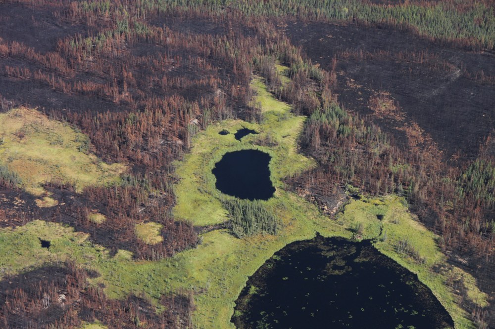
On 16 August, we flew over the Peace-Athabasca Delta, the largest inland freshwater delta in North America. The wetlands of the Peace-Athabasca Delta form a complex and dynamic ecosystem of rivers, lakes, canals, marshes and grasslands covering an area of approximately 3,900 square kilometres.
The remote sensing instruments require cloud-free conditions, which is why the flight routes have to be carefully planned based on the weather forecasts. This planning is carried out by a team in Germany. During the transfer flight to the Peace-Athabasca Delta, the sky was initially overcast, but it cleared up when the measuring area was reached, providing optimal conditions for the measurements. The timing could hardly have been better.
Flight N°5: Mackenzie Delta and a personal meeting with the AVIRIS-NG team
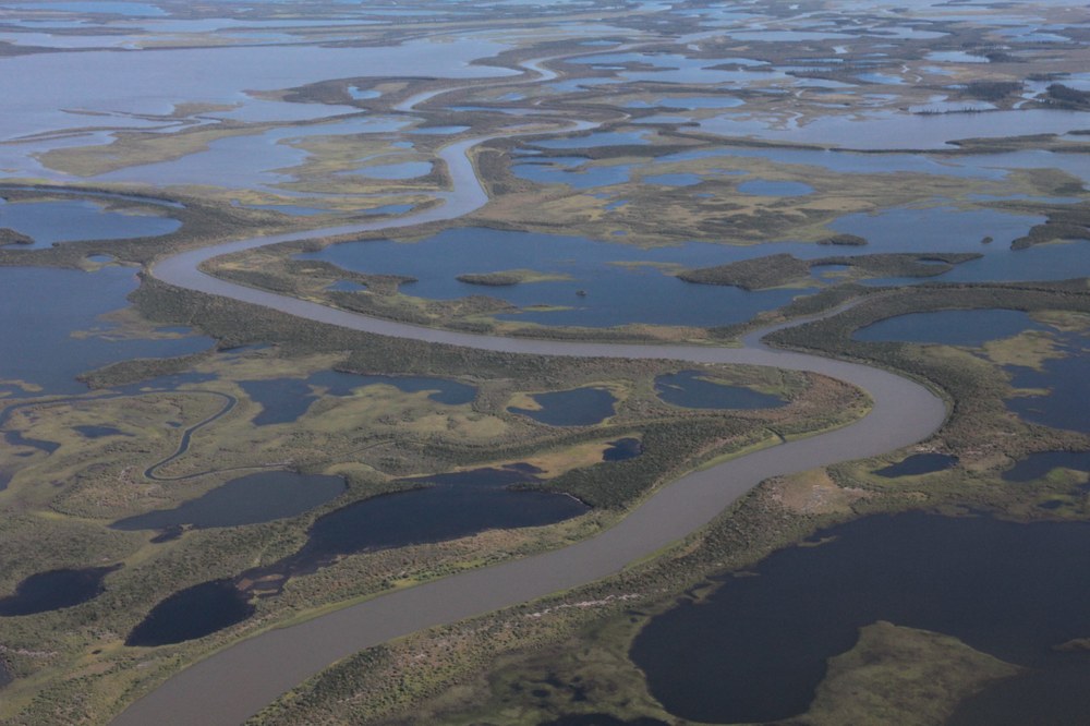
On 12 August, we flew north to the approximately 210-kilometre-wide wetland corridor of the Mackenzie Delta in the Canadian Arctic. We also made a stopover in Inuvik, where we met the NASA AVIRIS-NG team in person.
The weather conditions that day were almost ideal. Clear skies, warm temperatures, moderate winds and a sufficiently high planetary boundary layer provided excellent conditions for the measurements. The refuelling stop in Inuvik went smoothly and was very well organised. Several team members reported that the view of the extensive delta area from the air was a particularly impressive experience.
This flight also marked HALO's 1,000th landing - a significant milestone. Our thanks go to the pilots, the DLR-FX flight organisation and the instrument teams.
Flight N°4: Coordinated measurements over the Athabasca Oil Sands
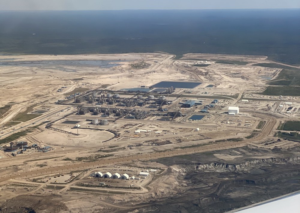
For the second flight in Canada, we headed for the Athabasca Oil Sands, one of the country's most important sources of methane. A key element of this flight was the coordination with the NASA instrument AVIRIS-NG, which was carrying out measurements over the same area on the same day.
As on the previous day, we benefited from cloud-free conditions, which are essential for our remote sensing instruments.
On the return flight, we had a clear view of Edmonton.
Flight N°3: Exploration of oil fields near Edmonton

The first flight in Canada took us to the oil fields near Frog Lake and Lloydminster as well as to power plants west of Edmonton.
This first measurement flight was a successful start to the campaign. The cloud-free conditions were extremely favourable for all instrument teams. The first preview images of the data already showed clearly recognisable signals from various methane and carbon dioxide sources. Detailed results will follow once the data has been fully analysed.
Flight N°2: The campaign has started

HALO and the crew have arrived safely in Canada.
The transfer flight for the CoMet 2.0 campaign took place from Oberpfaffenhofen over the northern Atlantic with a wonderful view of Greenland and finally over Canada to Edmonton.
The flight time from Oberpfaffenhofen in Germany to Edmonton in Canada was originally scheduled at around 9.5 hours, but the landing was delayed by two hours until 16:30 local time.
All instruments worked reliably during the transfer flight, even though large parts of the route were travelled above the cloud cover.
First scientific test flight to Madrid
A scientific test flight took place on 4 August. The destination was a large landfill site near Madrid. Anthropogenic methane and carbon dioxide measurements were recorded using HALO's current instrument payload.
Successful EMI flight
An important step in the preparation of the CoMet 2.0 Arctic mission was completed on Friday 22 July. The required EMI (Electromagnetic Interference) flight was successfully completed. Special thanks go to all those involved.
Preparations for CoMet 2.0 Arctic ᐅᑭᐅᖅᑕᖅᑐᖅ
Campaign preparation begins, and that means keeping everyone informed - really everyone. The mission brochure can be downloaded here. To make the campaign accessible to indigenous communities in Canada, the brochure has also been translated into the Inuktitut language:
ᓯᓚᐅᑉ ᐊᓯᔾᔨᖅᐸᓪᓕᐊᓂᖓ ᓄᓇᕐᔪᐊᕐᒥ ᐃᓅᖃᑎᒌᖑᔪᓄᑦ ᐊᒃᓱᕈᕈᑎᒋᔭᐅᕗᖅ ᐱᓕᕆᔭᐅᓪᓗᓂ ᐊᕐᕌᒍᖏᑦ 2100-ᖏᓐᓄᐊᓕᖅᑎᓪᓗᒋᑦ. ᐱᔾᔪᑎᒋᓪᓗᐊᑕᖅᑕᖓ ᓯᓚᕐᔪᐊᑉ ᐅᖅᑰᓯᕙᓪᓕᐊᓂᖓ ᐃᓯᐊᕿᓂᑦ ᐳᔪᕐᓗᓂᑦ ᓄᓇᕐᔪᐊᕐᒥᓐᖔᖅᑐᓂᑦ. ᒪᕐᕉᒃ ᐱᒻᒪᕆᐅᓂᖅᐹᖑᔪᑦ ᓄᓇᕐᔪᐊᕐᒥᐅᑕᔪᑦ ᐱᓕᕆᓂᖓᓐᓄᑦ ᓴᖅᑭᓯᒪᕗᑦ ᐊᓂᐊᕋᖅᑐᓂᒃ ᐃᓯᐊᕿᒥᑦ carbon dioxide (CO2) ᐊᒻᒪ ᐳᓪᓚᒃ methane (CH4). ᑭᓯᐊᓂᓕ ᓴᓇᔭᐅᔪᓄᑐᐊᖑᖏᑦᑐᖅ ᑕᐃᒪᐃᑦᑐᖅ ᓄᓇᕐᔪᐊᕐᒥ ᐱᓪᓗᒍ ᓄᓇᐃᑦ ᒪᓴᐃᑦ ᐊᒻᒪ ᐅᑭᐅᖅᑕᖅᑐᕐᒦᑦᑐᑦ ᐱᕈᖅᑐᑦ ᐱᒻᒪᕿᐅᖕᒪᑕ. ᑕᒪᒃᑯᐊ ᒪᓴᖕᒥ ᐱᕈᖅᑐᑦ ᐃᓯᐊᕿᑎᑦᑎᖕᒪᑕ ᐳᓪᓚᓂᒃ ᐱᕈᖅᑐᖏᑦ ᐊᒻᒪ ᑐᖁᓕᓕᖅᑎᓪᓗᒋᑦ ᐳᓪᓚᖏᓐᓂᒃ ᐊᓂᐊᕆᕙᒃᑐᑦ ᑕᐃᔭᐅᔪᒥᒃ CO2 ᐊᒻᒪ CH4. ᑕᒪᒃᑯᐊ ᐱᕈᖅᑐᑦ ᑐᖁᓕᓕᖅᑎᓪᓗᒋᑦ ᐊᐅᓚᓂᕆᔭᖏᑦ ᓄᓇᕐᔪᐊᕐᒥ ᐃᒪᖅᓱᖕᓂ ᐱᕈᖅᑐᑦ ᐱᒻᒪᕆᐅᓂᖅᐹᖑᓪᓗᑎᒃ ᑭᓯᐊᓂᓕ ᑐᒃᑭᓯᐅᒪᔭᐅᑦᑎᐊᖏᑦᑐᑦ ᐊᒻᒪ ᓇᒧᓐᖓᐅᖕᒪᖔᑕ ᐳᓪᓚᐃᑦ ᐊᓂᐊᕋᖅᑐᑦ ᐊᒻᒪ CO2-ᓕᕆᓂᕐᒧᑦ ᐊᑐᕈᒫᖅᑕᖏᑦ ᑮᓇᐅᔭᑦ.. ᖃᐅᔨᒪᔭᐅᓂᕆᔭᖓ ᓴᖅᑭᑉᐸᓪᓕᐊᓂᕆᕙᒃᑕᖏᑦ ᑕᒪᒃᑯᐊ ᐊᓂᐊᕋᖅᐸᒃᑐᑦ ᓯᓚᒧᑦ ᐊᖏᔪᒻᒪᕆᖕᒪᑕ ᐃᓯᐊᕿᓂᓐᖔᖅᑐᑦ ᐳᔪᕐᓗᖕᓂᑦ, ᐊᒻᒪ ᐊᐅᓚᓂᕆᔭᖏᑦ ᑐᑭᓯᒪᔭᐅᑦᑎᐊᕋᑎᒃ ᖃᐅᔨᓴᖅᑎᒻᒪᕆᐅᔪᓄᑦ ᐊᑐᐊᒐᓕᐅᖅᑎᓄᓪᓗ ᑕᒪᓐᓇ ᑭᐅᔭᐅᑦᑎᐊᕆᐊᓕᒃ ᓱᖅᑯᐃᔭᒪᐅᖏᓐᓂᖓᓄᑦ ᒥᒃᓴᐅᓴᖑᓐᓇᖅᓯᓂᐊᕐᒪᑕ ᖃᓄᐃᓐᓂᐊᕐᒪᖔᑦ ᓯᓚ ᐅᖅᑰᓯᕙᓪᓕᐊᑎᓪᓗᒍ.
ᐆᒃᑐᕋᖅᑕᐅᓂᖏᑦ ᖃᓄᑎᒌᕐᒪᖔᑕ ᐊᓂᐊᕋᖅᑐᑦ ᐳᓪᒪᐃᑦ ᓯᓚᒧᓐᖓᐅᔪᑦ ᖃᐅᔨᓴᖅᑕᐅᔭᕆᐊᖃᕐᒪᑕ ᑲᒪᒋᔭᐅᔪᓐᓇᖁᓪᓗᒍ ᑕᒪᓐᓇ ᑖᒃᑯᐊ ᐱᓕᕆᔭᐅᑎᓪᓗᒋᑦ CoMet 2.0 ᐅᑭᐅᖅᑕᖅᑐᕐᒥᒃ ᑕᐃᔭᐅᔪᖅ, ᐱᓕᕆᐊᖃᕈᒪᕗᒍᑦ ᖃᐅᔨᓴᐃᓗᑕ ᖃᖓᑦᑕᖅᑎᑕᐅᓯᒪᔪᒥᒃ ᐊᑐᕐᓗᑕ ᐊᐅᓚᑕᐅᔪᓐᓇᕐᓗᓂ ᖃᐅᔨᓴᐃᓗᓂ ᐃᓯᐊᕿᓂᒃ ᐳᓪᓚᓂᒡᓗ ᐊᓂᐊᕋᖅᑐᖃᕐᒪᖔᑦ ᓯᓚᒧᓐᖓᐅᔪᓂᒃ.
CoMet 2.0 ᐅᑭᐅᖅᑕᖅᑐᖅ ᑕᐃᔭᐅᔪᖅ ᐱᓕᕆᐊᖑᔪᖅ ᓄᓇᕐᔪᐊᕐᒥ ᖃᐅᔨᓴᐃᓪᓗᑎᒃ ᐱᓕᕆᔭᐅᔪᖅ ᓯᕗᓕᖅᑎᖃᖅᑐᑦ ᔮᒪᓂᕐᒥᐅᑦ ᓯᓚᓕᕆᔨᖏᓐᓂᒃ – DLR, ᔮᒪᓂᒃᑯᑦ ᒐᕙᒪᖏᑕ ᐱᓕᕆᕕᖓᑦ, ᐊᒻᒪ ᔮᒪᓂᒃᑯᑦ ᖃᔨᐅᓴᐃᔾᔪᑎᖓᓐᓂᒃ ᖃᖓᑦᑕᖅᑎᑕᐅᕙᒃᑐᒥᒃ ᐊᑐᕐᓂᐊᖅᑐᑦ HALO (ᖁᑦᑎᓈᕈᓐᓇᖅᑐᖅ ᐊᒻᒪ ᐅᖓᓯᒃᑐᒧᐊᕈᓐᓇᖅᑐᖅ), ᓴᓇᔭᐅᒃᑲᓐᓂᖅᓯᒪᓪᓗᓂ ᐋᖅᑭᒋᐊᖅᑕᐅᓯᒪᔪᖅ Gulfstream G550.
ᑖᓐᓇ ᐱᓇᓱᐊᕈᓯᕐᓄᑦ ᐊᕐᕕᓂᓕᖕᓄᑦ ᐱᓕᕆᔭᐅᓂᐊᖅᑐᖅ ᖃᐅᔨᓴᐃᓗᑎᒃ ᐋᒡᒌᓯ 6-ᒥᑦ ᓯᑎᐱᕆ 16, 2022 ᑎᑭᓪᓗᒍ ᑐᑦᑕᕐᕕᖃᕐᓗᑎᒃ ᐃᐊᓐᒪᓐᑕᓐ ᐃᐅᓪᐳᑕᒥᒃ. ᖃᓂᒋᔭᖓᓂ 120- ᖃᖓᑕᓗᓂ ᐃᑲᕐᕋᐃᑦ ᐊᑐᐃᓐᓇᐅᓂᐊᖅᑐᑦ ᑮᓇᐅᔭᖃᖅᑎᑕᐅᓪᓗᑎᒃ ᑕᖅᑲᒃᑯᓇᓐᖓᑦ ᐊᒻᒪ ᐅᓄᑲᓪᓚᒃᑐᓂᒃ ᓄᓇᖅᑲᑎᒌᖏᑦᑐᓂ ᑲᓇᑕᑉ ᐊᒡᒍᖅᑐᖅᓯᒪᓂᖏᓐᓂ ᐊᒻᒪ ᐅᑭᐅᖅᑕᖅᑐᕐᒥᐅᓂ ᓂᖓᑦᑕᖅᑎᑕᐅᖃᑦᑕᕐᓂᐊᖅᑐᑦ. ᐅᓄᖏᑦᑑᒐᓗᐊᑦ ᖃᖓᑕᑎᑕᐅᐃᔪᑦ ᓄᓇᕗᒧᐊᖃᑦᑕᕐᓂᐊᖅᑐᑦ. ᐊᒃᑐᐃᓂᖃᓗᐊᕐᓂᐊᖏᑦᑐᖅ ᓯᓚᒥᒃ, ᐆᒪᔪᓂᒃ ᐊᒻᒪ ᐃᓄᖕᓂᒃ. ᖃᖓᑕᑎᑕᐅᖃᑦᑕᕐᓂᐊᖅᑐᑦ ᖁᑦᑎᓈᖅᑎᑕᐅᓗᑎᒃ ᑭᓛᒥᑐᔅᓂᒃ ᐅᓄᖅᑐᓂᒃ. ᐃᓛᓐᓂᓚᐅᓱᖓᒃᑯᑦ ᓄᓇᒧᑦ ᐊᑦᑎᓈᖃᑦᑕᑉᕐᓂᐊᖅᑐᑦ ᑭᓯᐊᓂᓕ ᓴᐳᒻᒥᐅᓯᖅᑕᐅᓯᒪᔪᓄᐊᕐᓂᐊᖏᑦᑐᑦ. ᐃᑲᔪᖅᑕᐅᖁᓪᓗᒋᑦ ᐊᑐᖅᑕᐅᔪᑦ ᓴᓇᕐᕈᑎᕗᑦ, ᐅᓄᖏᑦᑑᒐᓗᐊᓂᒃ ᓯᓚᓐᓂᐊᕈᑎᓂᒃ ᖃᖓᑦᑕᖅᑎᑦᑎᖃᑦᑕᕐᓂᐊᖅᑐᑦ ᐊᒻᒪ ᐱᔭᐅᖃᑦᑕᕐᓗᑎᒃ ᐅᑎᖅᑎᑕᐅᓗᑎᒃ. ᑖᒃᑯᐊ ᐊᔾᔨᒋᔭᖏᑦ ᖃᖓᑦᑕᖅᑎᑕᐅᕙᒃᑐᑦ ᓯᓚᓐᓂᐊᖅᑎᒃᑯᓐᓄᑦ ᐳᕕᔫᕐᔪᐊᑦ 60-ᖏᖅᓱᖅᑕᐅᓪᓗᑎᒃ ᖃᖓᑦᑕᖅᑎᑕᐅᕙᒃᑐᑦ ᐅᓪᓗᑕᒫᓐ ᑲᓇᑕᓕᒫᒥ ᐊᒻᒪ ᐅᓗᕆᐊᓇᖅᑐᓂᒃ ᐃᓗᓕᖃᕐᓂᐊᖏᑦᑐᑦ ᖃᖓᑦᑕᖅᑎᑕᐅᖃᑦᑕᖅᑐᑦ.
ᑖᓐᓇ ᐱᓕᕆᐊᖑᔪᖅ CoMet 2.0 ᐅᑭᐅᖅᑕᖅᑐᖅ ᖃᐅᔨᓴᐃᔪᑦ ᒪᑐᐃᖓᓪᓗᓂ ᐱᓕᕆᔭᐅᔪᖅ ᐱᔨᑦᓯᖅᑕᐅᓪᓗᑎᒃ ᓄᓇᕐᔪᐊᕐᒥ ᓄᓇᖃᖅᑐᑦ. ᐱᔾᔪᑎᒋᓪᓗᒍ ᑭᓇᒃᑯᑐᐃᓐᓇᕐᓄᑦ ᑮᓇᐅᔭᖃᖅᑎᑕᐅᓪᓗᓂ ᐱᓕᕆᐊᖑᓂᖓᓄᑦ, ᐃᓘᓐᓇᖏᑦ ᑐᓴᒐᒃᓴᑦ ᓄᐊᑕᐅᔪᑦ ᑕᖅᑲᒃᑯᓄᖓ ᓴᖅᑭᑕᐅᕙᒃᑐᑦ. ᑕᓐᓇ ᐱᔾᔪᑎᒋᓪᓗᒍ HALO ᖃᐅᔨᓴᖅᑕᐅᔪᓂᑦ ᑐᓴᒐᒃᓴᑦ ᓄᐊᑕᐅᓯᒪᔪᑦ ᐱᑕᖃᖅᐳᑦ ᐃᓕᐅᖅᑲᐃᕕᔪᓐᓇᕐᓂᐊᖅᑐᑦ ᖃᕆᑕᐅᔭᖅ ᐊᒻᒪᓗ ᐊᓯᖏᑦ ᖃᕆᑕᐅᔭᒃᑯᑦ ᑐᖅᑯᐃᕕᐅᔪᑦ ᐅᑭᐅᖅᑕᖅᑐᕐᒥ ᖃᐅᔨᓴᐃᕕᐅᔪᓂᑦ ᑐᖅᑯᖅᑕᐅᔪᓐᓇᕐᓂᐊᕐᒥᔪᑦ. ᐅᓂᒃᑳᓕᐅᕈᓐᓇᑦᑎᐊᖅᐳᒍᑦ ᖃᐅᔨᓴᐃᓂᑦᑕ ᒥᒃᓵᓄᑦ ᑕᖅᑲᒃᑯᓄᖓ ᐊᒻᒪ ᑐᓐᖓᓱᒃᑎᑦᑎᒐᔭᖅᐳᒍᑦ ᓄᓇᖃᖅᑳᖅᓯᓚᔪᓂᑦ ᐅᑭᐅᖅᑕᖅᑐᕐᒥᐅᑕᐅᒧᓂᓪᓗ ᓄᓇᓕᖕᓂᑦ ᓂᓪᓕᕐᕕᐅᒃᐸᑕ ᑐᓴᕈᒪᓂᖃᖅᑐᓂᒃ ᖃᐅᔨᓴᐃᓂᕐᒥᒃ ᐊᒻᒪ ᑭᓱᓂᒃ ᓯᕗᓪᓕᐅᔾᔨᓯᒪᖕᒪᖔᑕ ᖃᐅᔨᓴᖅᑕᐅᔭᕆᐊᖃᖅᑐᓂᒃ ᑐᓴᕐᕕᒋᔪᒪᕙᕗᑦ.