
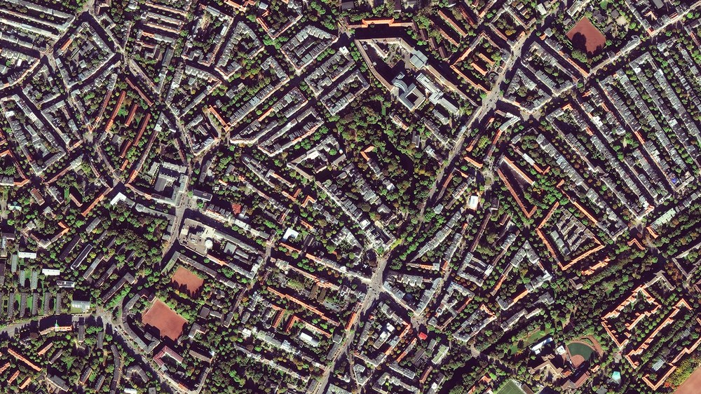
Urban Areas

EUSI / DLR
Cities have become the primary living environment for people—globally, as well as in Germany and Bavaria. They are considered engines of economic and social development. However, urban areas will face major challenges in the future. In particular, climate change is leading to urban heat islands, while extreme weather events such as heavy rainfall encounter highly sealed surfaces and complex infrastructures. At the same time, particulate matter and pollutants such as ozone or nitrogen oxides burden the growing urban population. Estimates suggest that during very hot summers, up to 10,000 people in Germany could fall victim to urban heat hotspots. In addition, air pollutants significantly reduce life expectancy and quality of life.
But even in rural settlements, people and infrastructure are at risk from extreme weather events—especially heavy rainfall and flooding.
Objective
The goal is to map the settlement areas in Bavaria and enable comprehensive monitoring. Remote sensing products, combined with ground-based measurements, numerical urban climate models, other geospatial data, and socioeconomic and demographic information, will form the basis for policy and planning. These will support the development of scenarios to evaluate the effectiveness of climate adaptation measures.
Current Work
- Blue-Green-Grey Infrastructure
High-resolution 3D mapping (20 cm) and analysis of the blue-green-grey infrastructure across the entire settlement area of Bavaria. - Ecosystem Services
Modelling of ecosystem services provided by urban trees (including annual CO₂ storage capacity) for the pilot regions of Munich, Augsburg, and Würzburg. - Climate Adaptation Measures
Provision of spatially comprehensive data on the temporal development of land surface temperature, as well as improved input data for high-resolution urban climate modelling, to serve as a basis for assessing the effectiveness of climate adaptation measures in Bavarian cities (supporting the cross-cutting topic “Health”). - Pluvial Flood Runoff Modelling
Creation of an expanded data basis to improve pluvial flood runoff modelling for selected regions (supporting the cross-cutting topic “Geo-risks”).
The collected data and models are continuously evaluated and fed into interdisciplinary exchanges with experts, planners, and decision-makers. In this way, a practical toolkit is being developed that provides both long-term monitoring solutions and actionable options for urban planning and policy.