MOSAiC Arctic expedition – DLR measurement technology for navigation signals will freeze with the Polarstern research vessel in the Arctic Ocean
September 20, 2019
MOSAiC Arctic expedition – DLR measurement technology for navigation signals will freeze with the Polarstern research vessel in the Arctic Ocean
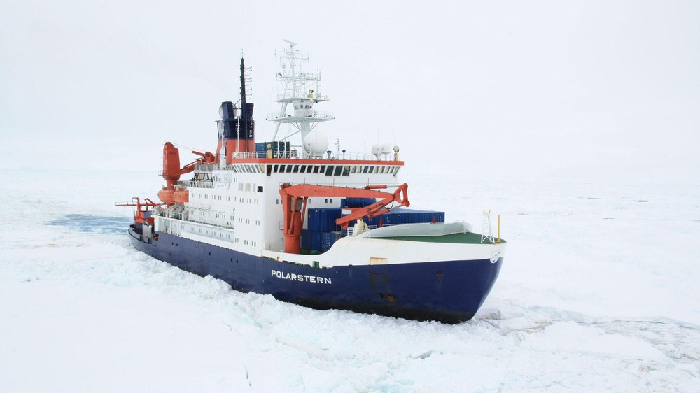
The Polarstern research icebreaker moving through the ice
On the evening of Friday, 20 September 2019, the research icebreaker Polarstern, which is operated by the Alfred Wegener Institute (AWI) will set sail towards the Arctic Ocean. During the largest Arctic expedition ever, it will drift, frozen with the sea ice, for a year. This is an archive image from 2012 and shows Polarstern on its way to Neumayer Station III in Antarctica.
Image: 1/6, Credit:
Folke Mehrtens/Alfred-Wegener-Institut
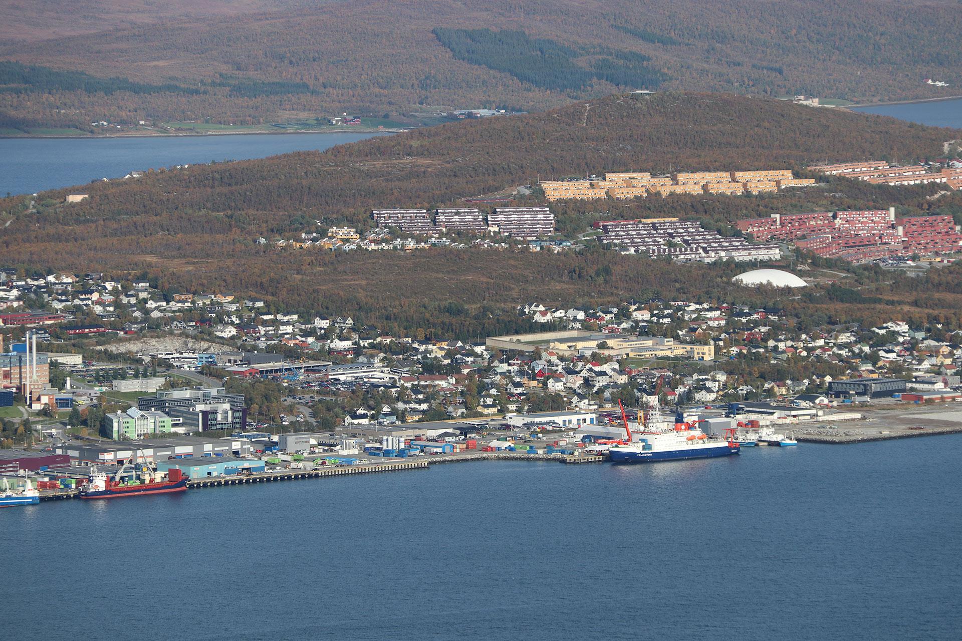
AWI research icebreaker Polarstern – expedition preparations in Tromsø, Norway
In the port of Tromsø in northern Norway, the experiments and instruments were brought aboard the research vessel Polarstern of the Alfred Wegener Institute (AWI) by teams of researchers from 19 countries. The DLR team from the Institute of Communications and Navigation has installed its measurement system for the reception and storage of raw data from the Galileo and GPS navigation satellites.
Space weather influences the Earth’s magnetic field
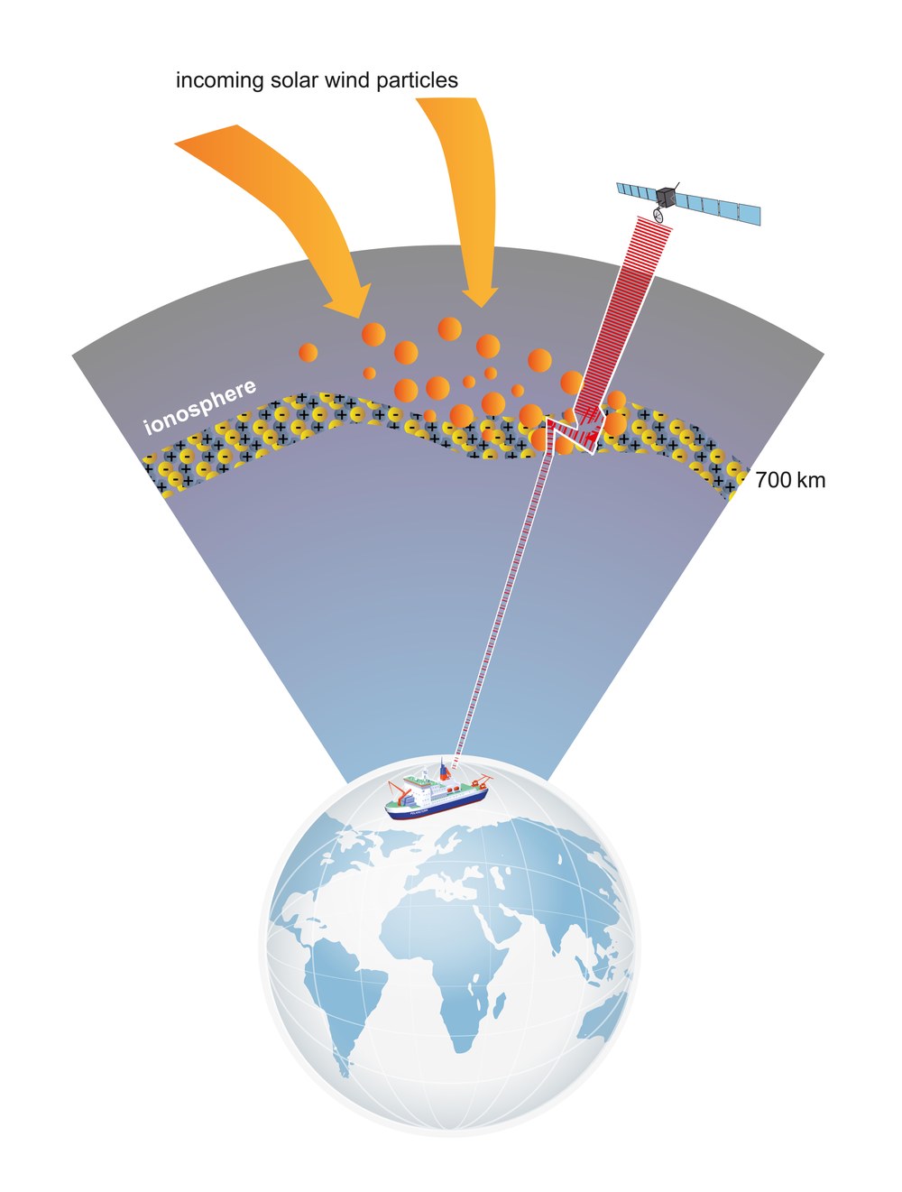
Charged particles from the Sun interact with Earth’s ionosphere and affect signals from navigation system satellites, among other things. These effects are particularly strong near the north and south poles. These disturbances lead to significant, temporary errors in position determination – a danger to maritime traffic in the polar regions.
Particularly in the vicinity of the north and south poles, the signals from navigation satellites are subject to disturbances caused by solar activity. No real data are currently available for the development of suitable countermeasures.
DLR is closing this gap by collecting the necessary raw data from the Galileo and GPS systems in the Arctic Ocean during the one-year-long MOSAiC polar expedition. They will then be used to develop processing and correction algorithms.
In the harsh environment of the Arctic Ocean, it is particularly important that position determination is always precise, and that safe navigation can be guaranteed.
Focus: DLR security research, maritime security, satellite navigation, global change
The Polarstern research icebreaker, operated by the Alfred Wegener Institute (AWI), will set sail for the Arctic Ocean on the evening of 20 September 2019. There, it will freeze in the sea ice and drift with it across the Arctic for a year. Researchers from 19 countries have a unique opportunity to conduct experiments and collect data. On 17 and 18 September, before the Polarstern departed from Tromsø, in northern Norway, a team from the German Aerospace Center (Deutsches Zentrum für Luft- und Raumfahrt; DLR) installed a measurement system for receiving and storing raw signals from navigation satellites on board the icebreaker.
During the Multidisciplinary drifting Observatory for the Study of Arctic Climate’ (MOSAiC) expedition, researchers from the DLR Institute of Communications and Navigation will be measuring the disturbances of the Galileo and GPS navigation signals near the pole over a long period. “For this purpose, we have installed a high-rate receiver for navigation satellite data, one of our ‘in-house’ processors for measuring scintillations and a recording device for the raw data on board Polarstern,” says Simon Plass from the DLR Institute of Communications and Navigation. Scintillations are fluctuations of the electron density in Earth’s ionosphere. They influence the propagation of electromagnetic radiation; this includes the signals from navigation satellites.
His team will operate the processor together with colleagues from the newly founded DLR Institute for Solar-Terrestrial Physics. “This is the first time that we will have acquired such extensive data from the north polar region. They represent a unique opportunity to compare the performance of different receivers under identical, controlled conditions and to develop new signal processing algorithms,” explains Plass.
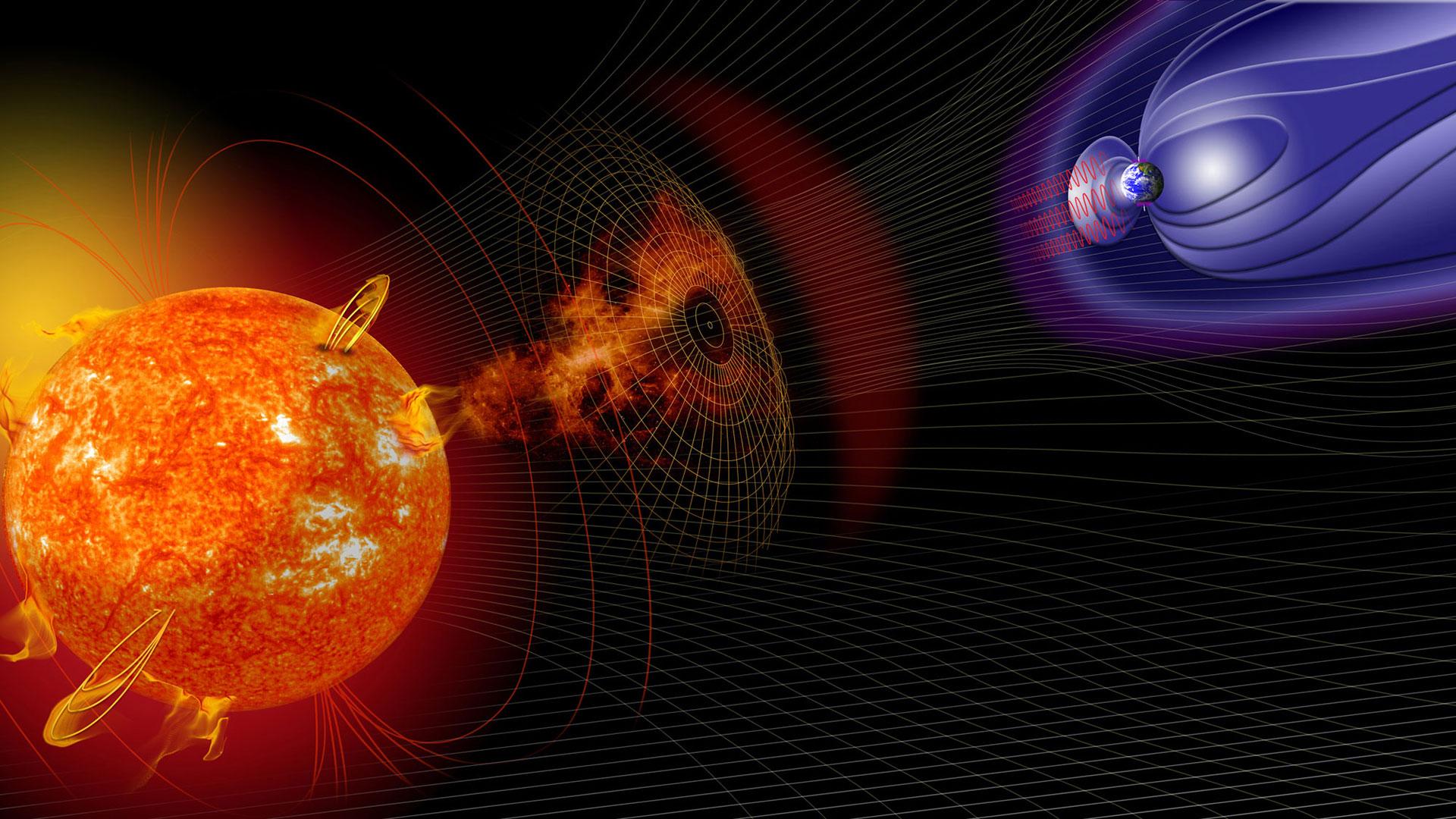
The solar storm particles influence the functioning and accuracy of communications and navigation systems – particularly near Earth’s poles
The explosive eruptions of charged particles from the surface of the Sun are referred to as solar flares. They are a cause of ‘space weather’ and the particles regularly interact with Earth’s magnetic field. The nearer one gets to the poles, the stronger the interactions become. Two of the best-known effects are the Aurora Borealis and the Aurora Australis, fascinating natural spectacles that make the influence of the Sun on the northern and southern polar regions visible to the human eye.
Charged particles from the Sun interact with Earth’s atmosphere and cause scintillations in the ionosphere. This interferes with radio signals on their way from satellites to the planet’s surface. Navigation signals in particular can be influenced to such an extent that precise positioning is sometimes no longer possible. In order to develop effective countermeasures, such as correction algorithms for navigation systems, satellite data from the polar regions are required. These data are currently not available.
Currently, the Arctic is warming twice as fast as any other region in the world. From 2040, climate researchers expect a largely ice-free Arctic Ocean during the summer. Maritime traffic in this region has already increased significantly. As the polar ice continues to melt, it is foreseeable that new routes will emerge. In addition, the harsh environment and poor weather conditions make precise navigation all the more important for safe sailing.
Other DLR participants in the MOSAiC Arctic expedition
In addition to the Institute of Communications and Navigation, two other DLR facilities are taking part in MOSAiC. During the expedition, the German Remote Sensing Data Center (DFD) will be providing images derived from data acquired by the German TerraSAR-X radar mission in near-real time to support the complex expedition logistics in the sea ice. In addition to DFD’s own receiving stations in Neustrelitz and Inuvik, Canada, the Kongsberg Satellite Services (KSAT) station near Longyearbyen on Spitsbergen will also be used to receive data from the satellite. This station network is suitable for making the satellite data collected over the Arctic Ocean available to the researchers on board Polarstern as soon as possible after acquisition. The data are first transmitted from the receiving stations to Neustrelitz for processing and then delivered from there.
In addition to TerraSAR-X, other radar satellites will be used for MOSAiC, such as the Canadian RADARSAT-2 and the Japanese ALOS-2. The DLR Maritime Safety and Security Lab in Bremen will be responsible for the coordination of all the satellite images and the timing of further experiments or aircraft measurements. Together with the University of Bremen, it will also use the MOSAiC mission to improve the methodology developed at DLR for distinguishing between different types of ice and to derive further properties of snow and ice cover from satellite signals in the microwave frequency range. This research is part of a separate project, MOSAiCmicrowaveRS, funded by the German Research Foundation (DFG). In addition to the satellite data, it will use the extensive measurement facilities on the Polarstern.
The multinational MOSAiC expedition
During the MOSAiC expedition, researchers from 19 countries will spend a whole year exploring the Arctic. For this purpose, the German icebreaker Polarstern will drift in the Arctic Ocean ice from autumn 2019 to autumn 2020. MOSAiC is led by the Alfred Wegener Institute, Helmholtz Centre for Polar and Marine Research (AWI). In order to make this unique project a success and to collect as much valuable data as possible, more than 70 institutes will pool their resources in a research consortium. The expedition budget is approximately 140 million euro. MOSAiC will be the largest Arctic expedition ever.
Current news directly from the Arctic is published on the MOSAiC channels on Twitter and Instagram under the Hashtags #MOSAiCexpedition, #Arctic and #icedrift. More information about the expedition can be found at www.mosaic-expedition.org and follow.mosaic-expedition.org.
Security research at DLR
In security research at DLR, research and development activities with defence and security relevance are planned and controlled in coordination with partners in government, scientific research, industry and international organisations. The cross-sectoral area of security research combines the core competencies from DLR’s established programmes in aeronautics, space, energy and transport. A total of more than twenty DLR institutes and facilities contribute to the development, testing and evaluation of technologies, systems and concepts as well as to the analysis and evaluation of security-related applications.


