The topography of Mars in large format

The topography of Mars in large format
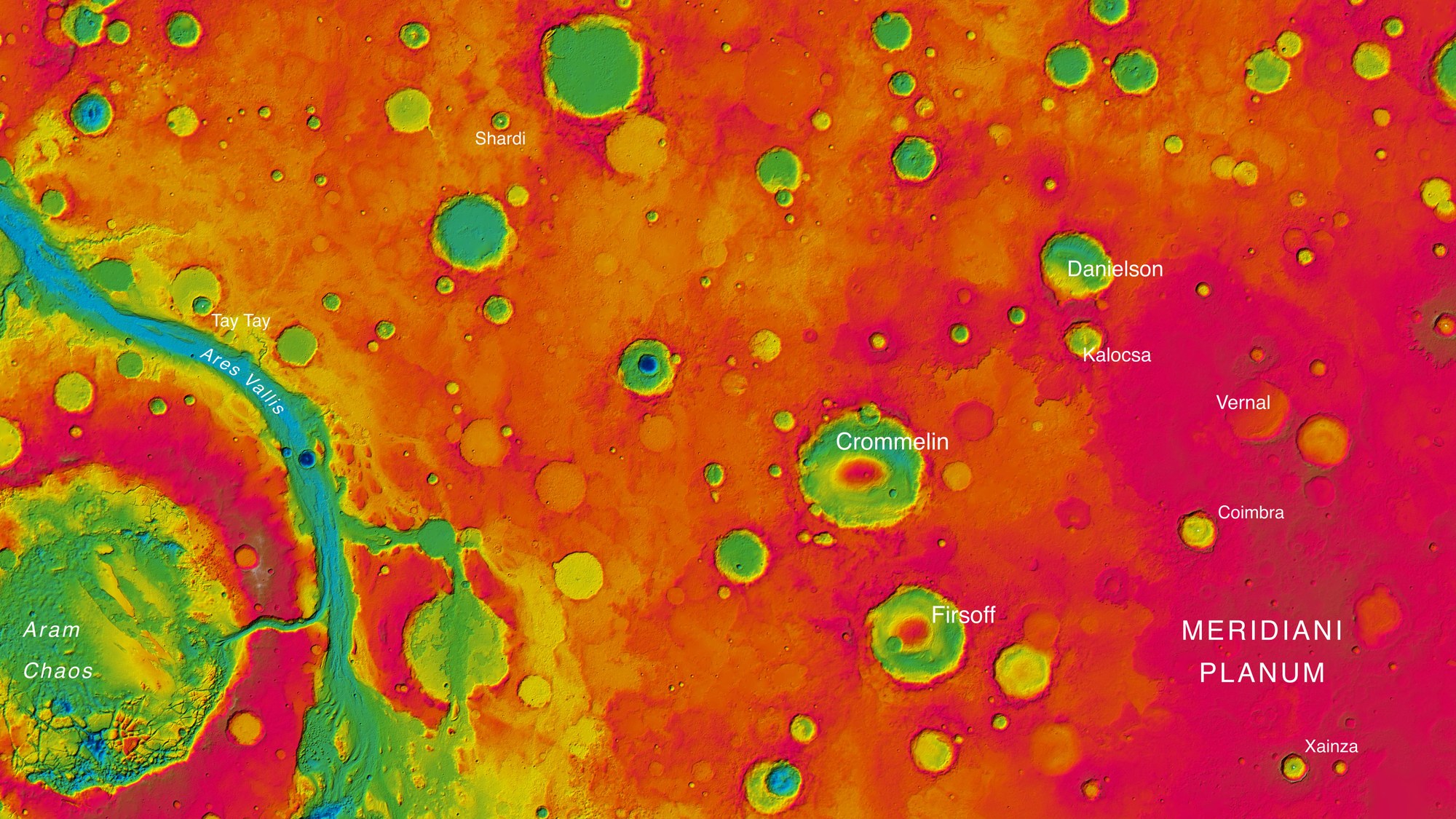
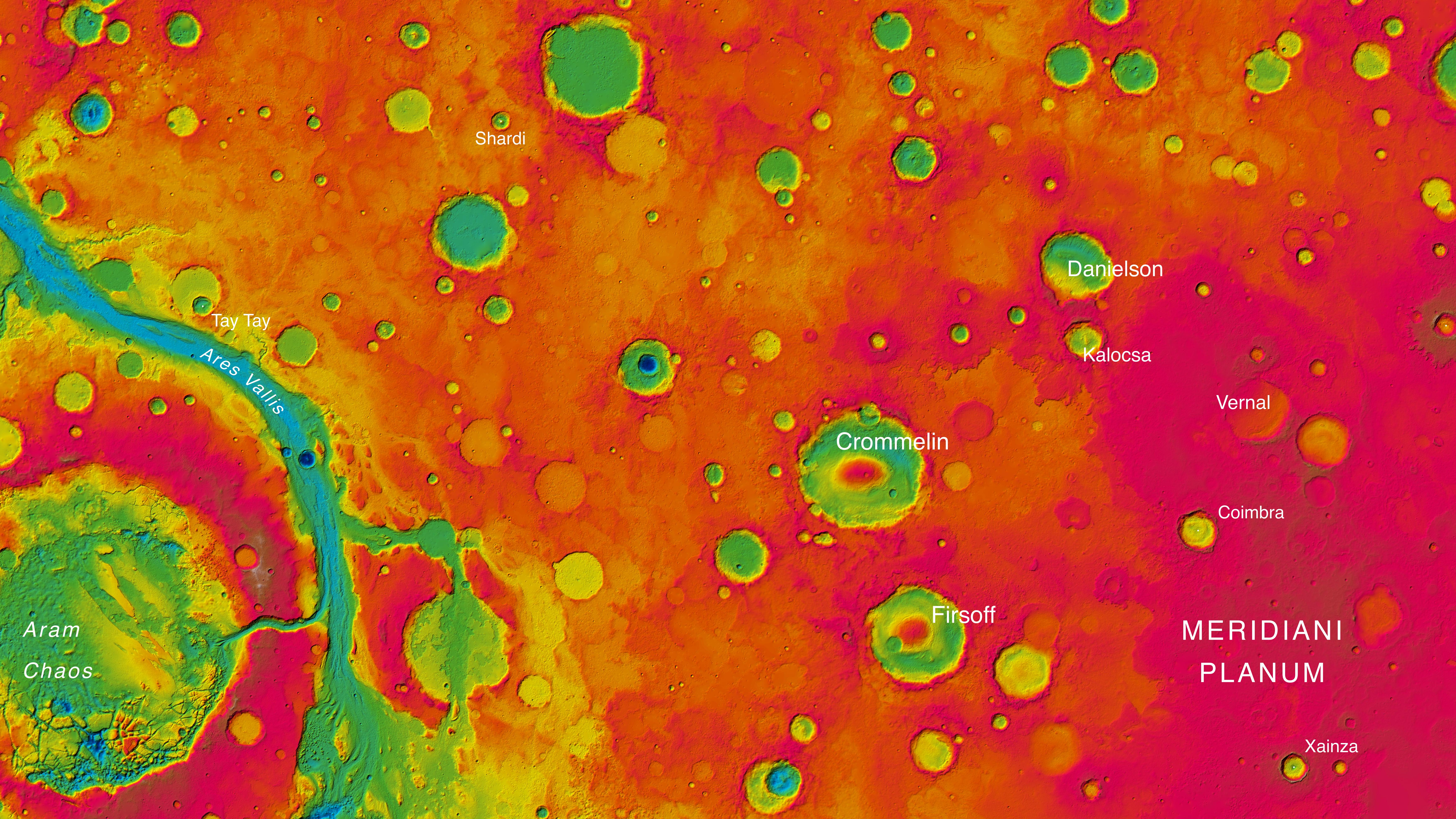
The High Resolution Stereo Camera (HRSC) operated by DLR on board ESA’s Mars Express spacecraft has been imaging parts of the planet’s surface every third of fourth orbit since January 2004. In the course of 11 years, it has created over 4000 image strips, each between 50 and 100 kilometres wide and several hundred kilometres long from north to south. The stereo images, acquired with nine sensors, show not just the Martian surface in colour, but also allow the elevation to be computed for each pixel. The Working Group for 3D Mapping in the HRSC team has now performed these calculations for the eastern half of the map sheet ‘MC-11’ near the Martian equator. This image mosaic covers 2.3 million square kilometres, an area about six times the size of Germany. The figure shows a detail of the colour-coded relief map with high altitude areas in red and orange and low-lying areas in yellows, greens and blues. The range of differences in height is about 5000 metres.