More intelligent crane control; fighting bark beetles – New ideas in satellite navigation and Earth observation


Showcasing and promoting outstanding and innovative concepts for applications of satellite navigation and Earth observation are the objectives of the 'European Satellite Navigation Competition' (ESNC) and 'Copernicus Masters', two ideas competitions. The German Aerospace Center (Deutsches Zentrum für Luft- und Raumfahrt; DLR) will also be choosing a special prize winner for each competition this year.
Faster construction – how cranes can be controlled more precisely
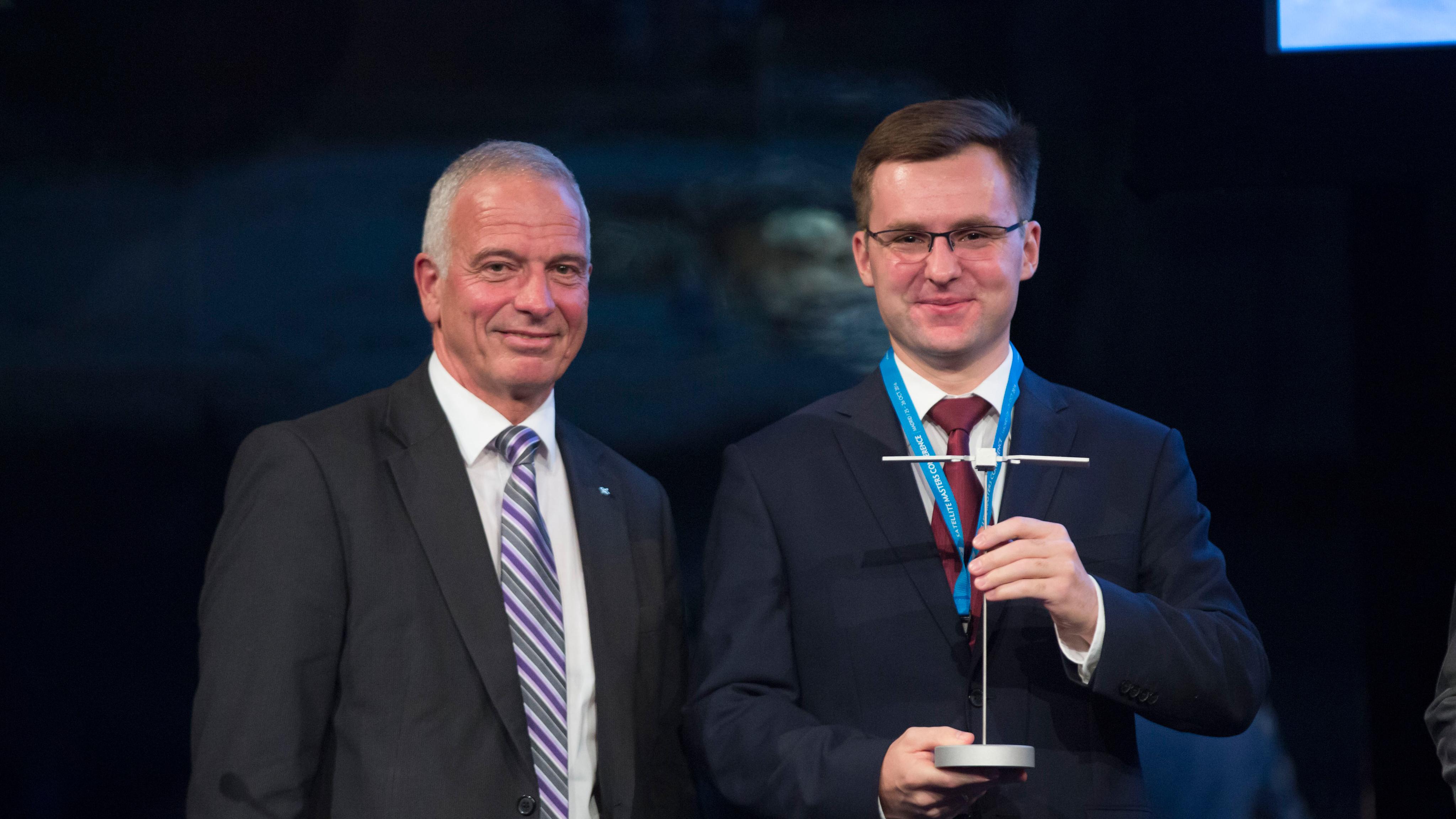
The DLR Special Prize from the European Satellite Navigation Competition (ESNC) goes to Poland. Piotr Krystek submitted an idea called the Augmented Crane Navigation System (ACNS) that convinced the six-member jury. The ACNS is the innovative intelligent operation of tower cranes on construction sites through the integration of highly accurate navigation receivers and a powerful processor unit. This will increase efficiency and safety at construction sites.
Modern tower cranes can reach a height of more than 200 metres and operate in a very complicated, chaotic and constantly changing environment. This creates obstacles for the crane operator: poor visibility and 'dead angles' – places that cannot be seen by the crane operator.
ACNS wants to tackle this challenge in three stages: the position of the crane elements can be determined and oriented using four to five low-cost, yet highly precise Galileo and/or satellite navigation (GNSS) receivers. The central processor calculates the best possible route for load management. In addition to the position values of the various satellite navigation receivers, the digital model of the physical structure, the so-called Building Information Model (BIM), is also included here. The visualisation is done directly on the head-up display, that is, the information is projected directly onto the crane operator's field of view. This enables easy and precise navigation.
ACNS has a modular design and can be mounted on the crane easily; this includes the retrofitting of existing cranes. The project is still in the concept phase. In order to implement the idea, the market must be explored and feasibility studies carried out with cranes in collaboration with crane manufacturers. Today, crane operation is a highly demanding task, and new technologies and solutions are needed. Thus, ACNS represents a step towards the automation of tower cranes and could be transferred to other construction machinery and commercial vehicles. As one of the leading economic sectors, the construction industry can benefit immensely from GNSS-based solutions.
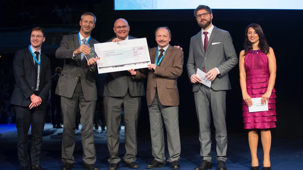
On the trail of the bark beetle – Copernicus Masters winners hunt for a forest plague
The idea of creating hazard maps for forestry workers on the basis of satellite data, conceived by Lisa Broekhuizen and Wendy Mensink, thrilled the DLR Copernicus Masters jury members this year. They call their project 'Viridian Raven', which translates as 'Green Raven', and founded a company of the same name. The focus of the project is forests with potential bark beetle infestations. In the face of climate change, the living conditions of many insects are changing in Central Europe. The tree population is also reacting to this change. Since insects are cold-blooded, their activity and population depend on climatic conditions. They especially benefit from mild winters and warm summers. Insects with the potential to damage forests and wood are of great interest to forestry. It is known in forestry that bark beetles are one of the most persistent pests. The economic loss from them can reach up to several hundred million euro annually. Entire areas can be deforested. The maps created by Viridan Raven make it possible to examine the forest for infestation more efficiently and enable early intervention for prevention.
From the ground, determining which areas are most affected by the beetles and their larvae is difficult and labour intensive. The use of satellite data enables large areas to be observed, regular updates to be made and, in particular, to take the spatial proximity into account. The digital maps produced show different vegetation characteristics and enable the forestry to access the latest data, carry out extended risk assessments for their forest stock and initiate corresponding countermeasures in good time.
In addition to the Sentinel-2 data from the Copernicus programme, Viridian Raven also uses NASA's data, as well as high-resolution satellite and local soil data. The measurements from weather stations, existing forest maps as well as information about previous infestations are combined on a web platform. This easy-to-use platform helps to identify, check and efficiently manage the endangered areas. This should prevent large-scale outbreaks. The maps are currently updated about every 10 days. In the coming years this will happen every two to five days.
Winner of the BMVI Special Prize
This year, DLR is not only awarding special prizes, it is also taking one home. Since 2016, the German Federal Ministry for Transport and Digital Infrastructure (Bundesministerium für Verkehr und digitale Infrastruktur; BMVI) also awards a special prize at the Copernicus Masters. This year's goes to RETRIEVE, by DLR's Hartmut Runge from the Remote Sensing Technology Institute, Achim Dreher from the Institute of Communications and Navigation and Robert Klarner from Technology Marketing. RETRIEVE is a service to identify, locate and track goods, such as containers and vehicles, around the world. For the first time, Earth observation is being used as a logistical tool – completely independent of navigation satellites and mobile communications. The DLR idea enables carriers to monitor entire fleets of trucks with their loads and even locate lost or stolen objects.
Special labels, so-called tags with a coded identity, are placed on the surface of the object. These tags are inexpensive, do not require any power as passive reflectors and are protected against interference. Every article to be transported is thus given its own identity, like a kind of DNA or the familiar bar codes on supermarket items. Using these tags, the goods are spatially located and identified by radio satellites, primarily Sentinel1-A/B.
And yet another winner
The 'Regional Winner' Bavaria this year is DLR researcher Hartmut Runge. With his app 'Nightwatch', users only have to hold their smartphone in the direction they are looking in to have a Street View image automatically display on the screen. Based on the GNSS receiver of the smartphone, the user's position is determined and the respective images found on databases. This new app provides a user-friendly way of exploring the environment when it is dark or under poor visibility conditions, such as through fog. So the app is able to support existing navigation systems. In addition, with the Night Vision app, it is possible to find the location of shops and restaurants on a street using the smartphone. When on a flight you can see the ground, even if it is cloudy or are not seated by the window.