
Comunicado de prensa: Comprender mejor los riesgos geológicos - los Andes en el punto de mira (press release Spanish)
79.6 KB | PDF
Spanish press release: 'A better understanding of geo-risks - focusing on the Andes'

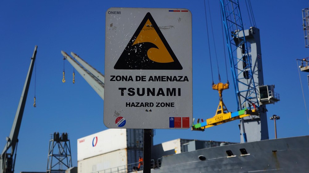
More and more people around the world are flocking to cities, creating densely populated regions. This also means that natural disasters pose a threat to a greater number of people, and that risk has been rising for decades worldwide. A catastrophe is rarely an isolated event: flooding can precipitate a landslide; an earthquake may destroy electricity and water supplies, compounding the situation for those affected as well as emergency services on the ground. The possible consequences of such escalation chains were evident in the Fukushima nuclear disaster of 2011, in which an earthquake triggered a catastrophic tsunami along the Japanese coast that subsequently caused a nuclear accident at the Fukushima power plant.
In order to better understand and predict interdependencies during major emergencies, the German Aerospace Center (Deutsches Zentrum für Luft- und Raumfahrt; DLR) has joined with project partners to develop a multi-risk information system: the RIESGOS project (Spanish for 'risks') aims to improve the information base for natural disaster management and to develop strategies to avoid or mitigate risks. In future, web-based application services will enable decision makers and stakeholders to prepare risk analyses for the overall situation and to simulate scenarios with complex risk chains. Until now, risk information systems have mainly considered just individual components. A new system is now being developed as a prototype for the Andean region in Chile, Peru and Ecuador, which is particularly vulnerable to natural disasters.
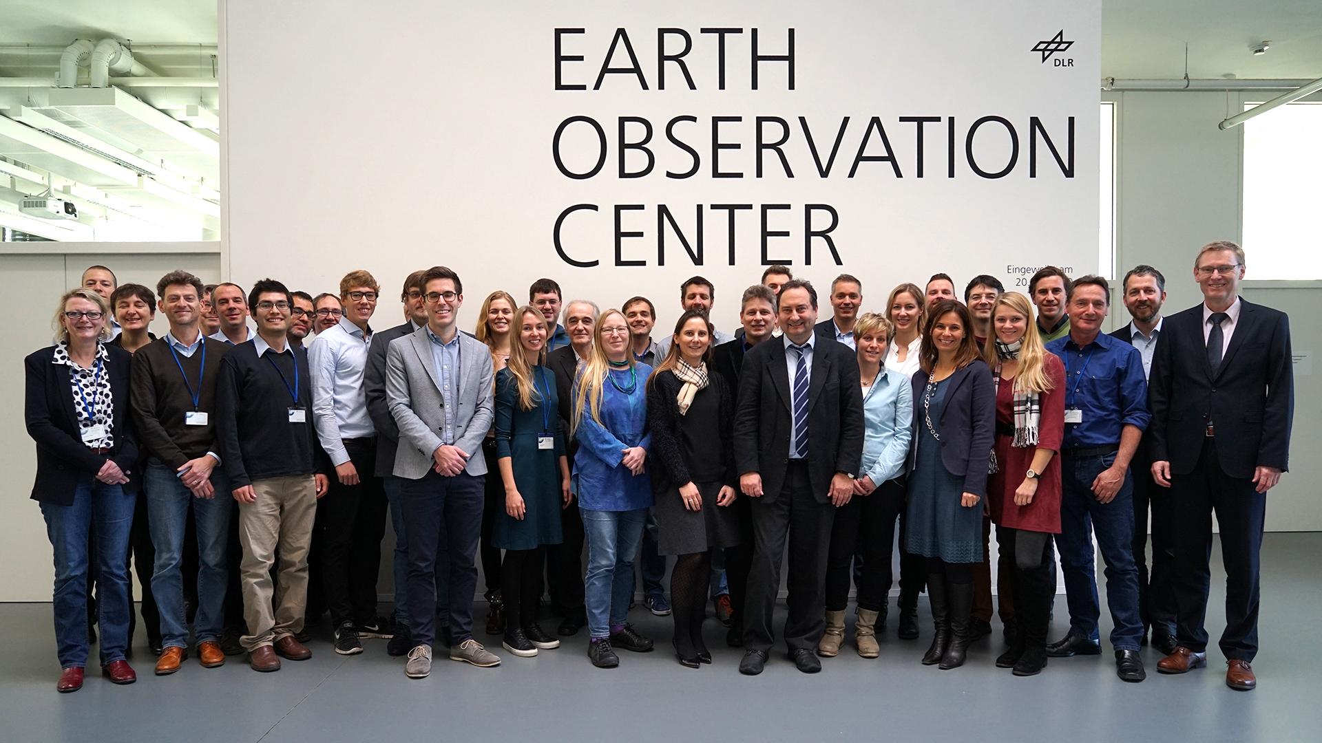
"Over the next three years, we will explore the different types of threats that may arise from natural disasters, and we will develop scientific methods to assess the various risks. I am already looking forward to obtaining an overall impression from the details submitted by the individual disciplines in this project. In the process, we can make an important societal contribution to minimising the risks of natural hazards. This will help to advance ongoing research even beyond the project itself," explains Elisabeth Schöpfer, RIESGOS project manager at the The German Remote Sensing Data Center (DFD) (DFD). Approximately 40 national and international research institutions, government agencies and companies are contributing their expertise. The project is funded by the German Federal Ministry of Education and Research (BMBF). The RIESGOS projected was officially launched with a kickoff meeting at the DLR site in Oberpfaffenhofen on 7 December 2017.
The threats related to natural disasters are not only mutually dependent, they can also lead to cascading effects, meaning that chain reactions can occur. Its geographical location places the Andean region at high risk of natural disasters – any cascading effects would be particularly devastating here.
"International collaboration is fundamental to improve risk reduction processes and anticipate potential impacts from future disasters. Moreover, this project will help better orient recent advances towards the critical need of assessing complex interrelations between physical phenomena and social and economic systems, to increase the effectiveness of risk reduction measures and policies. As an Excellence Research Center funded by the National Comission for Science and Technology in Chile (CONICYT), CIGIDEN is proud to collaborate in this international initiative," saysRodrigo Cienfuegos, Director of the Research Center for Integrated Disaster Risk Management (CIGIDEN) and professor at the Pontificia Universidad Católica de Chile.
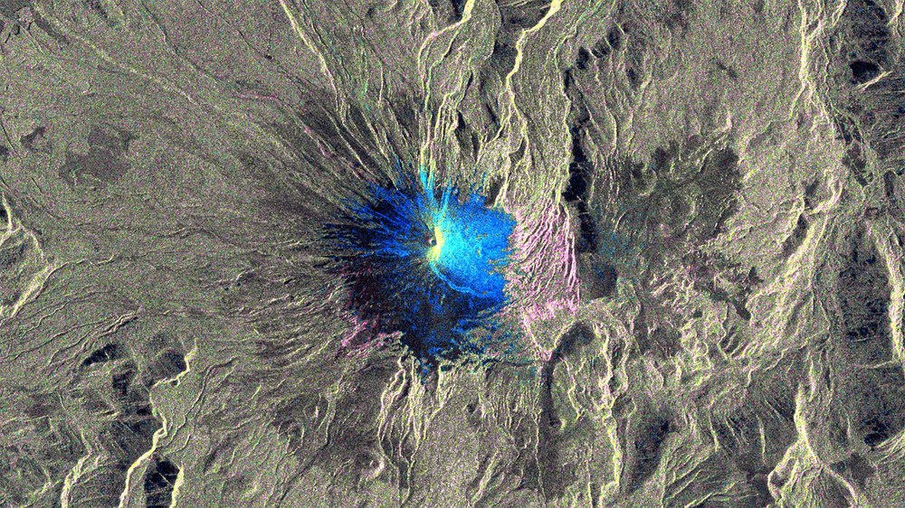
Accordingly, the RIESGOS project teams are working through scenarios for flood situations, landslides, volcanic eruptions, earthquakes, tsunamis and their mutual dependencies from the perspective of ‘what would happen if…?’ Researchers from a variety of disciplines are using a broad range of data, including high-resolution optical remote sensing and radar data, to extend local analysis areas to a regional and national level.
"A better understanding of the impact of extreme natural events on society is only possible via the long-term, interdisciplinary collaboration of various specialist groups in Germany and South America. In this way, we will eventually be able to limit their consequences, for instance through sustainable land management and long-term urban planning that acknowledges and appropriately considers the vulnerabilities and risks," says Stefan Dech, Director of the German Remote Sensing Data Center at DLR.
The work in Germany is taking place in close cooperation with South American partners. Their experience in the management of natural disasters is key to the needs-based and practice-oriented focus of RIESGOS. For instance, the project aims not only to develop innovative technical system components and web services, but also to identify application potential for the German and South American markets. There are also plans to add services based on the RIESGOS multi-risk analysis to the value chain of the research and development project in the future.
RIESGOS is funded by the German Federal Ministry of Research and Education (BMBF) as part of the funding programme 'BMBF CLIENT II – International Partnerships for Sustainable Innovations' within the 'Research for Sustainable Development (FONA3)' platform. The Project Management Agency Jülich technically and administratively supervises the project on behalf of the German Federal Ministry of Education and Research.
The RIESGOS project consortium comprises the following academic research institutions and industrial partners: the German Aerospace Center (DLR), the German Research Centre for Geosciences (GFZ), the Alfred Wegener Institute (AWI), The Technical University of Munich, 52°North, geomer GmbH, EOMAP GmbH & Co. KG, plan + risk consult, DIALOGIK. The following associated partners support the project: GIZ, UNOOSA /UN-SPIDER, UNESCO and MunichRE. RIESGOS is already cooperating with more than 25 research partners and government agencies in the South American partner countries of Chile, Ecuador and Peru, and plans to expand this collaboration over the course of the project.