Clouds as a factor influencing the climate – EUREC4A field campaign aims to solve one of the great mysteries of climate science

- World's largest study to date of low-level clouds and their local interactions with the atmosphere and ocean.
- The measurement campaign will examine whether climate change is leading to a reduction in cloud cover in the trade-wind regions, which in turn would accelerate global warming.
- HALO will be in operation from Barbados for approximately four weeks, alongside four other research aircraft and four ships.
- Focus: Climate change, aeronautics, space, digitalisation
The almost six-week-long EUREC4A (Elucidating the role of clouds-circulation coupling in climate) field campaign will begin on 20 January 2020. The aim is to test theories about the role of clouds and convection in climate change by conducting comprehensive measurements in the atmosphere and ocean. In addition, EUREC4A will examine how fine-scale features in the ocean – eddies and fronts – interact with the atmosphere. Five research aircraft and four research ships will be deployed to the east and south of the Caribbean island of Barbados, together with ground measurement stations and satellite-based remote sensing, as part of the German-French initiative that involves over 40 partners. The world’s largest study to date of low-level clouds and their local interactions with the atmosphere and ocean will be conducted by the Max Planck Institute for Meteorology (MPI-M) in Hamburg and the Laboratoire de Météorologie Dynamique (LMD) in Paris. It will build upon decades of collaboration with the Caribbean Institute for Meteorology and Hydrology (CIMH). The German Aerospace Center (Deutsches Zentrum für Luft- und Raumfahrt; DLR) is an important partner, with experiments on the ground and on board the High Altitude and LOng Range (HALO) research aircraft. DLR is also responsible for operating the research aircraft.
Low-level clouds in the trade-winds region
Clouds are an important factor in the climate system. The way in which low-level clouds in the trade-wind regions respond to global warming largely determines how rapidly and how intensively future developments will take place. Until now, science has been investigating the role of clouds and convection on the climate system using theoretical and numerical models. In order to verify these, the researchers have a particular requirement for observational data relating to the dynamics of the atmospheric and oceanic conditions in which clouds form and dissipate. The extensive measurements conducted during the EUREC4A field campaign will allow them to study the lifecycle of convective clouds in the trade-wind regions in great detail and obtain a picture that is as complete as possible.
How do clouds react to climate change?
Analysis of comparative climate model studies (CMIP – Climate Model Intercomparison Project) over the past few decades has shown that the decrease in cloud cover in the trade-wind region caused by climate change has brought about a further increase in global warming, referred to as a positive feedback effect. Co-principal Investigator Bjorn Stevens, Director of MPI-M and Head of the Atmosphere in the Earth System Department says: "We will test whether the behaviour of models, which show a large decrease in cloud cover with warming, is correct. If so, it would imply that higher estimates of the expected warming from increasing carbon dioxide levels are more plausible. Regarding the question of cloud response to climate change, there is still much uncertainty. We hope that EUREC4A will change this." The geographical extent and scope of the measurements offers the opportunity to evaluate a new generation of climate models and satellite data products.
In numerical models, trade-wind clouds have so far reacted differently to climate disturbances. Complex climate models predict that the area covered with low-level clouds will be highly sensitive to the prevailing conditions, while simpler process models show the opposite. Understanding and resolving these contradictions serves as the starting point for the EUREC4A field study. The most important research questions are as follows. How resilient or susceptible is the amount of shallow cumulus cloud cover to variations in the strength of convective mixing, surface turbulence and large-scale circulations? How do the radiative effects of water vapour and clouds influence shallow circulations and convection? What are the implications for the spatial arrangement of clouds and convection in the tropics, and ultimately for climate sensitivity – that is, the vulnerability of the climate system to a given perturbation, such as the presence of additional greenhouse gases?
"Estimates of climate sensitivity remain very uncertain, and most of this uncertainty stems from the response of low-level clouds in the tropics, especially in the trade-wind regions," explains Co-principal investigator Sandrine Bony of LMD. "The low-level clouds over Barbados are typical of the cloud cover that can be found in trade-wind regions throughout the tropics. Therefore, what we learn from EUREC4A will not only enhance our understanding of clouds off Barbados, but also tropical clouds more generally."
Studying water vapour with an airborne laser
One area of focus for the scientists at the DLR Institute of Atmospheric Physics is to obtain a very accurate picture of the atmospheric conditions around and between the clouds by conducting lidar measurements using the HALO research aircraft. "The lidar developed in Oberpfaffenhofen allows us to record smaller clouds, working in combination with radar and dropsondes. More importantly, it enables us to measure the water vapour that surrounds the clouds; this has a significant impact on the way in which they grow and behave. Humid layers of air above the clouds also have an indirect influence on their formation due to radiative effects and can be accurately captured by the lidar," explains DLR researcher Martin Wirth.
In addition to a better understanding of the coupling processes between clouds and circulation, the campaign will provide a reference dataset containing extensive measurement data. This will serve as a benchmark for improving the modelling and satellite-based remote sensing of clouds and circulation. Felix Ament of the University of Hamburg says: "The information about clouds and their interactions with the atmosphere that we will capture during EUREC4A will be more detailed, multifaceted and comprehensive than ever before. We want to provide a reference point that will serve as a touchstone for encouraging and inspiring scientists over the coming decades."
Campaign processes and measurement platforms
The core of the measurement campaign is the use of five research aircraft, four ocean-going research ships, advanced ground-based remote sensing at the MPI-M Barbados Cloud Observatory (BCO), a new generation of sophisticated satellite-based remote sensing techniques and state-of-the-art turbulence-resolving climate models (100-metre grid size over thousands of kilometres).
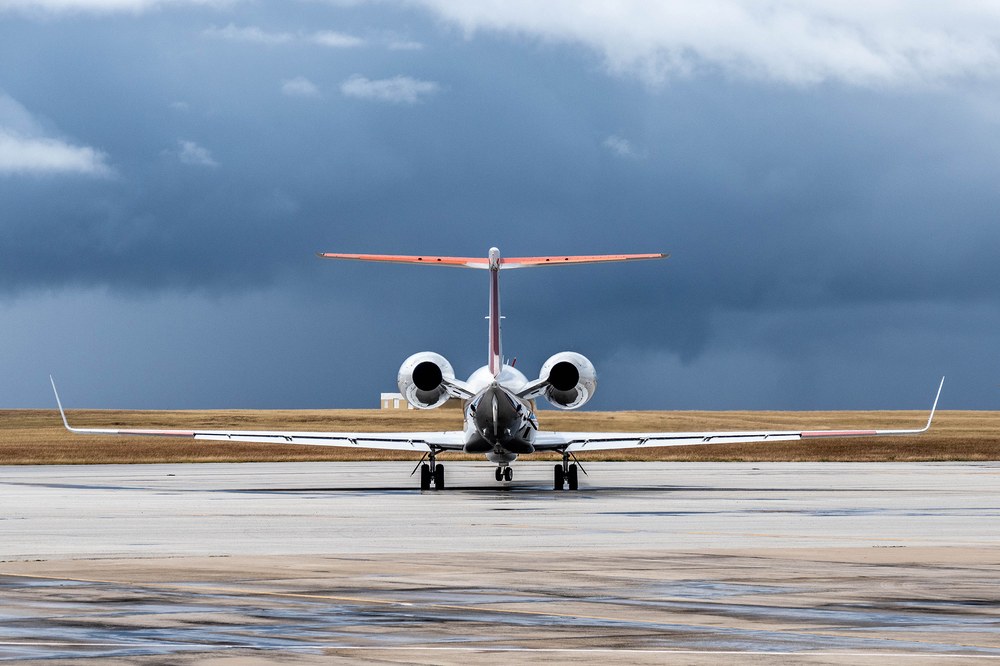
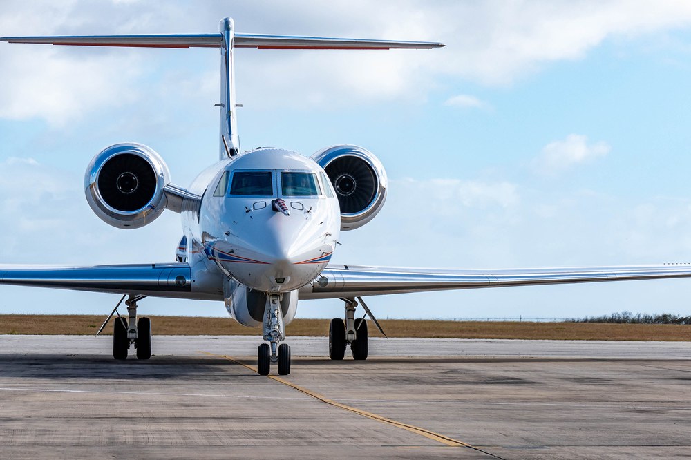
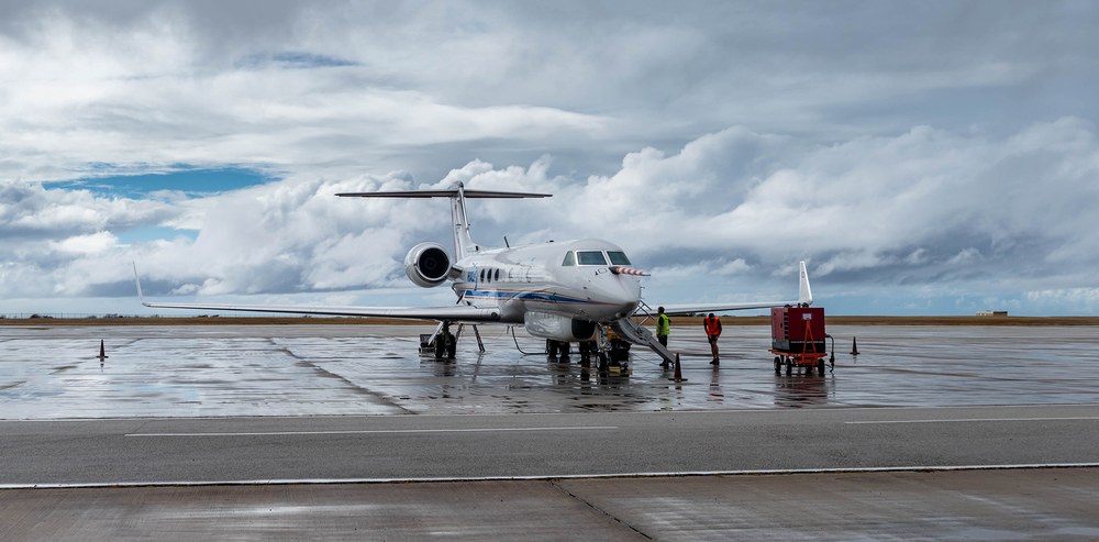
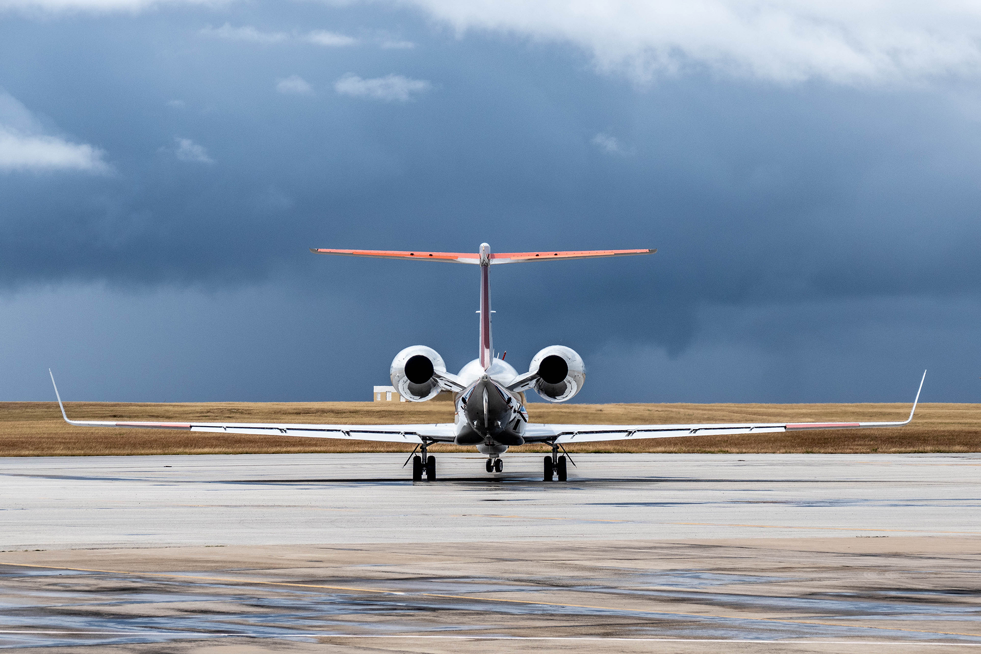
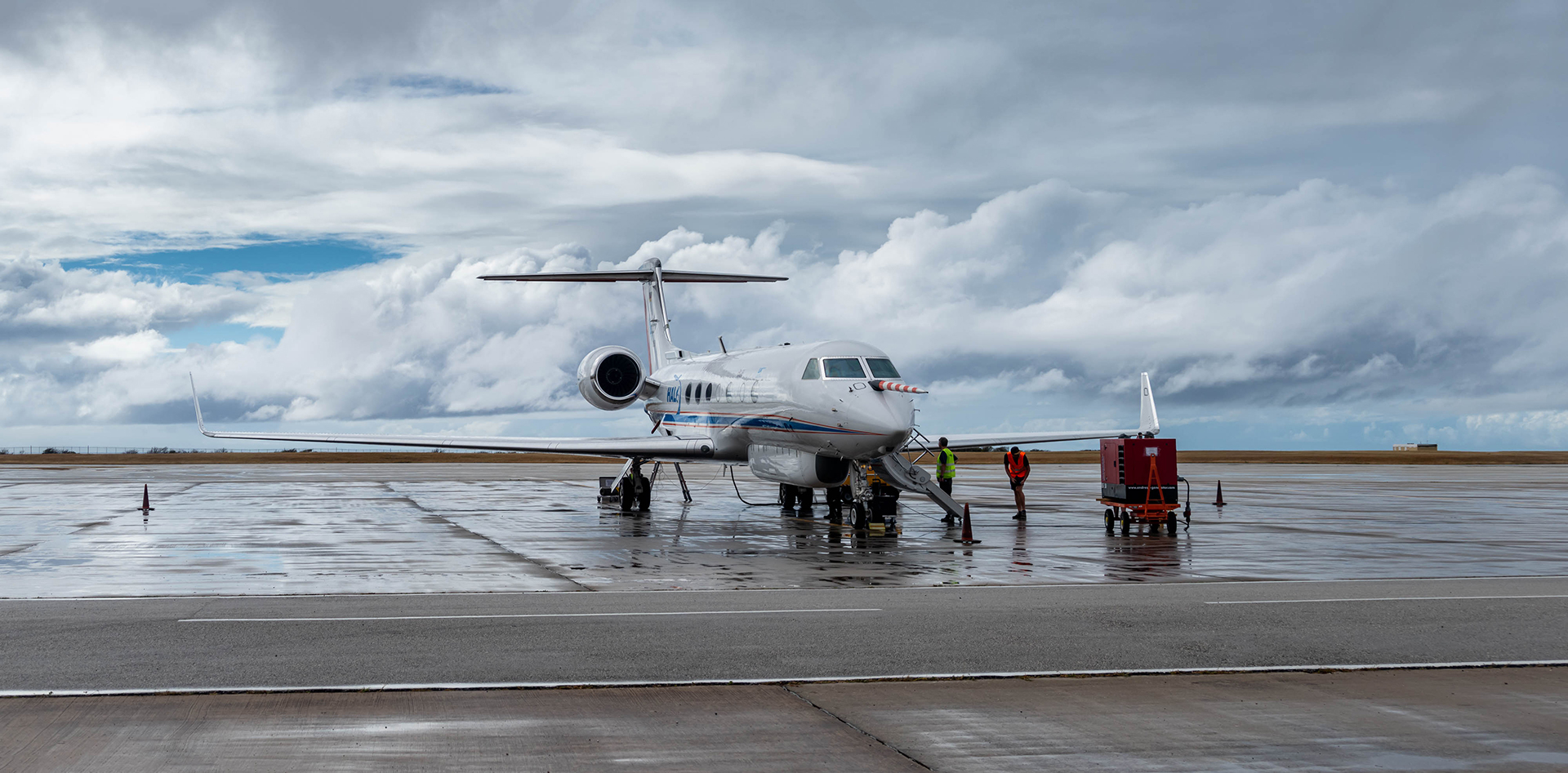
EUREC4A is largely focused around the deployment of three research aircraft on Barbados. The first of these is the French ATR-42, which will be used for in-situ and remote sensing in the lower troposphere. It will be joined by the DLR HALO research aircraft, which has a range of over 8000 kilometres and a maximum operating altitude of 15 kilometres. HALO is equipped with an extensive suite of modern instruments for remote sensing – including radar and lidar – as well as a system for ejecting dropsondes. Finally, the Twin-Otter operated by the British Antarctic Survey (BAS) will focus on measuring aerosols and the turbulent and microphysical cloud structure. In addition, the Lockheed WP-3D Orion research aircraft belonging to the US National Oceanic and Atmospheric Administration (NOAA) and the aircraft of the Regional Security Service (RSS), which is permanently stationed on Barbados, will also support the measurements. The WP-3D flights will, among other things, complement those of HALO by determining the large-scale conditions and connecting them with measurements performed by the ships.
The data acquired by the aircraft will be complemented by measurements performed at the BCO and using the flexibly controllable Polarisation Diversity Doppler Radar (POLDIRAD) system. POLDIRAD will be stationed on a high plateau eight kilometres southeast of the BCO during the campaign. Martin Hagen of the DLR Institute of Atmospheric Physics says: "POLDIRAD allows us to record the development of precipitation with high temporal and spatial resolution at a range of up to 250 kilometres to the east of Barbados. The measurements conducted at the BCO, from the ships and along the flight paths, can thus be considered within the spatial and temporal context of the large-scale distribution and development of precipitation."
Unmanned aerial systems will take off from ships
In addition to the aircraft measurements and those conducted by the BCO, four ships will also conduct intensive observations. The German research ships Meteor and Maria S. Merian, the US vessel Ronald H. Brown and the French ship L'Atalante will all be taking part. The research ships serve as remote sensing and in-situ platforms for atmospheric and ocean observations. These may include radiosondes, lidar and radar technologies, tethered balloons and unmanned aerial systems. "Spatial variability at the sea surface is an important boundary condition for the development of the overlying atmosphere and thus also for cloud formation," says Johannes Karstensen from the GEOMAR Helmholtz Centre for Ocean Research Kiel, who is the Expedition Leader on the Maria S. Merian. "We want to understand the coupling between oceanic and atmospheric processes, especially in the case of large eddies and frontal zones, and thus make these easier to represent in model simulations."
Germany's participation in the EUREC4A campaign includes four Max Planck institutes (MPI-M, MPI for Dynamics and Self-Organization, MPI for Chemistry, MPI for Marine Microbiology), along with five universities (Hamburg, Hohenheim, Cologne, Leipzig and Munich), three Helmholtz institutions (DLR, GEOMAR and the Helmholtz-Zentrum Geesthacht Centre for Materials and Coastal Research), the Leibniz Institute for Tropospheric Research (TROPOS) and the German Weather Service (Deutscher Wetterdienst; DWD). EUREC4A is funded and supported by the European Research Council (ERC), the Max Planck Society (Max-Planck-Gesellschaft; MPG), the Centre National de la Recherche Scientific (CNRS), the German Research Foundation (Deutsche Forschungsgemeinschaft; DFG), the Caribbean Institute for Meteorology and Hydrology (CIMH), the Natural Environment Research Council (NERC) and the World Climate Research Programme (WCRP).
About HALO
The High Altitude and Long Range (HALO) research aircraft is a joint initiative of German environmental and climate research institutions. HALO is supported by grants from the German Federal Ministry of Education and Research (Bundesministerium für Bildung und Forschung; BMBF), the German Research Foundation (DFG), the Helmholtz Association of German Research Centres (Helmholtz-Gemeinschaft Deutscher Forschungszentren; HGF), the Max Planck Society (Max-Planck-Gesellschaft; MPG), the Leibniz Association, the Free State of Bavaria, the Karlsruhe Institute of Technology (KIT), the Forschungszentrum Jülich and the German Aerospace Center (DLR).
About the German research vessels
The operations of the research vessels Meteor and Maria S. Merian are coordinated by the German Research Fleet Coordination Centre at the University of Hamburg. Both ships are used to carry out Germany's programme of fundamental ocean research around the world; this is done in collaboration with other countries working in this field. Ship operations are funded by the German Research Foundation (Deutsche Forschungsgemeinschaft; DFG) (70 per cent) and the German Federal Ministry of Education and Research (Bundesministerium für Bildung und Forschung; BMBF) (30 per cent).