March 1, 2021 | Natural hazards and chain reactions
Assessing risks more accurately
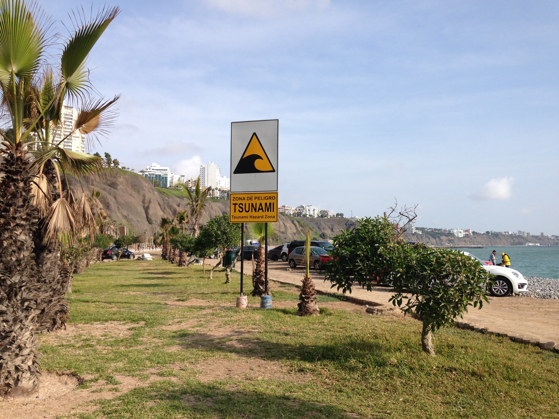
Tsunami warning sign on the coast near Lima, Peru
Every year, earthquakes endanger the people in Peru's capital Lima and the port city of Callao. With almost 10 million inhabitants, almost a third of the total population of the country lives here. Lima-Callao is the commercial and industrial centre as well as the cultural heart of the country. Settlements and infrastructures extend right to the coast. Earthquakes and tsunamis pose a particularly high risk for the people in this region.
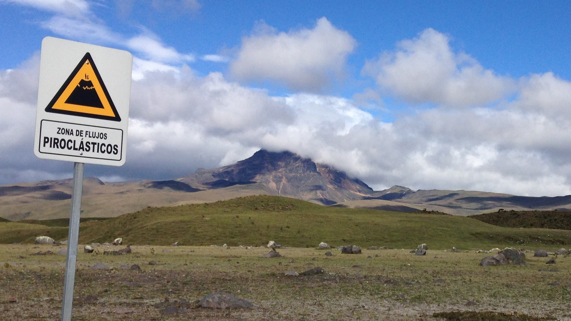
In the Cotopaxi National Park in Ecuador, the danger of volcanic activity is present. The 5897-metre-high Cotopaxi – one of the highest active volcanoes on Earth – is located here. Since it is located only 50 kilometres from the capital, Quito, the potential for danger is high.
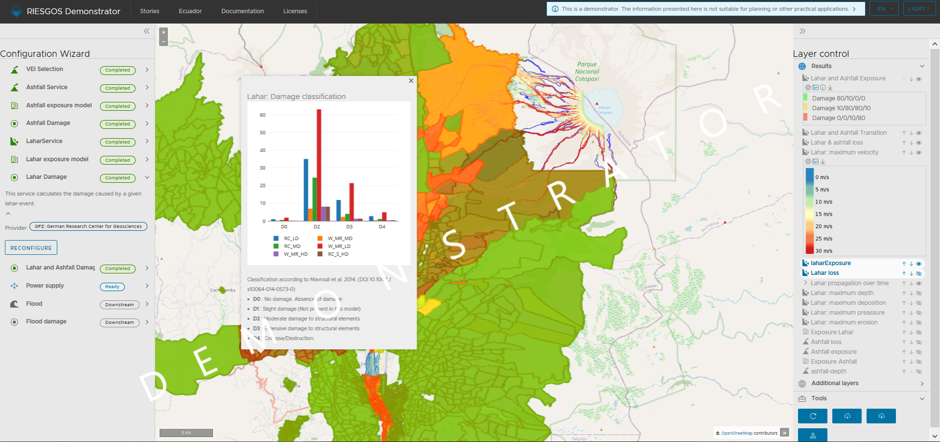
The RIESGOS demonstrator is based on a modular and scalable concept for multi-risk information. It consists of a series of independent, distributed webservices, and a user interface that accesses these services. The graphical user interface of the demonstrator can be accessed from a web browser. The main screen is divided into three main display areas: the central map window, the configuration wizard for the control of each web service to the left, and the results panel to the right.
International joint project RIESGOS 2.0 to support risk management for natural hazards begins.
Practical methods and technologies for multi-risk analysis are being developed for particularly vulnerable regions in Chile, Ecuador and Peru.
The course and interactions of various natural hazards - including earthquakes, landslides, volcanoes, floods and tsunamis - can be simulated and displayed via a web platform.
Increasing numbers of people worldwide are being exposed to natural hazards, particularly in densely populated cities and conurbations. In these situations, effective risk management can save lives. Hazards are rarely isolated; if an earthquake triggers a tsunami, this in turn can generate further environmental disasters and disruptions. Torrential rain can cause landslides and lead to rivers bursting their banks, resulting in flooding. These chain reactions can compound a disaster and quickly overwhelm victims and rescue workers. Information systems can help planners and emergency services to pre-emptively draw up multi-risk scenarios and to take targeted precautions. For this reason, the RIESGOS 2.0 international project kicked off on 1 March 2021. Under the leadership of the German Aerospace Center (Deutsches Zentrum für Luft- und Raumfahrt; DLR), the project partners are developing scientific methods and technologies for multi-risk analysis.
Interest in new approaches
This project builds on the achievements of its predecessor, RIESGOS (Spanish for 'risks'). RIESGOS designed and demonstrated a new method for modelling and simulating complex multi-risk situations, using the Andes as an example region. "The concept developed within RIESGOS has met with a very positive response in our South American partner countries," says Project Leader Elisabeth Schöpfer of the DLR Earth Observation Center. “Over the next three years we will jointly address open, central research questions, substantially expand our approach and strengthen the potential for practical implementation."
Project developments are currently being discussed virtually with representatives from Chile, Ecuador, Peru and Germany. The launch event was attended by approximately 200 people, clearly demonstrating the great interest in this new approach to multi-risk assessment.
Distributed web services
The demonstrator for the multi-risk information system is designed to function in a decentralised manner. A web platform allows users to simulate and model how various natural hazards, such as earthquakes, landslides, volcanic eruptions, floods and tsunamis, would progress and interact. It is also able to consider the impacts on critical infrastructure such as power grids. Web services are used to map individual natural hazards, their interactions and compounding effects and analyse them simultaneously. This allows users, such as emergency services, planners and relief organisations, to simulate and assess different future scenarios.
The project developments will all be open source and compliant with international standards, allowing them to be integrated into existing system environments. This will provide the basis for a sustainable use of the results from the project in partner countries.
Close collaboration with users
RIESCOS 2.0 will be used to analyse potential disaster scenarios based on particularly endangered pilot regions in Chile, Ecuador and Peru. "We live in vulnerable societies that have to plan for contingencies and future risks. That is why strengthening R&D&I is essential. Multiple risks pose socio-environmental challenges that require a firm response in different spheres, including administrative and legislative, based on technical and scientific evidence. Acutely aware of the importance of developing a plan for analysing risk from a scientific and technological perspective, the Equadorean Secretariat of Higher Education, Science, Technology and Innovation (Secretaria de Investigación Científica, Innovación y Transferencia de Tecnología; SENESCYT) has been involved in the project RIESGOS with DLR since 2017," said Nicolás Malo, SENESCYT Undersecretary of Research, Innovation and Technology Transfer.
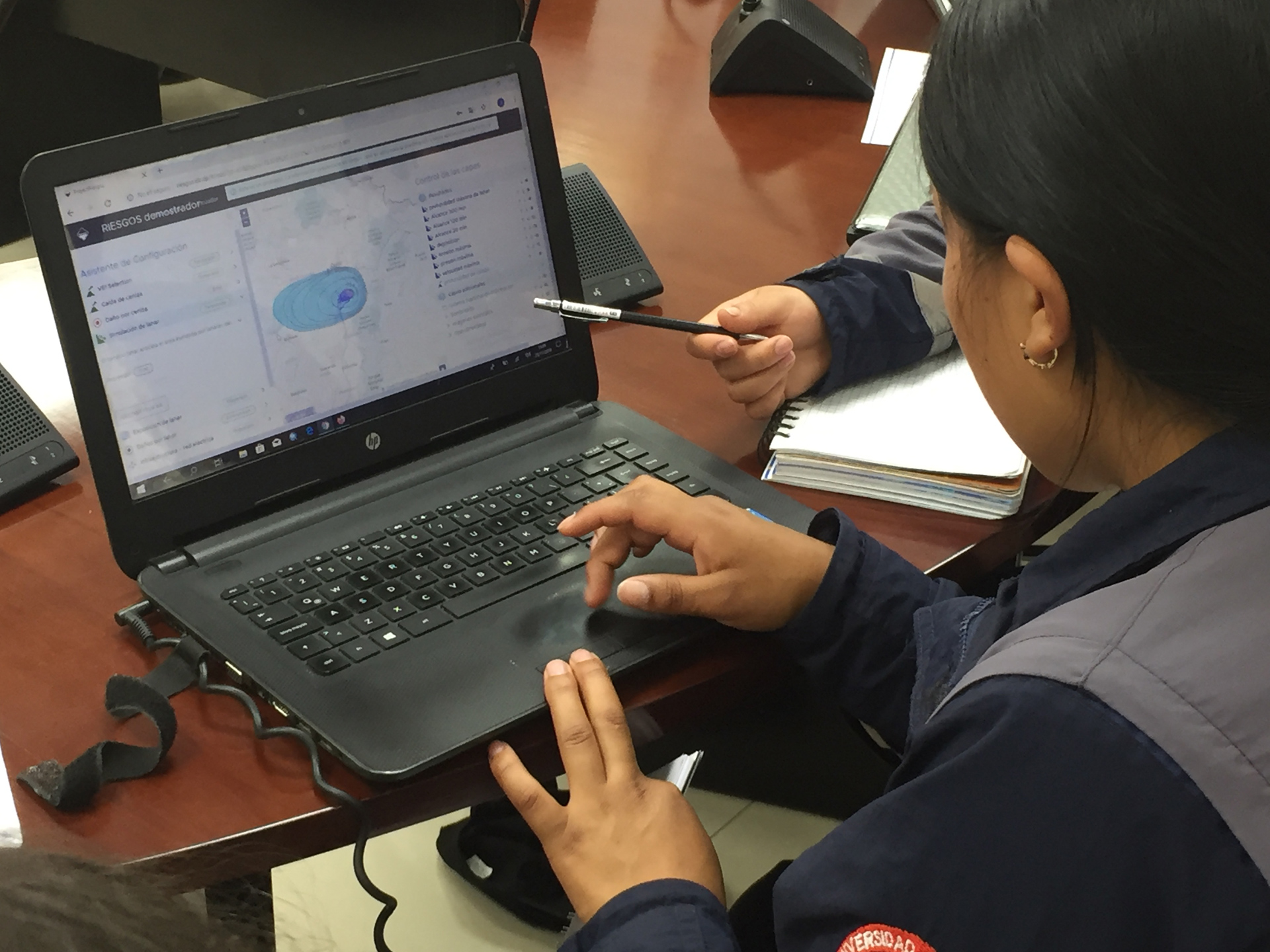
The development team is, in close collaboration with local and national partners, optimising the demonstrator platform for practical use. In future, it will be possible to integrate elements of the platform into country-specific information systems, which will assist the development of local strategies to avoid or mitigate risks. For example, authorities will have new opportunities to adapt land use planning to risk scenarios and to heighten risk awareness among the population.
"The approach developed through RIESGOS is 'fostering synergies in order to deliver more precise analysis, which facilitates the proper identification of disaster risk reduction and prevention activities, programmes and projects, interrelating the impacts between different dimensions of vulnerability, in order to inform decision making at the three levels of government,'" says Juvenal Medina Rengifo, Chief of the Peruvian National Center for Disaster Risk Assessment, Prevention and Reduction (Centro Nacional de Estimación, Prevención y Reducción del Riesgo de Desastres; CENEPRED).
In RIESGOS 2.0, uncertainties and inaccuracies discovered in the models will be scientifically assessed and quantified. This will be achieved through interdisciplinary collaboration between the project partners, who will utilise techniques from geophysics, hydrology, geology, geography, geostatistics and remote sensing, as well as from existing initiatives and services employed by their South American partners.
Rodrigo Cienfuegos, director of the Research Center for Integrated Disaster Risk Management (Centro de Investigación para la Gestión Integrada del Riesgo de Desastres; CIGIDEN) and a member of the Engineering Faculty at Pontificia Universidad Católica de Chile, highlighted that: "The use of distributed technologies to operate interconnected web services will enhance the interoperability of different countries' disaster information systems and assessment models on the platform being implemented by the RIESGOS project. Similarly, the R&D&I work being carried out in Chile to generate detailed exposure maps and prospective risk analysis for different cities could easily be linked to the RIESGOS platform, facilitating the transfer of knowledge to the decision-making stage."
Societal responsibility and innovation
Our highly technological and globalised world is growing increasingly susceptible to natural disasters, which can quickly have far-reaching consequences. The eruption of Eyjafjallajökull in 2010, for example, brought air traffic across Europe to a standstill. In view of these growing challenges, international cooperation involving all sectors of society has become essential. With RIESGOS 2.0, DLR and its project partners are furthering their commitment to sustainability. To achieve this goal, the project is building long-term partnerships in the target countries, examining solutions for specific issues and putting them into practice. The development team will also learn a lot from the practical experience of its South American partners.
Through international cooperation and DLR's coordination, the project further strengthens research and innovation in Germany and supports the competitiveness of German industry. For example, the German Chambers of Commerce Abroad (Auslandshandelskammer; AHK) are providing support for SMEs involved in RIESGOS 2.0 in the target countries, and researching the economic potential of the developments for industries such as the insurance sector.
About the project
RIESGOS 2.0. (Scenario-based multi-risk assessment in the Andes region) is supported by the German Federal Ministry of Education and Research (BMBF). The Project Management Agency Jülich technically and administratively supervises the project on behalf of BMBF. The RIESGOS 2.0 project consortium consists of the following research institutions and industry partners: the German Aerospace Center (Deutsches Zentrum für Luft- und Raumfahrt; DLR), the German Research Centre for Geosciences (Deutsches GeoForschungsZentrum; GFZ), Alfred-Wegener-Institute (AWI), the Technical University of Munich, 52°North, geomer, Dialogik and SLU. The associated partners are GIZ, UNOOSA / UN-SPIDER, UNESCO and Munich Re. RIESGOS 2.0 cooperates with numerous research institutes and public authorities in the south American countries of Chile, Ecuador and Peru.


