DLR acquires aerial images and evaluates them with additional Earth observation data for the disaster relief workers in the affected regions.
Artificial intelligence (AI) combines information from satellites and aircraft.
Focus: Earth observation, security
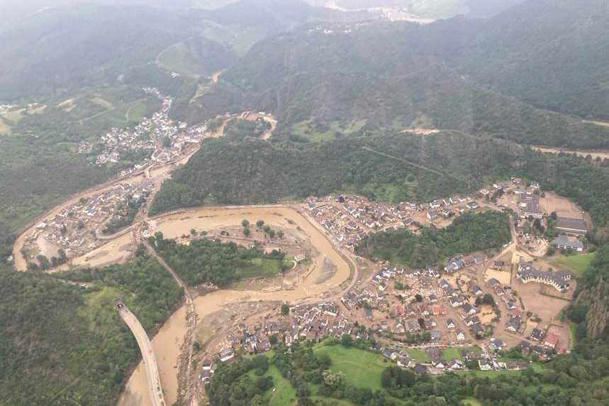
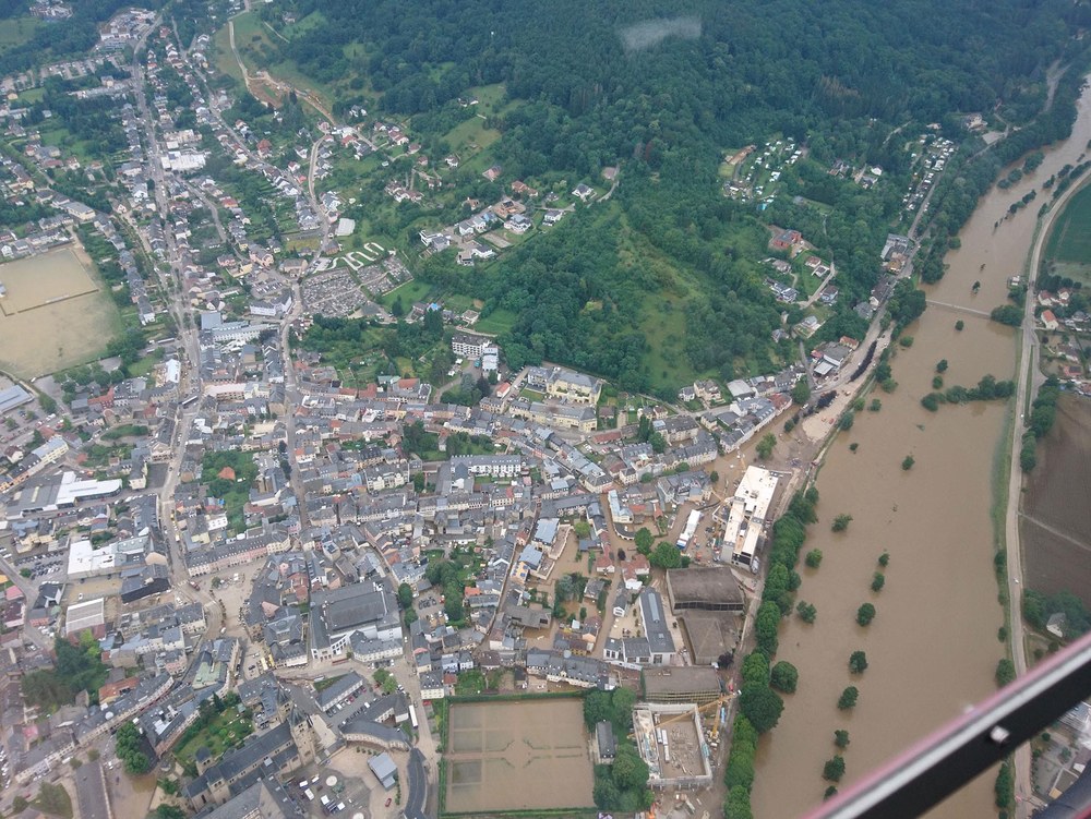
In western Germany, prolonged heavy rain caused flooding. People lost their lives and numerous buildings and infrastructures were destroyed. Areas in North Rhine-Westphalia and Rhineland-Palatinate are particularly affected. The German Aerospace Center (Deutsches Zentrum für Luft- und Raumfahrt; DLR) is supporting disaster relief workers with a number of activities. This includes the rapid creation of maps based on satellite data and DLR aerial images. The Center for Satellite Based Crisis Information (ZKI) relays the situation information to the Federal Office of Civil Protection and Disaster Assistance (BBK) and the German Red Cross (DRK). Furthermore, there is a continuous exchange with the Federal Agency for Cartography and Geodesy (BKG) and its satellite-supported crisis and information service. The ZKI is a facility within the German Remote Sensing Data Center (DFD) in Oberpfaffenhofen. It analyses Earth observation data and uses it to provide up-to-date information.
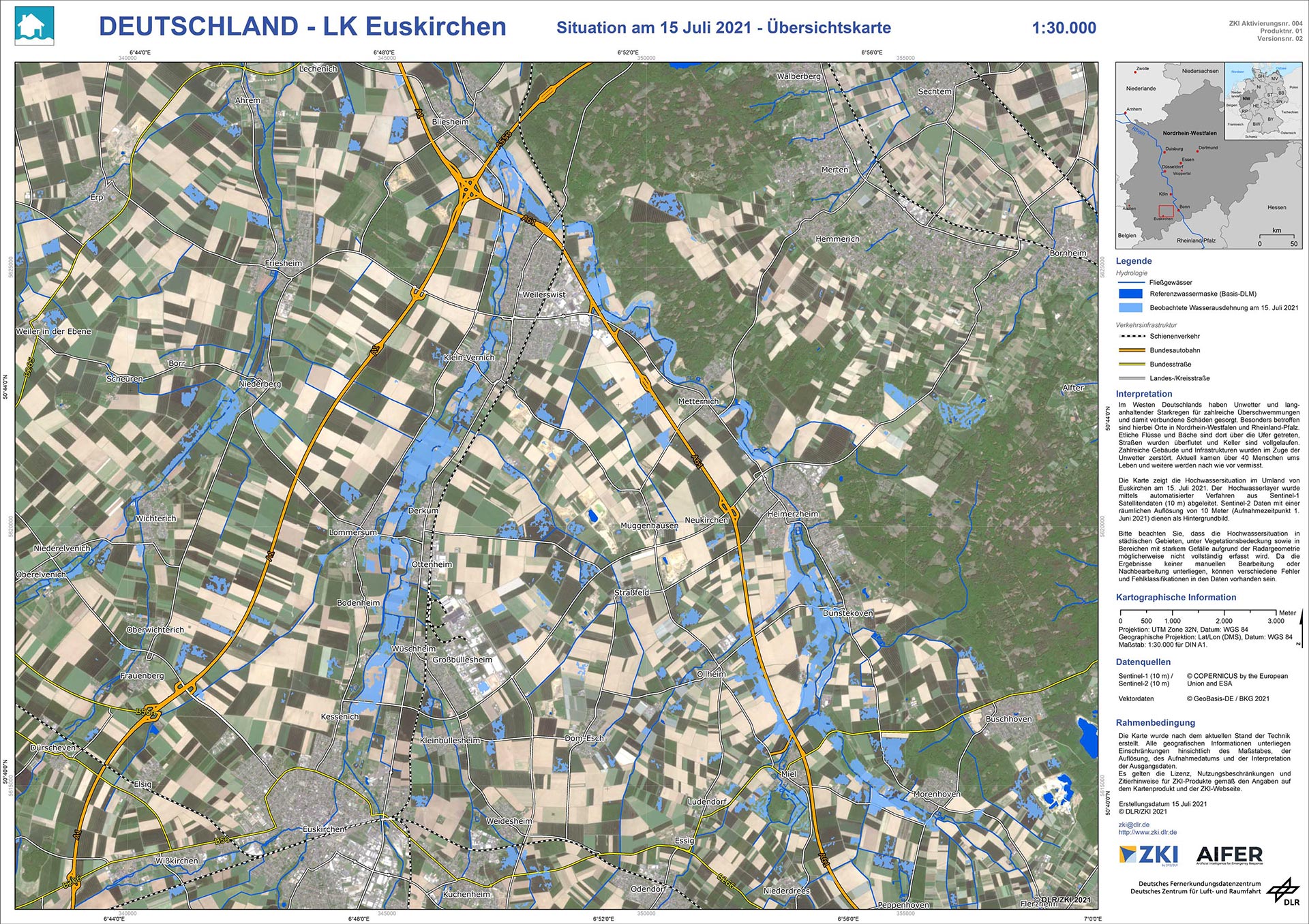
The ZKI has derived information on flooding for regions in North Rhine-Westphalia from satellite data (Sentinel-1). The evaluation is carried out using automated processes. The images and so-called 'water wasks', which illustrate the extent of the bodies of water, are available to the relief workers. In addition, the ZKI provides situation maps showing particularly affected areas, which are identified together with the rescue teams on site. For this purpose, DLR captured aerial image data with resolutions of 10 to 15 centimetres using a camera from the Remote Sensing Technology Institute. The flights were spontaneously organised in cooperation with partners.
The images and maps are created as part of the AIFER research project in close cooperation with the Bavarian Red Cross (BRK) and the German Red Cross (DRK). AIFER develops artificial intelligence (AI) methodology that automatically recognises and combines information from satellite data, aerial images and other media. The project is being funded by the German Federal Ministry of Education and Research (BMBF).

