DLR tests technologies to protect maritime infrastructure
October 20, 2022 | Situation picture created to protect a port area in Nordenham
DLR tests technologies to protect maritime infrastructure
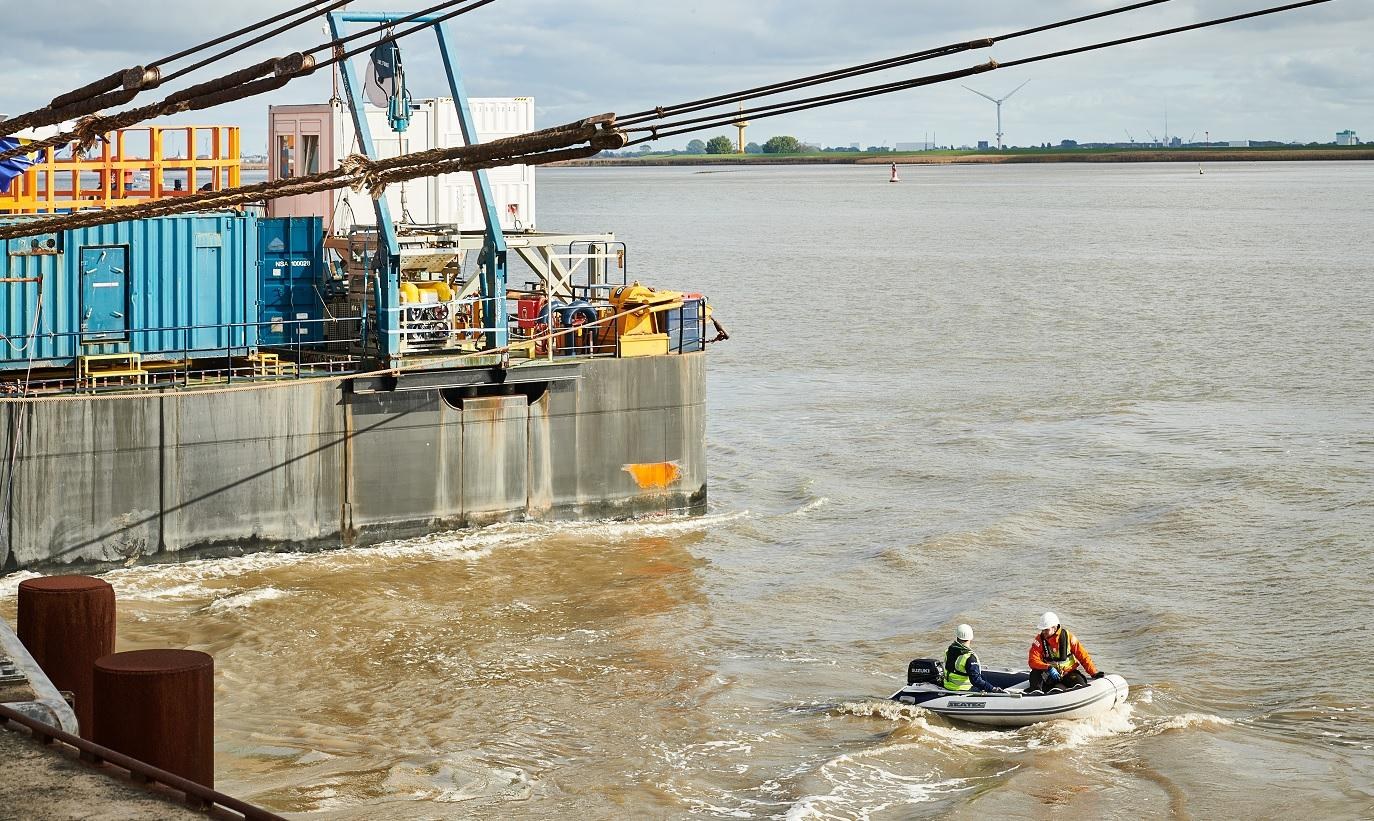
The dinghy makes its way to the starting position before the scenario begins
The dinghy is used to simulate an intrusion into the closed port area from the sea. Different camera systems recognise it automatically and sound an alarm as soon as they detect that it is entering the relevant area.
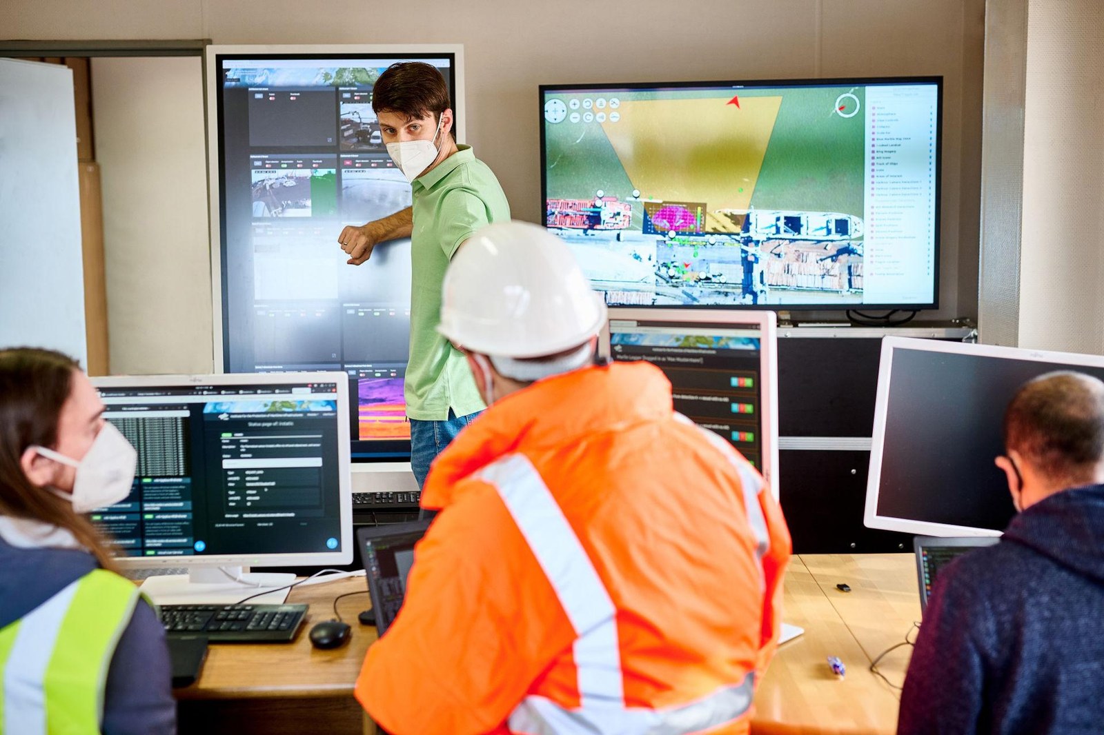
The sensor data and processed information come together in the situation room
The measurement data and knowledge gained are visualised live on several screens. Automatically recognised objects, including ships, vehicles and people are displayed in the image data with their associated position. The system issues an alarm upon detecting an undesired event and draws attention to the relevant locations.
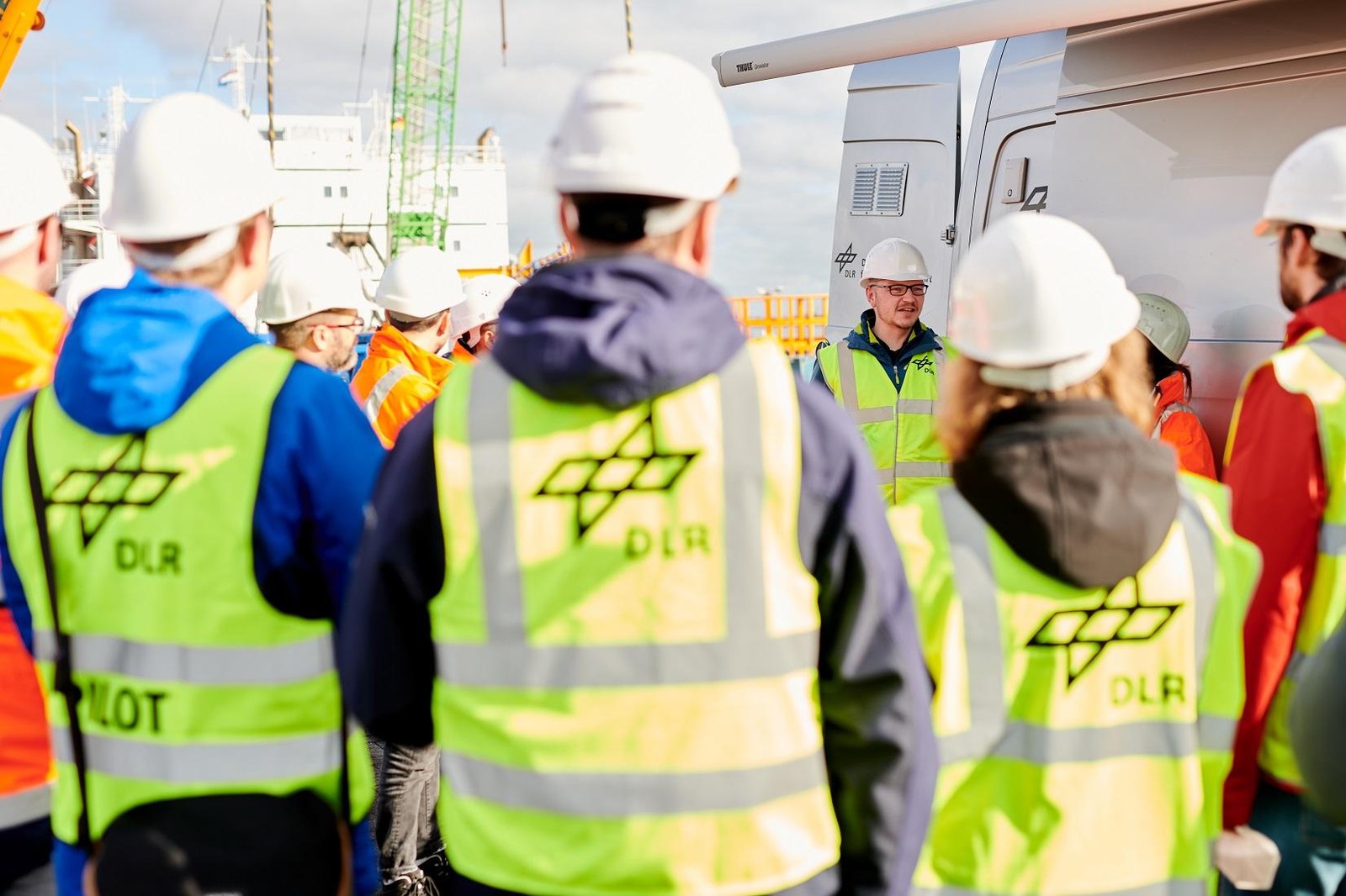
The team discusses the course of the technology demonstration
The successful use of many different technologies and the implementation of the application scenario requires the cooperation of many committed colleagues. Researchers, engineers and technicians come together in the project to develop the MARLIN overall situational picture system from a large number of individual systems.
On 19 October 2022, DLR demonstrated a technological system to protect a port area in Nordenham.
It simulated a scenario of disruption to port operations from land, water and air.
DLR created a real-time situational picture by collecting and processing observation data from the air, water and land.
Focus: maritime systems, maritime security, protection of infrastructure
Public attention is currently focused on the security of maritime infrastructure. The German Aerospace Center (Deutsches Zentrum für Luft- und Raumfahrt; DLR) is conducting research into the protection of port facilities as well as their functionality. On 19 October 2022 DLR carried out a technology demonstration at the Seaport of Nordenham alongside the emergency services. The participants ran through various scenarios for disrupted port operations as part of the MARLIN project. DLR develops technologies and uses them to generate real-time situational overviews of the port to assist the emergency services in their efforts to ensure port security.
"The unique expertise of the participating DLR institutes and their research infrastructure are now a focus of security research. Together with the research areas of aeronautics, space, energy and transport, we are devising application-oriented solutions geared towards immediate use,“ says Anke Kaysser-Pyzalla, Chair of the DLR Executive Board. "DLR has on-going collaborations with politicians and authorities, as well as with industry and businesses to put our innovative security solutions to targeted use. A security- and protection status-related concept for recording the location of offshore wind farms has already been developed together with industry.“
Testing disruption of port operations
The demonstration focused on protecting a port area subjected to disruptions from the ground, water and air. The scenario was as follows: A cargo vessel loaded with dangerous goods docks at the quay wall. Shortly after, intruders spy with a drone. This is registered by the system. A drone from the defence system displaces the scout drone. Next, people approach the vessel from a boat and from land. They detonate a smoke bomb on land to draw attention away from the water's edge, allowing them to slip into the port unnoticed. Potential underwater hazards, such as explosive devices, are also part of the scenario. Following prevention of the seaborne intrusion, the dinghy turns around and the occupants throw all possible evidence overboard.
Several devices with installed sensors observe the scenario and generate a complex picture of the situation from the combination of geo and sensor data. Fixed and mobile cameras on a bus and robotic dog record photos and videos. Various camera systems were used in the drill. Cameras with active laser lighting, known as range-gated systems, can see through the fog. This makes it easy to see people or objects floating on the water in poor visibility conditions. Cameras installed on drones, meanwhile, provide an aerial overview of the danger zone and the surrounding area.
"In our opinion, today's demonstration went very well. It's remarkable that our team has managed to combine so many different technologies in a single situational awareness system within such a short space of time,“ says Maurice Stephan, Project Manager at the DLR Institute for the Protection of Maritime Infrastructures in Bremerhaven.
The system also includes the DLR Seekatze. The sonar of this autonomous underwater vehicle can locate lost or submerged objects. Where required, another remote-controlled submersible vehicle can provide detailed recordings of conspicuous spots.
Real-time situational picture provides an overview
The data are then combined into a situational picture in an office container on the port premises. Algorithms that use artificial intelligence from the field of machine learning automatically identify relevant objects and events and display them on a map application. The current AIS signals that ships send out to indicate their position are also displayed on the map. From the situation room, the observers have a comprehensive overview of the situation and any potential dangers. This enables them to better coordinate security-related tasks. From here they can also control data sources and instruments, as well as add new ones. The emergency services can infer the situation and give those on the ground information such as the best route to the danger zone. The situational picture can also be accessed via mobile devices such as tablets. This makes it possible for emergency services to receive the same information in different locations in order to proceed in a coordinated manner.
Summing up a successful day, Stephan says, "Among other things, our research stands out thanks to the fact that we work intensively with official end users and develop and promote different technologies for them. I'm sure that the work we’re doing will bring many of our system components to real-world application in the future.“
Contact
Jana Hoidis
Corporate Communications Bremen, Bremerhaven, Hamburg and Oldenburg
German Aerospace Center (DLR)
Corporate Communications
Am Fallturm 9, 28359 Bremen
Tel: +49 421 24420-1908
Dr. rer. nat. Maurice Stephan
German Aerospace Center (DLR)
Institute for the Protection of Maritime Infrastructure