Colour plan view of Tinto Vallis


Colour plan view of Tinto Vallis
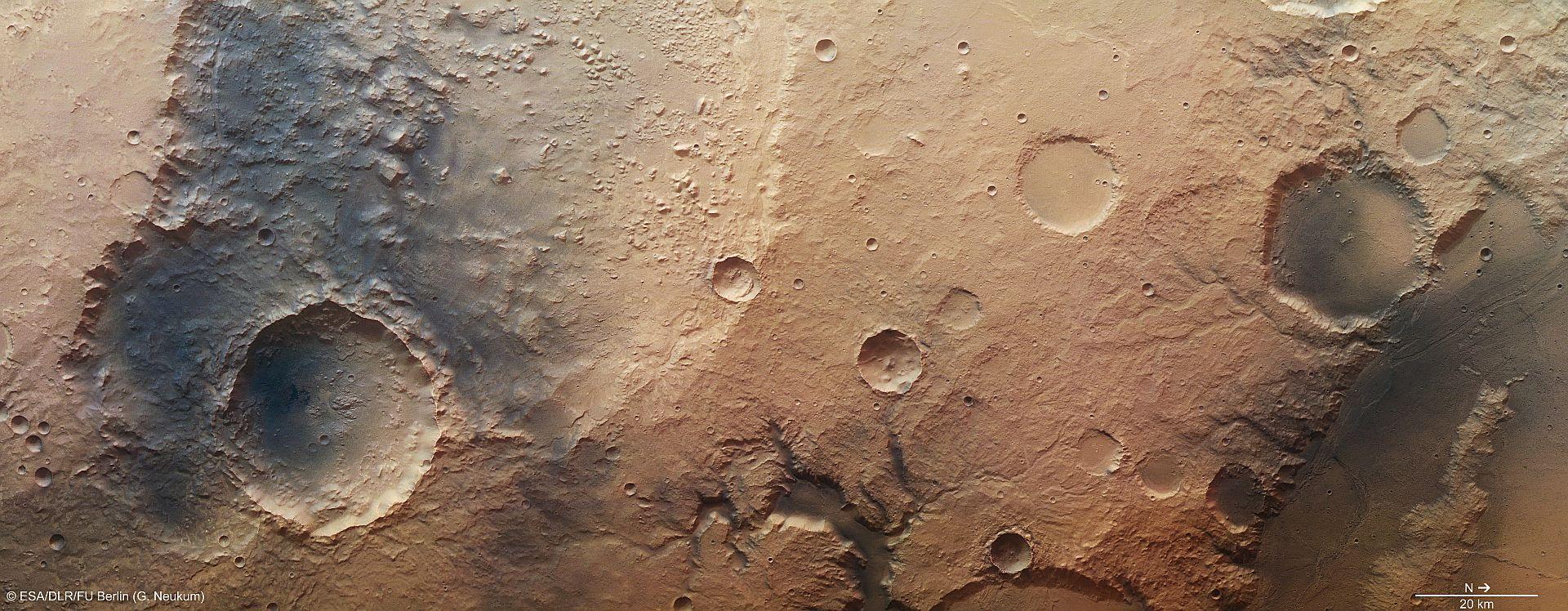
High Resolution Stereo Camera (HRSC) nadir and colour channel data acquired during orbit 11,497 on 13 January 2013 by ESA’s Mars Express spacecraft has been combined to form a natural-colour view of the Tinto Vallis region. The region imaged, which lies southwest of Amenthes Rupes and Palos Crater, is centred at around three degrees south and 109 degrees east, and has a ground resolution of about 22 metres per pixel. The mouth of Tinto Vallis, seen clearly in the lower centre of this image, is believed to have formed 3.7 billion years ago after volcanic activity warmed and melted subsurface ice, which then escaped to the surface to form 'sapping valleys'.
Copyright note:
As a joint undertaking by DLR, ESA and FU Berlin, the Mars Express HRSC images are published under a Creative Commons licence since December 2014: ESA/DLR/FU Berlin, CC BY-SA 3.0 IGO. This licence will also apply to all HRSC images released to date.