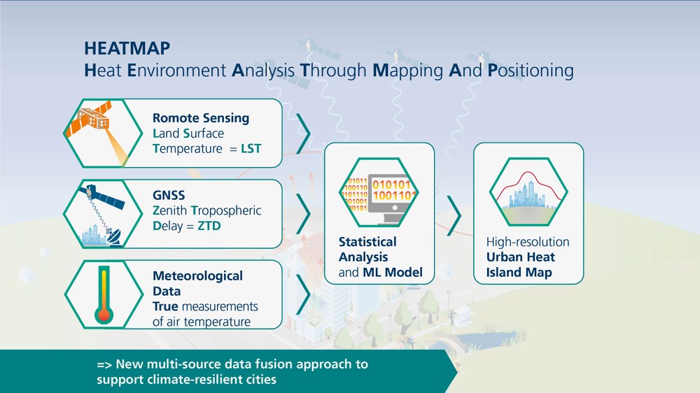
Heatmap (Heat Environment Analysis Through Mapping And Positioning)
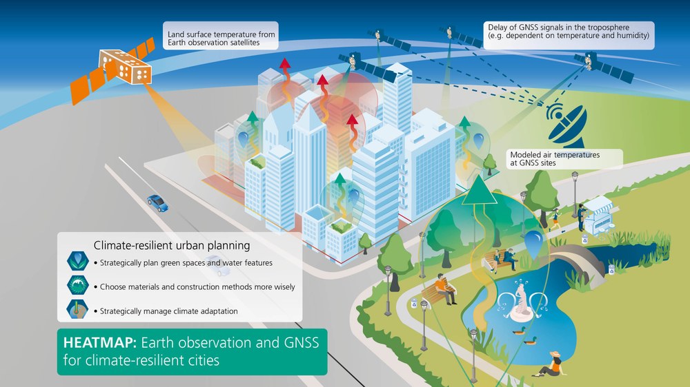
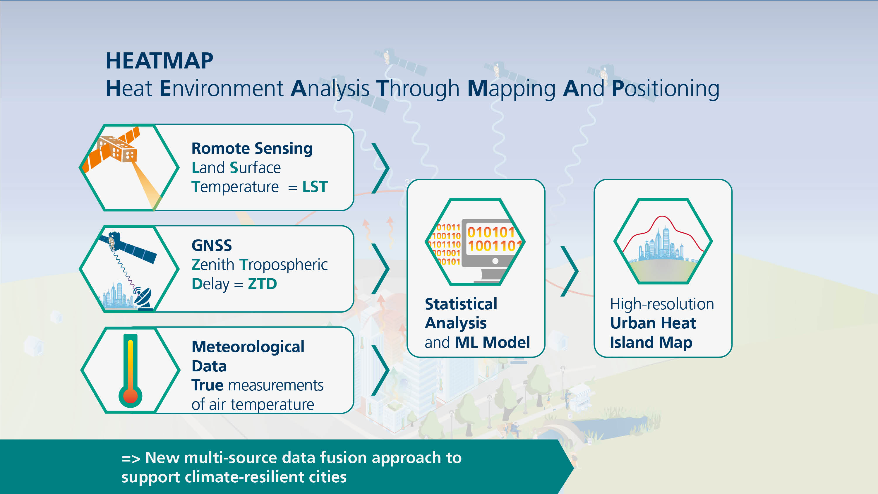
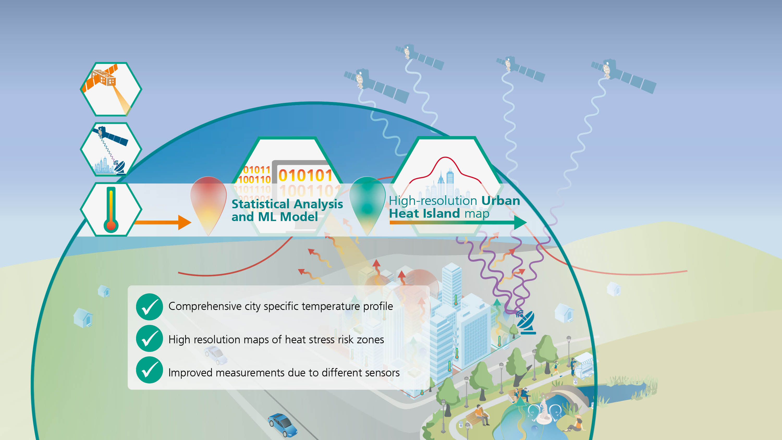
How can urban heat islands be detected more precisely? In the HEATMAP project, the Galileo Competence Center (GK) combines GNSS data with thermal satellite remote sensing to develop high-resolution maps of urban air temperatures. This innovative approach opens up new possibilities for analysing urban heat distribution and can, in the long term, support climate-adapted urban planning.
The project utilises the tropospheric delay of GNSS signals to draw conclusions about air temperature. The models developed are validated using ground-based meteorological measurements.
Climate-Adapted Urban Development
Urban heat islands are among the central challenges for climate-adapted urban development. In densely built-up areas in particular, sealed surfaces and poor air circulation lead to significantly higher temperatures than in the surrounding rural areas. Analysing these processes requires temperature data that are both spatially high-resolution and as temporally continuous as possible.
In the HEATMAP project, GK is developing, together with the German Remote Sensing Data Center (DFD), a new approach to modelling urban air temperatures. The focus is on the use of permanently operated GNSS stations to derive atmospheric information.
GNSS signals are delayed as they pass through the troposphere. This tropospheric propagation delay, known as the Zenith Tropospheric Delay (ZTD), depends, among other factors, on the temperature, air pressure, and water vapour content of the atmosphere. Based on the GNSS observations – taking into account additional meteorological quantities - air temperatures are therefore derived at the respective station locations. For this purpose, GK contributes its expertise in the processing and analysis of high-precision GNSS data.
The air temperatures derived from the GNSS data are combined with thermal satellite data from Earth observation. DFD is developing methods to derive high-resolution surface temperatures from thermal infrared satellite imagery of varying spatial and temporal resolution. The goal is to produce a dataset that offers high spatial detail together with high temporal resolution.
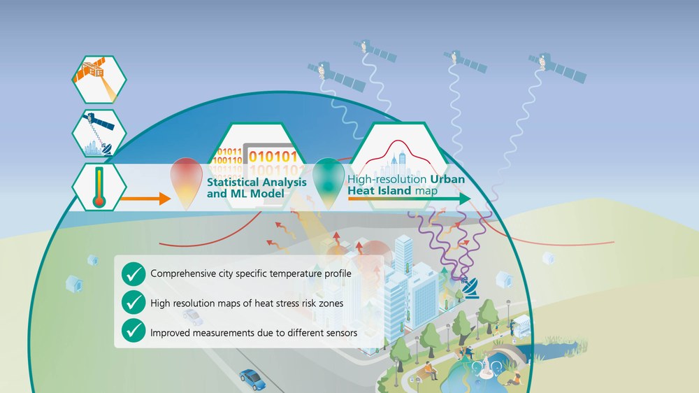
In the next step, the modelled air temperatures at the GNSS station locations are linked with the satellite-based surface temperatures. This will enable air temperatures to be modelled across entire urban areas - including areas without direct meteorological measurement stations. Complementary ground-based meteorological station data are used to validate the results.
HEATMAP thus creates a new approach combining GNSS-based atmospheric modelling with thermal remote sensing for the analysis of urban heat islands. Linking these data sources in this way represents new scientific ground. Statements on the achievable accuracies will be examined within the framework of the modelling and validation.
The temperature maps developed in the project will form the basis for further urban climate analyses and can, in the long term, contribute to supporting climate-adapted urban planning. In particular, in areas where conventional temperature measurement networks are sparse, the approach opens up new possibilities for the high-resolution detection of urban temperature distributions.