Italy – Automatic speed control of moving objects using the Doppler effect
Italy – Automatic speed control of moving objects using the Doppler effect
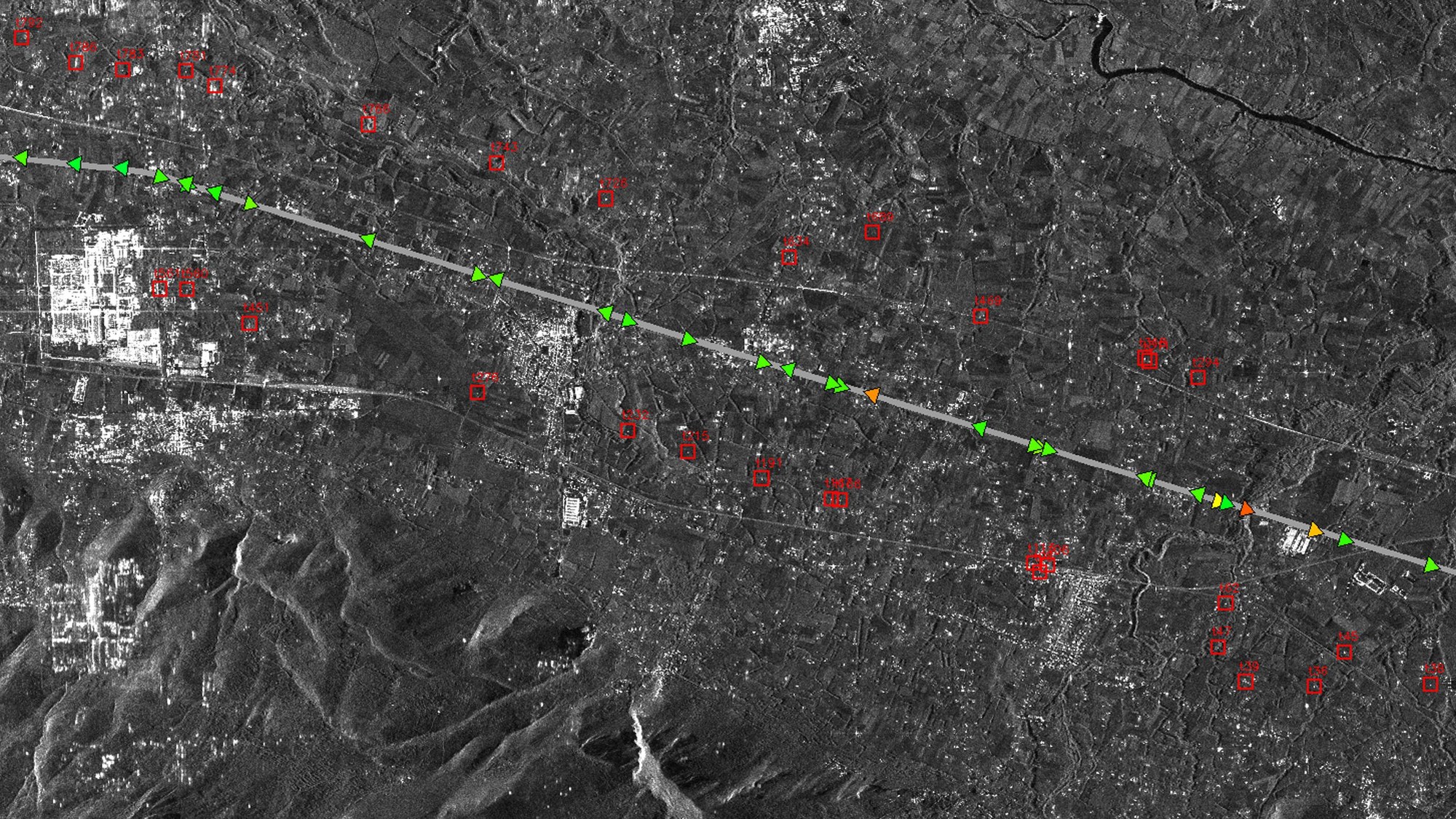
TerraSAR-X can operate in a new mapping mode that enables it to detect moving objects and measure their speed. This capability is used to determine the speed of ocean currents but also to record the speed of ships or motor vehicles. This image shows the A1 highway (Autostrada del Sole). The section is located about 100 kilometres southeast of Rome. This radar imaging technique is based on the Doppler effect, so the vehicles appear 'offset' from the highway. The extent of the lateral deviation is a measure for a vehicle’s speed. Using this new mode, TerraSAR-X will detect vehicles off the road, and determine their distance from the road. The red squares mark the vehicles, the coloured triangles indicate their current position, with the colour indicating their speed. These data will, in future, be used by transportation research teams who will integrate these extensive pictures of moving traffic into their traffic models along with locally obtained sensor data, to improve their capability to predict congestions and to manage the flow of traffic. This will be particularly useful in disaster management and mass events, in which current traffic models may fail. The identification of individual vehicles is not possible with this technology, but also unnecessary for traffic research.

