Precise maps of Saturn's moons as the basis for scientific work
Precise maps of Saturn's moons as the basis for scientific work
As is the case for geoscientists on Earth, it is of fundamental importance for planetary researchers to have precise maps of the areas they are investigating. The creation of global image mosaics and atlases of the icy moons is therefore an important long-term project of the Cassini mission. The Cassini team at the DLR Institute of Planetary Research in Berlin uses the images from the camera system on the Cassini space probe for this purpose. The system has collected image data from various distances during the numerous flybys of Saturn's large icy moons.
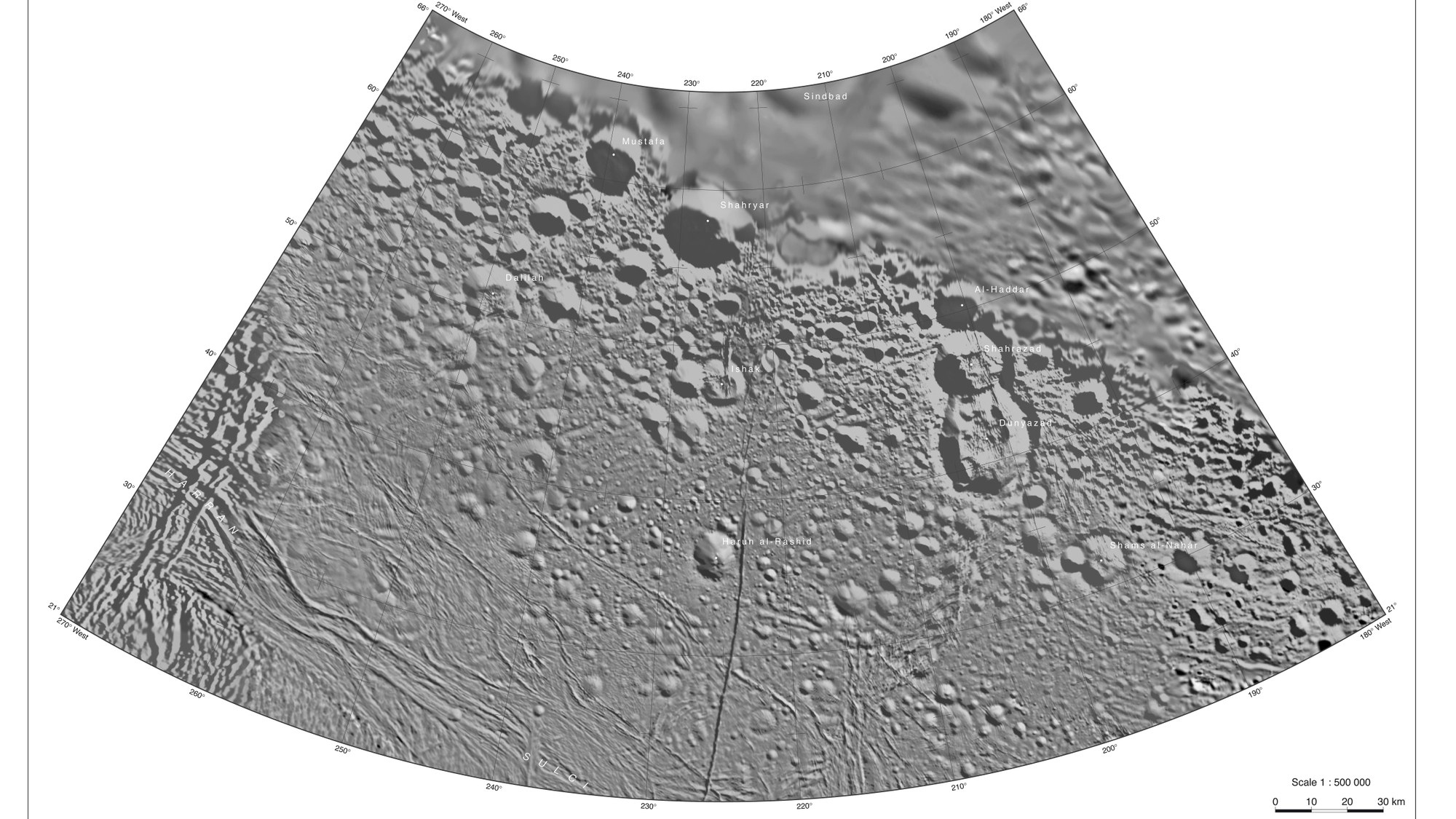
The example shows a map sheet from the northern hemisphere of the icy moon Enceladus at a scale of 1:500,000; this means that one centimetre on the original map sheet (105 centimetres by 75 centimetres) corresponds to five kilometres (500,000 centimetres) in reality. This representation is referred to in cartography as the 'Lambert conformal conic projection'.
Enceladus has a diameter of 504 kilometres and is of particular interest to planetary researchers because of its 'cryovolcanic' ice eruptions, which are ejected into space from the southern polar region. The map is called 'Shahrazad' (Scheherazade). DLR cartographers give all surface phenomena on Enceladus, such as craters, plains or fissures, names from the oriental tales of the Arabian Nights – following rules set by the International Astronomical Union (IAU). Shahrazad is the storyteller in these tales.

