TerraSAR-X imaged the flooding in Pakistan during July and August 2010

TerraSAR-X imaged the flooding in Pakistan during July and August 2010
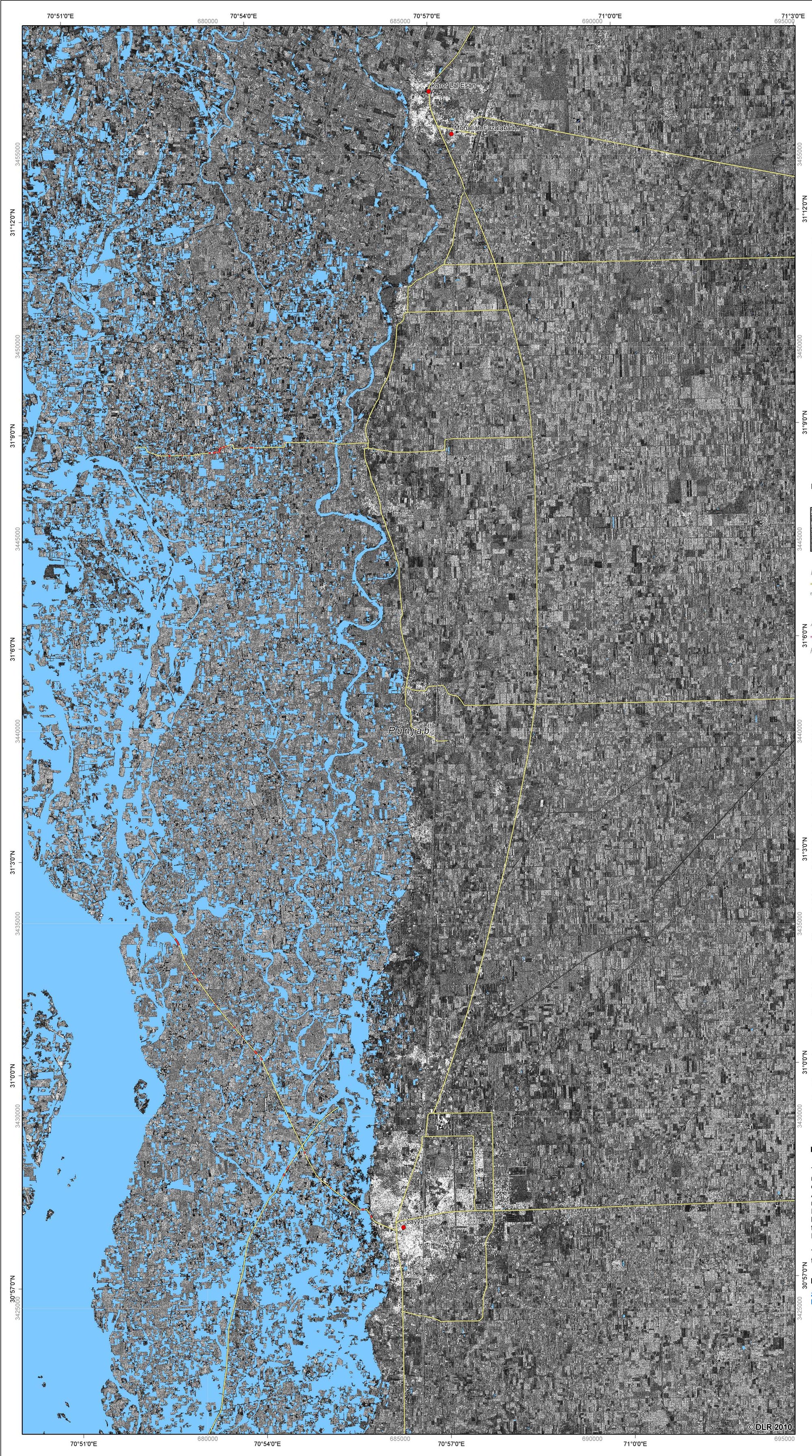
In July and August 2010, the province of Khyber Pakhtunkhwa in Pakistan was affected by severe flooding; TerraSAR-X mapped the flooded area. There were estimates of at least 1300 dead and more than 3700 houses destroyed, with 45 bridges washed away. The flood directly affected more than a million people.