3D model of the Rhine Valley

3D model of the Rhine Valley
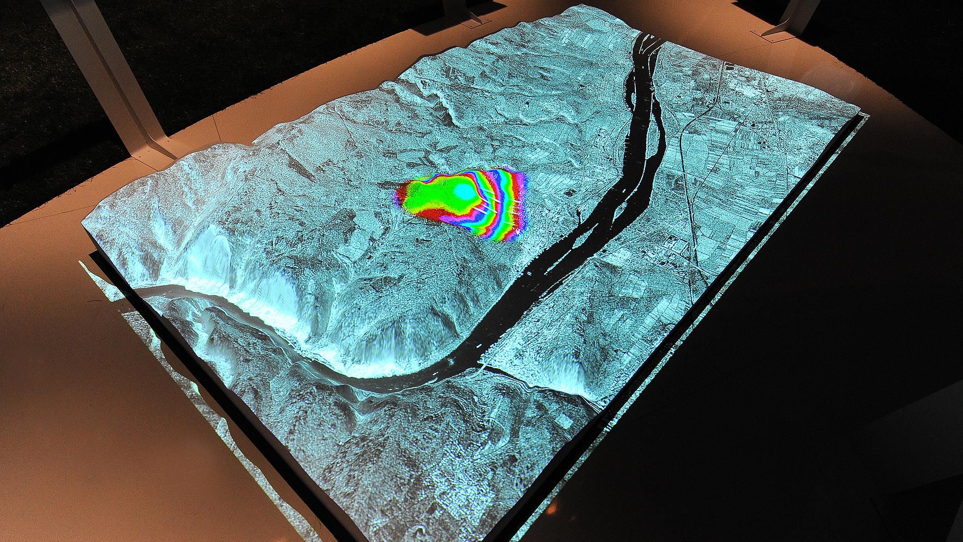
Earth observation satellites provide information on altitude, climate change and much more. Based on the data obtained with the German Earth observation satellites TerraSAR-X and TanDEM-X, DLR researchers have developed a sample 3D elevation model of the Rhine valley, which will be showcased on German Aerospace Day 2011 in Cologne.