The Mountain of Mountains

The Mountain of Mountains
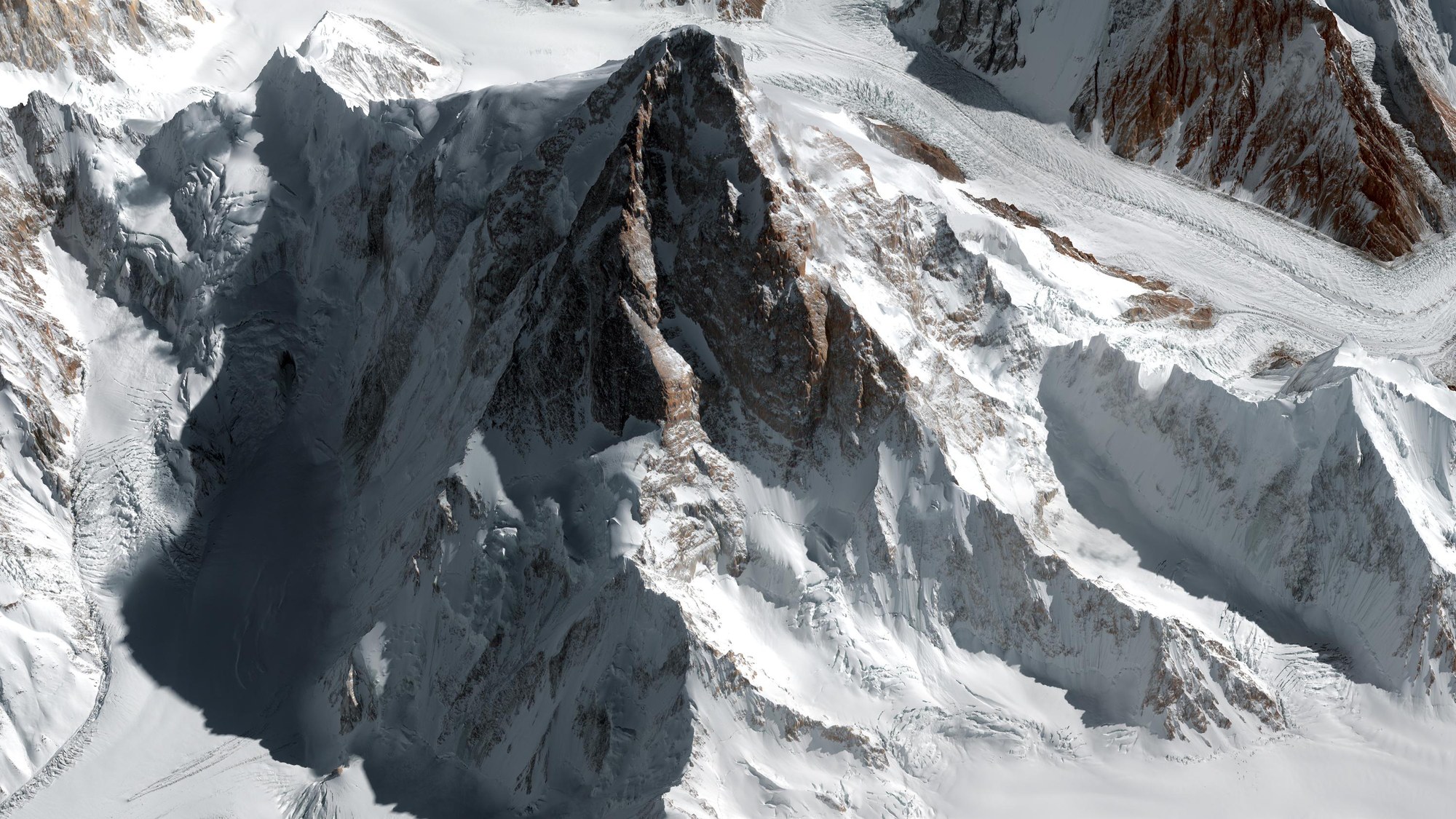
A view of the 'Mountain of Mountains' from the northwest. The two mighty pillars of rock to the northwest and west (centre) literally bisect the mountain. The North Pillar has still not been climbed in its entirety. To the right, on the Southwest Pillar of K2, the famous Magic Line can be seen – a route conceived by Reinhold Messner but not conquered until later by subsequent expeditions. A large erosion gully, similar to a large ravine, runs between the northwest and west ridges. To the right in the foreground, the Savoia Glacier can be seen; in the centre is the Savoia Pass. In the background is the Godwin-Austen Glacier, which joins the Baltoro Glacier as it flows to the south towards Concordia (out of image). At the right edge of the image is Angelus Peak, a foothill of K2.
As part of the International K2 North Pillar Expedition 2011, German mountaineer Ralf Dujmovits and his wife Gerlinde Kaltenbrunner plus a small international team planned on climbing K2 at the end of June 2011, via the technically demanding north route, which has seldom been followed to date. DLR scientists supported the expedition with a highly accurate 3D model of the mountain. Thanks to the ability to explore the intended route virtually in advance, the mountaineers had a relatively clear idea of which route they would be taking. On 23 August 2011 Gerlinde Kaltenbrunner reached the summit of K2 together with three other climbers from the team, making her the first woman to climb all 8000-metre peaks without an oxygen bottle.
Technical information regarding this image:
Satellite: WorldView-2
Operator/Reference: Digital Globe, Longmont, USA, European Space Imaging, Munich
Date acquired: November 10th 2010; 06:02 UTC
Geometric resolution of image data: 0.5 metre
Resolution of elevation model derived: 0.5 metres (horizontal), 2 metres (vertical)
Data processing and visualisation: DLR Earth Observation Center (EOC)