Topographic map of the mouth of Ares Vallis


Topographic map of the mouth of Ares Vallis
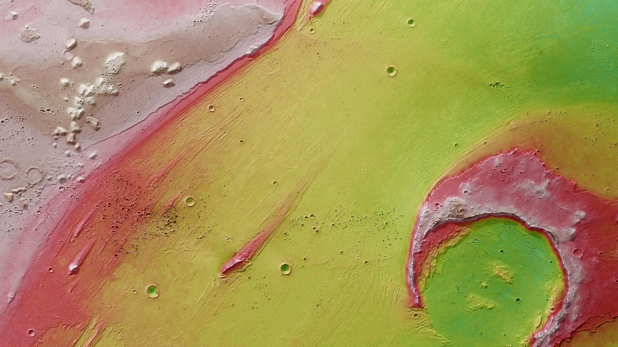
Digital terrain models can be generated using data acquired by several of the nine channels of the High Resolution Stereo Camera (HRSC) on ESA's Mars Express spacecraft, which image the planetary surface from different angles. These allow the landscape profile to be represented pictorially and can be used to create topographic maps. North is to the right in this image. In the absence of ‘sea level’, the height information (see key at top right of full-size image) is referenced to what is known as an areoid, a modelled equipotential surface on which everything experiences the same gravitational attraction towards the centre of the planet. The water that once flowed through Ares Vallis produced a valley about 1000 metres deep and 50 kilometres wide at the mouth of the outflow channel. The erosion of the rim of the Oraibi crater is clearly visible. The prominent 'islands' in the watercourse were able to resist the erosive power of the flow.
Copyright note:
As a joint undertaking by DLR, ESA and FU Berlin, the Mars Express HRSC images are published under a Creative Commons licence since December 2014: ESA/DLR/FU Berlin, CC BY-SA 3.0 IGO. This licence will also apply to all HRSC images released to date.