Topographic map of the mouth of the Ares Vallis outflow channel showing context of other images

Topographic map of the mouth of the Ares Vallis outflow channel showing context of other images
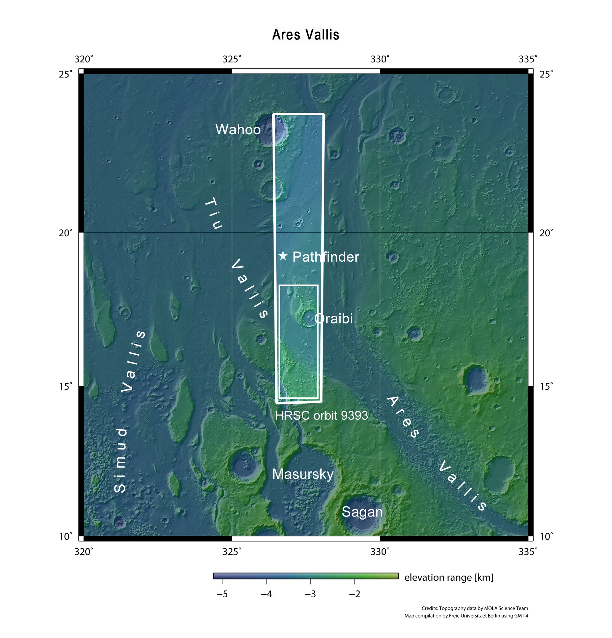
This map shows the area surrounding the mouth of Ares Vallis, a large outflow channel with its origin in the southern highlands of Mars and, at about 15 degrees north, flows out into the lowlands of Chryse Planitia. The larger framed area shows the location of the entire image strip that was acquired by the High Resolution Stereo Camera (HRSC) on board ESA’s Mars Express orbiter on 11 May 2011 during orbit 9393. The smaller framed area shows the location of the images described in this article. The asterisk marks the site where NASA’s Pathfinder mission landed on 4 July 1997. A small rover, Sojourner, spent 12 weeks exploring the area around the landing site.