Topographical map of part of the Phlegra Montes region

Topographical map of part of the Phlegra Montes region
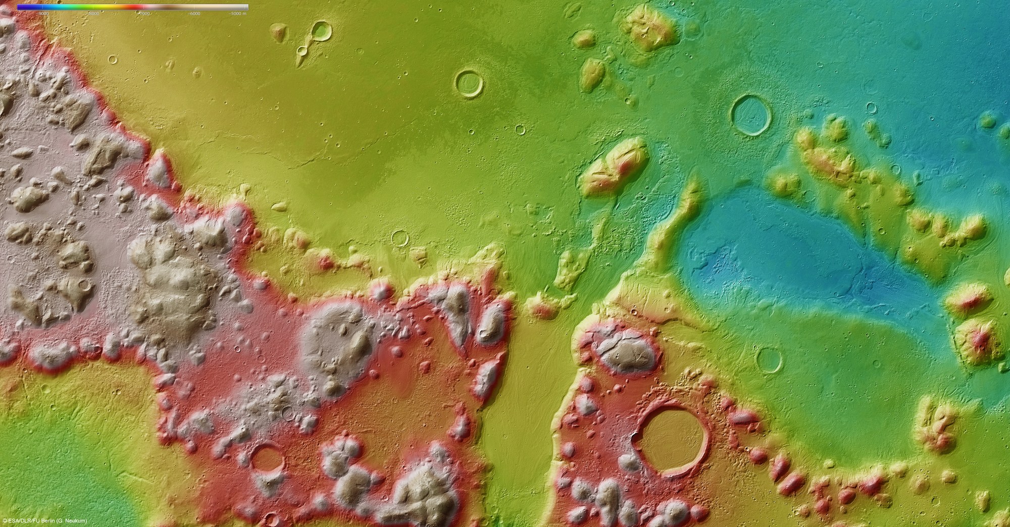
Digital terrain models can be generated using data acquired by several of the nine channels of the High Resolution Stereo Camera (HRSC) on ESA's Mars Express spacecraft, which image the planetary surface from different angles. The use of false colours enables the topography to be pictorially represented – the elevation scale is at the top left of the image; north is to the right. In the absence of 'sea level', the elevation data is referenced to an areoid – a modelled equipotential surface on which everything experiences the same gravitational attraction towards the centre of the planet.
The Phlegra Montes mountain chain running diagonally through the image is elevated some 2000 to 3000 metres above the surrounding Elysium and Arcadia Planitiae. In general, material forming the distinct flow patterns in the valley at the centre of the image – but which is also found in other depressed areas – appears to have moved from the hills towards the lower-lying regions.
Copyright note:
As a joint undertaking by DLR, ESA and FU Berlin, the Mars Express HRSC images are published under a Creative Commons licence since December 2014: ESA/DLR/FU Berlin, CC BY-SA 3.0 IGO. This licence will also apply to all HRSC images released to date.