Anaglyph image of a volcanic plain in the eastern part of Syrtis Major

Anaglyph image of a volcanic plain in the eastern part of Syrtis Major
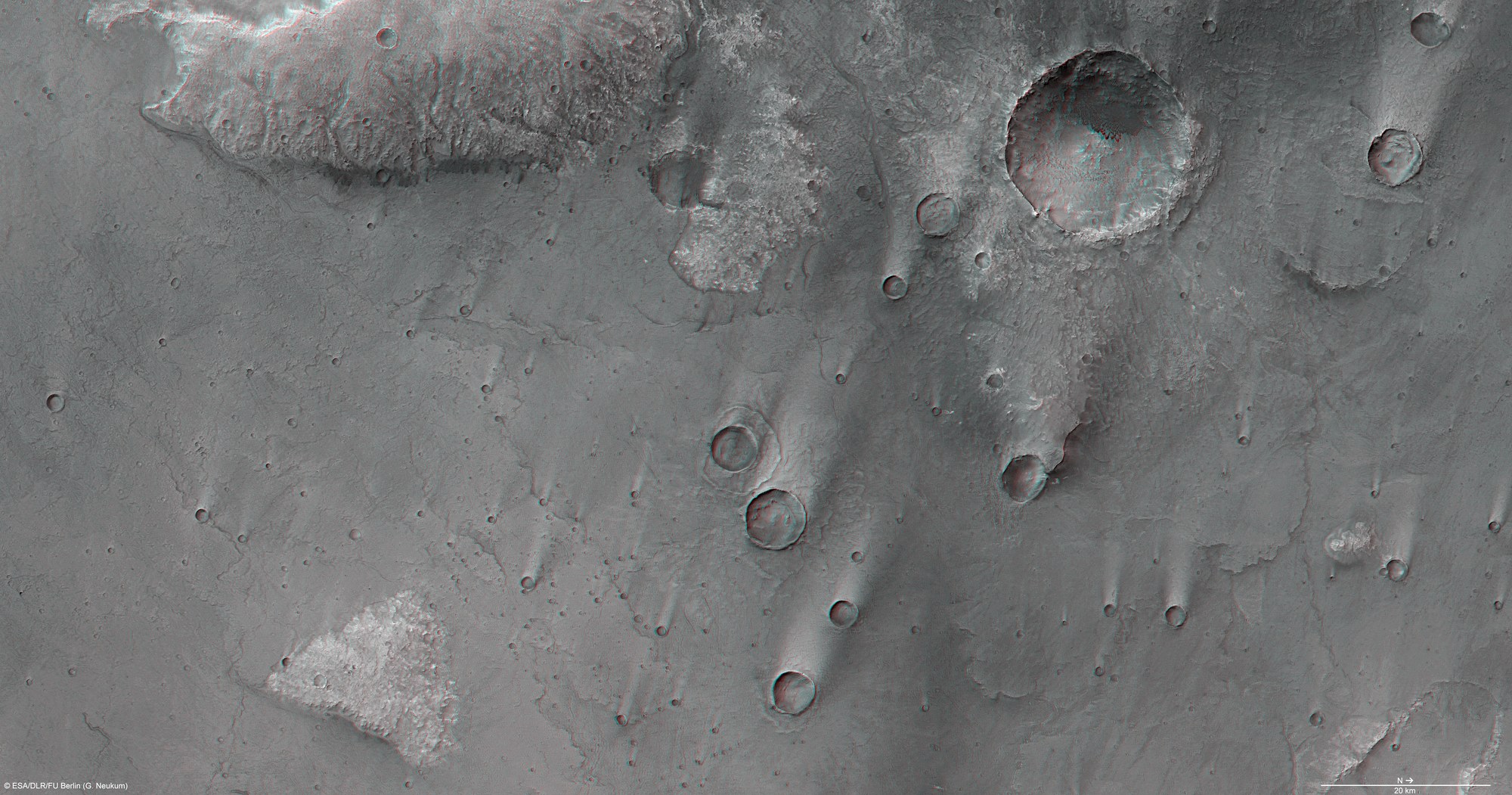
Anaglyph images can be created using data from the nadir channel of the High Resolution Stereo Camera (HRSC) camera system, the field of view of which is which is directed vertically down onto the Martian surface, and one of the four stereo channels, which are directed obliquely towards the surface. By using red/blue (cyan) or red/green glasses, a three-dimensional impression of the landscape can be obtained; north is to the right in the image.
At first glance, the topographical differences of the volcanic plain formed from solidified lava flows are not particularly distinctive. But if one zooms in on the image and observes it at full resolution, the differences in altitude at the edges of the individual lava flow tongues (their flow fronts) can be seen. With their edges rising above the plain, the circular outlines of some large impact craters are easily recognisable. The wind has blown dust and sand on the lee side of the craters, forming drop-shaped deposits behind the edges of the craters. In the top right of the image, and in the largest crater in the region, is a central mountain formed by the Martian crust springing back as a result of an impact.
Copyright note:
As a joint undertaking by DLR, ESA and FU Berlin, the Mars Express HRSC images are published under a Creative Commons licence since December 2014: ESA/DLR/FU Berlin, CC BY-SA 3.0 IGO. This licence will also apply to all HRSC images released to date.