Anaglyph image of the northern edge of Tempe Terra

Anaglyph image of the northern edge of Tempe Terra
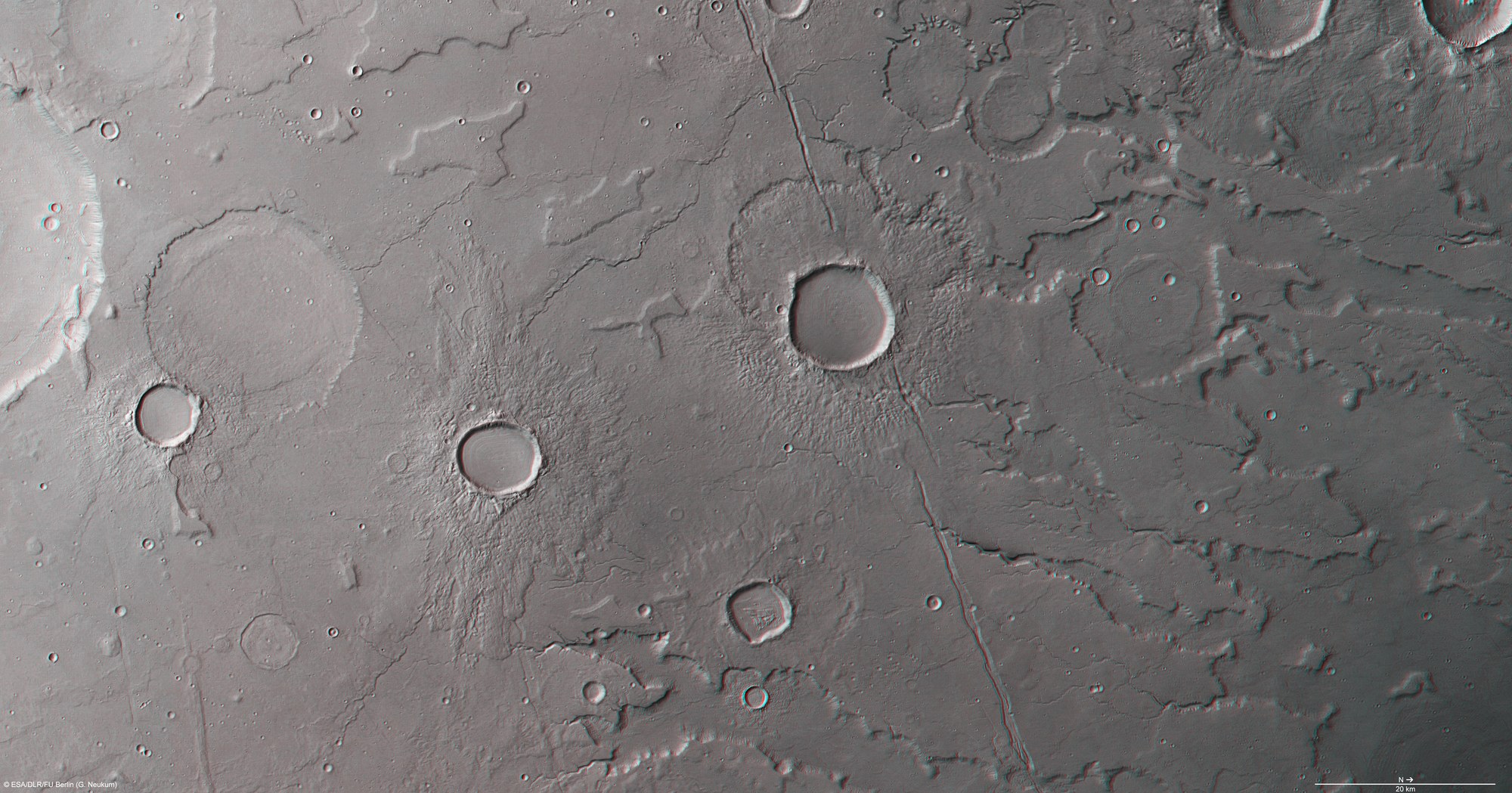
Anaglyph images can be created using data from the nadir channel of the High Resolution Stereo Camera (HRSC) camera system, the field of view of which is which is directed vertically down onto the Martian surface, and one of the four stereo channels, which are directed obliquely towards the surface. By using red/blue (cyan) or red/green glasses, a three-dimensional impression of the landscape is obtained; north is to the right in the image. On inspecting the northern edge of Tempe Terra in 3D, it becomes apparent that the area continually falls away from the south (left in the image) towards the northern lowlands. Small dendritic valleys indicate that flowing water must have played a role in the shaping of the landscape. A number of mesa-like promontories rise up to a thousand metres out of the plains. The circular rims of numerous impact craters and isolated mesas with irregular contours stand out strikingly in the south of the scene.
Copyright note:
As a joint undertaking by DLR, ESA and FU Berlin, the Mars Express HRSC images are published under a Creative Commons licence since December 2014: ESA/DLR/FU Berlin, CC BY-SA 3.0 IGO. This licence will also apply to all HRSC images released to date.