… and a TanDEM-X image of the Jülich mine for comparison


… and a TanDEM-X image of the Jülich mine for comparison
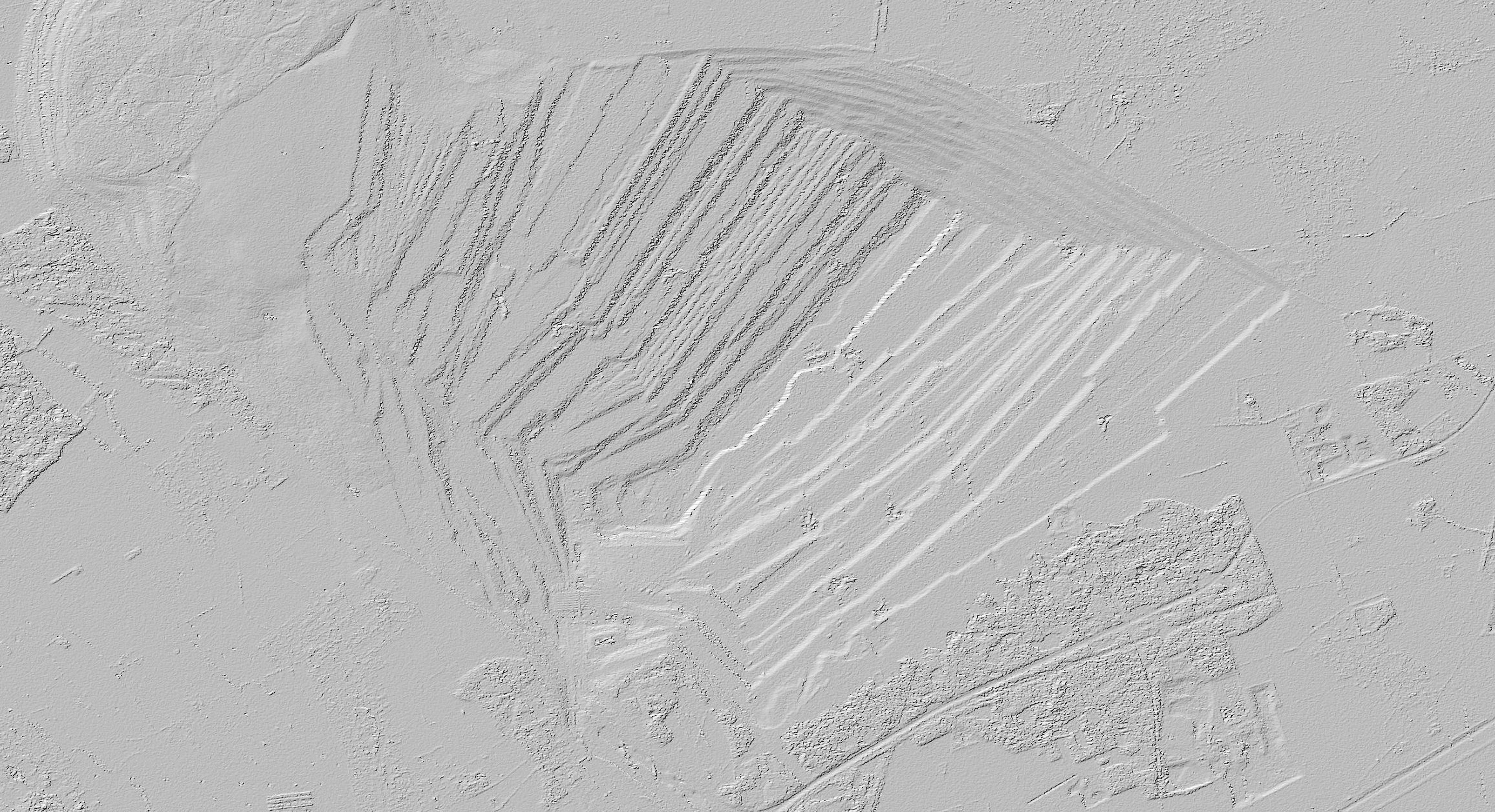
Comparing the Shuttle Radar Topography Mission (SRTM) elevation model from 2000 and the data acquired by TanDEM-X over the opencast lignite mine at Hambach, near the German town of Jülich, the improved accuracy is impressively demonstrated. In addition, the changes over the past 10 years can be seen – the mining activity has progressed considerably.