Colour plan view showing the northern scarp of Ius Chasma in Valles Marineris
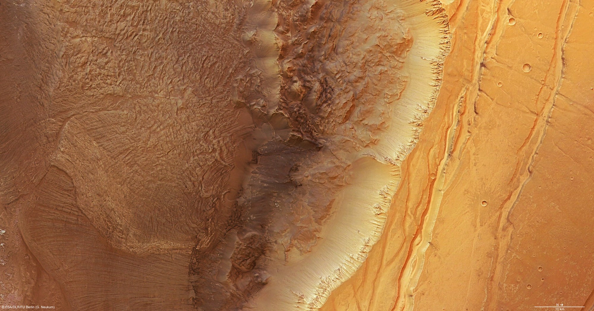

Colour plan view showing the northern scarp of Ius Chasma in Valles Marineris
This colour plan view was created using the nadir channel, which is directed vertically down onto the Martian surface, and the colour channels of the High Resolution Stereo Camera (HRSC) camera system on board ESA's Mars Express spacecraft; north is to the right in the image.
The image covers an area of 7200 square kilometres, which is about the size of the island of Corsica. The different colour shades where movements of rock have occurred along the northern scarp of Ius Chasma, which runs vertically through the centre of the image, suggest that the mineralogical composition differs across the various regions of the Martian highlands.
Copyright note:
As a joint undertaking by DLR, ESA and FU Berlin, the Mars Express HRSC images are published under a Creative Commons licence since December 2014: ESA/DLR/FU Berlin, CC BY-SA 3.0 IGO. This licence will also apply to all HRSC images released to date.