HRSC nadir image of the east of Syrtis Major

HRSC nadir image of the east of Syrtis Major
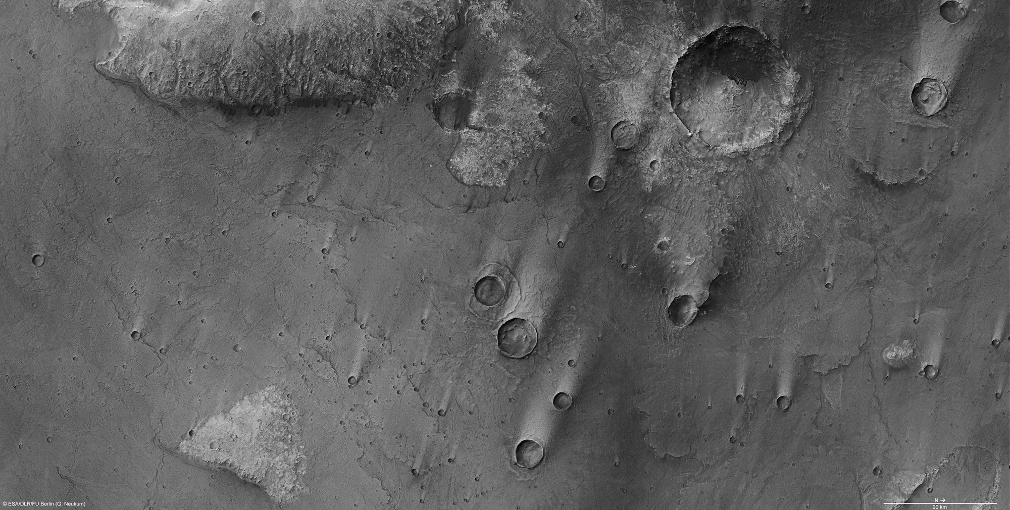
The nadir channel, which points vertically down towards the planet's surface, enabled HRSC image data to be captured with a resolution of 19 metres per pixel as Mars Express flew over the northeast of Tempe Terra during orbit 9487. This allows small-scale geological structures to be identified; north is to the right of the image. The image detail shown covers an area of about 180 kilometres by 90 kilometres.
This area is characterised by volcanic activity that took place during the early history of Mars. A large part of the image comprises a plain formed by solidified streams of low-viscosity lava. Some of the individual lava flows can be distinguished by the subtle flow fronts that twist through the image like finely-chiseled seams. The wind has deposited light dust trails in the lee of impact craters formed at a later time. The landscape to the west of the scene (top of the image) that was not covered by lava flows has a noticeably rougher texture.
Copyright note:
As a joint undertaking by DLR, ESA and FU Berlin, the Mars Express HRSC images are published under a Creative Commons licence since December 2014: ESA/DLR/FU Berlin, CC BY-SA 3.0 IGO. This licence will also apply to all HRSC images released to date.